A last post for the camping road trip. Well until I get through all the photos I took. So there will be more to come, but for this last post we’ll cover our last days mountain biking and hiking in Mount Rainier, and then the long drive home.
Saturday we were woke by the sounds of rain on the tent! Not what we wanted - I’d have preferred that they send the rain to Galiano - but I suppose a bit of rain won’t ruin our trip. So I quickly set up a tarp to act as an outdoor kitchen, and settled in for a relaxing day.
Aunt Rosie’s tent came in handy once our rainy stretch started.
Denman Falls Ride
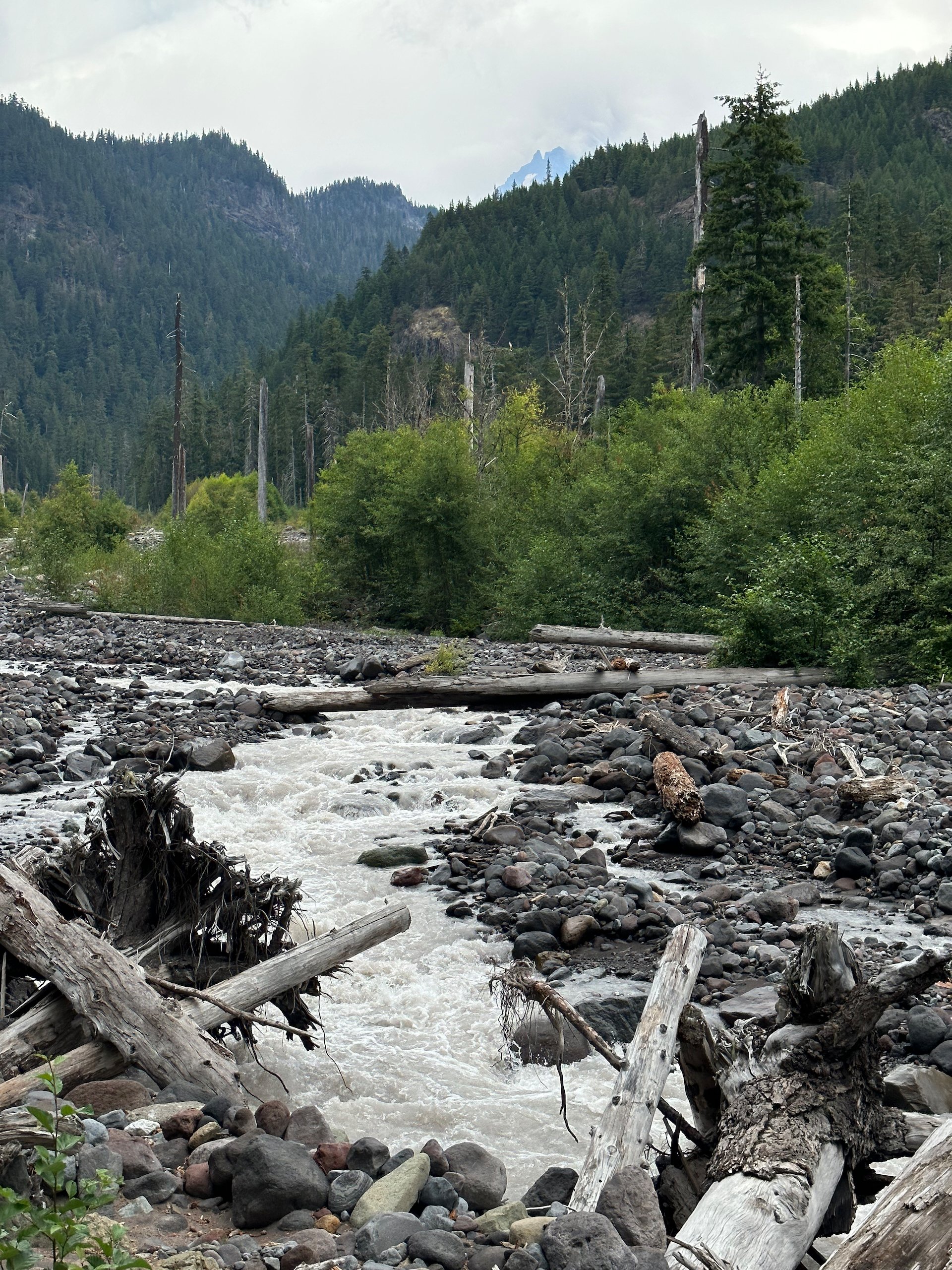
Fairly early in the ride the scenery opened up as the road travelled parallel to the river for a while.
The plan had been to take today off from any major physical activities. But with the rain and overcast, we decided on a change of plans.
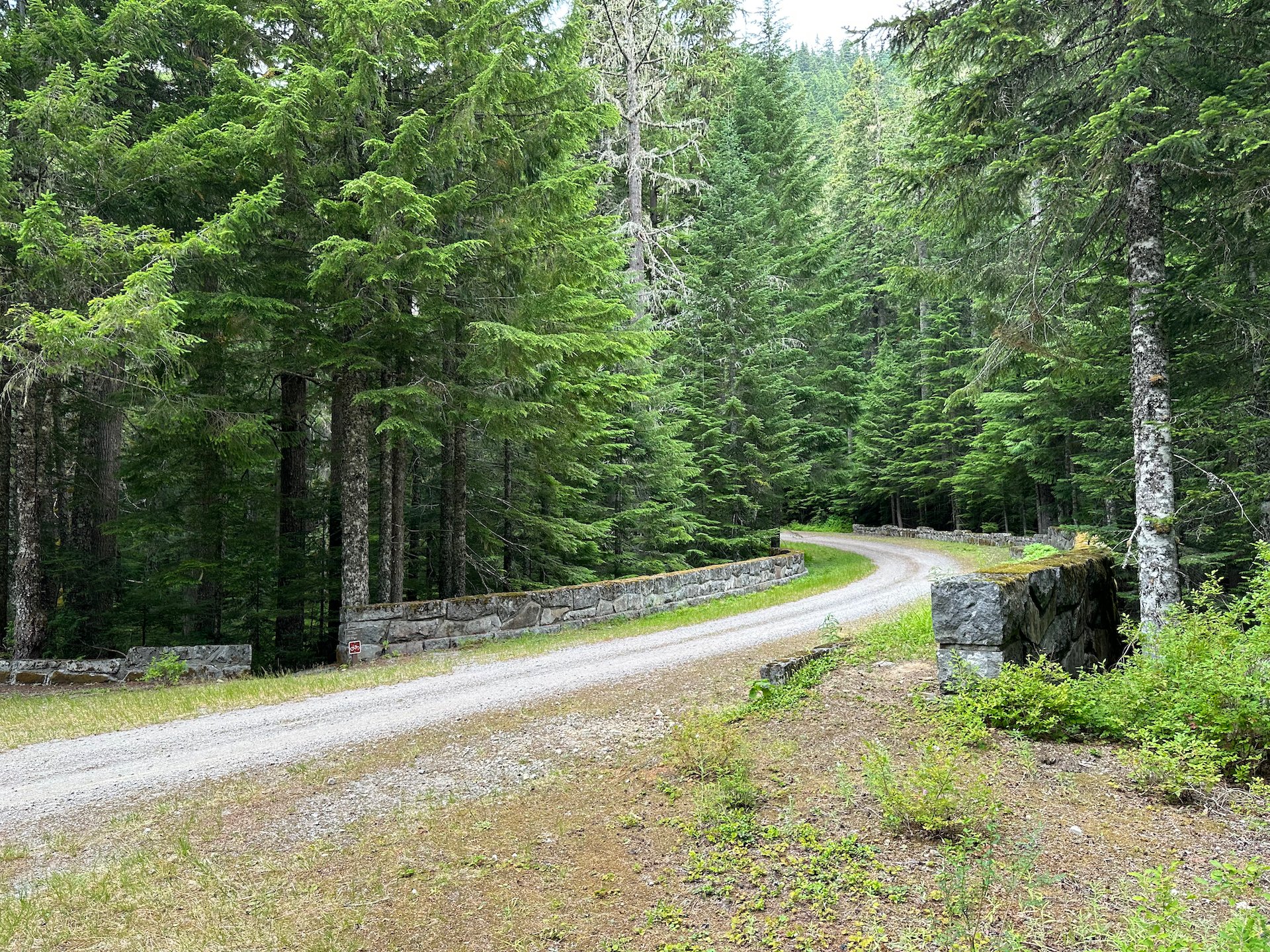
After a slow start to the morning, we packed up the bikes and drove back near the main entrance to the park, and up the Westside Road. We had learned that there was a trail (one of only two in the whole park) that they allow bikes on. So we thought we would check that out.
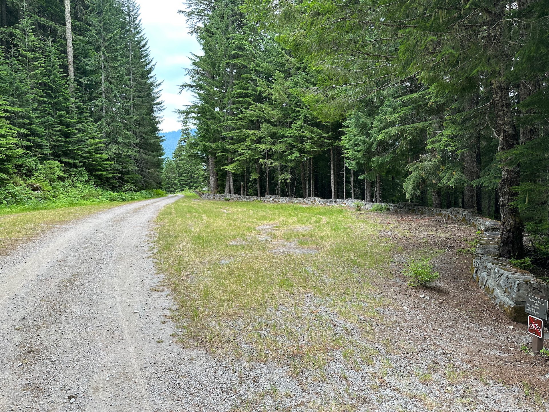
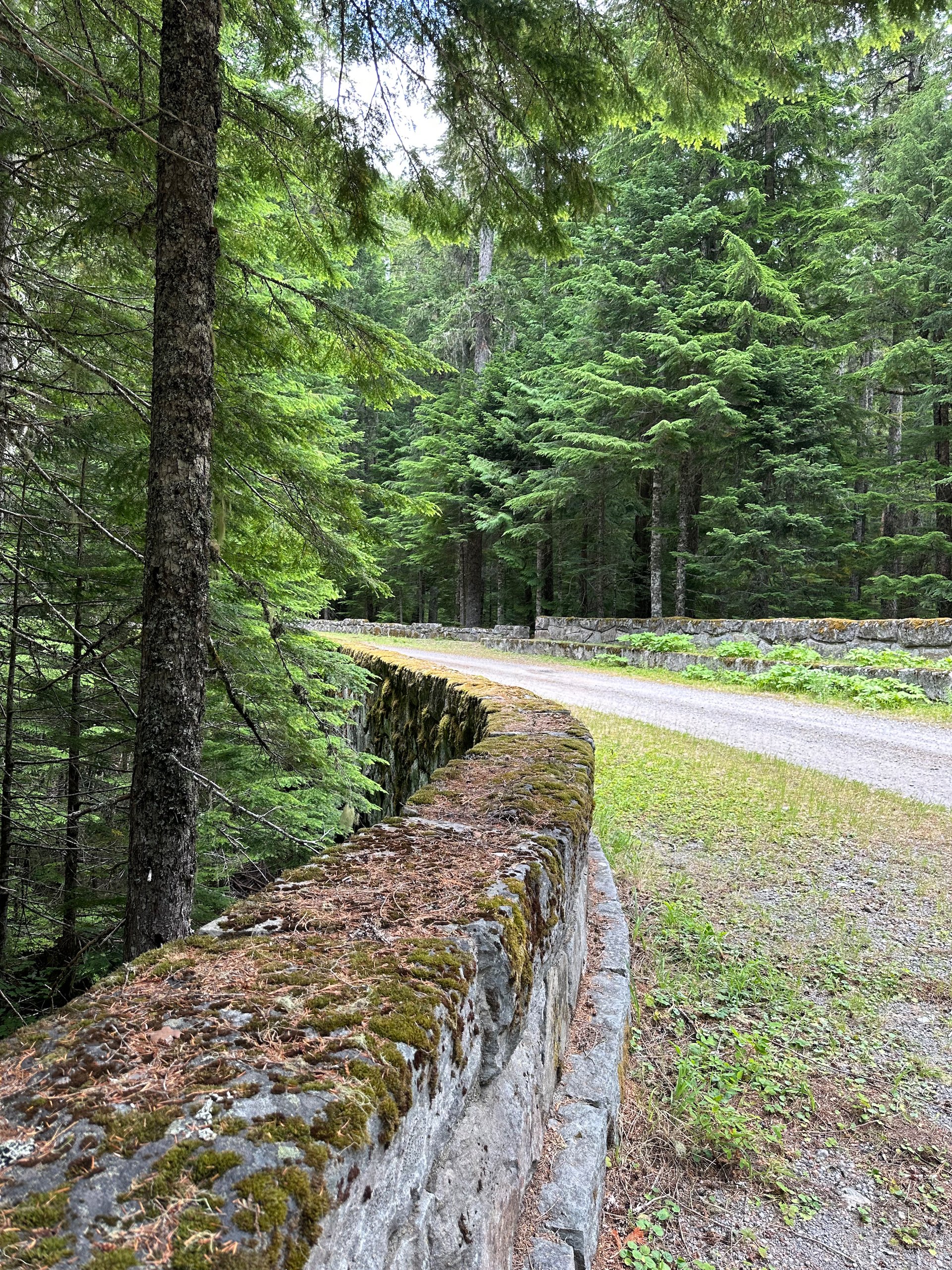
We were not clear on what to expect, but they have decide not to maintain this road any longer, and they are letting it return to nature somewhat. So while it was a wide, easy road in most places, there were sections where you can clearly see that nature is winning.
The drive up to the trailhead was about 3 miles long and ended at a very busy trailhead parking lot. There were a lot more cars here than we had expected! We later figured out that quite a few people access backcountry camping spots from this trailhead, and after doing the ride up I can see the attraction. You can ride a good stretch and really shorten the hiking distance. We unpacked the bikes and got geared up, not really knowing what to expect.
As it turned out, a lot of climbing! The trail rose steadily up, and for the first third of the ride we climbed until we reached Round Pass at 3,900’. For reference, the park entrance is at 2,023’ - but I’m guessing we drove about half the elevation gain in getting to the trailhead.
At this point there was a trail heading off, that if we wanted to hike a couple of miles would have taken us to Lake George or to a lookout tower. Instead, we went down the other side of the pass… And down, and down, all the way to the valley floor.
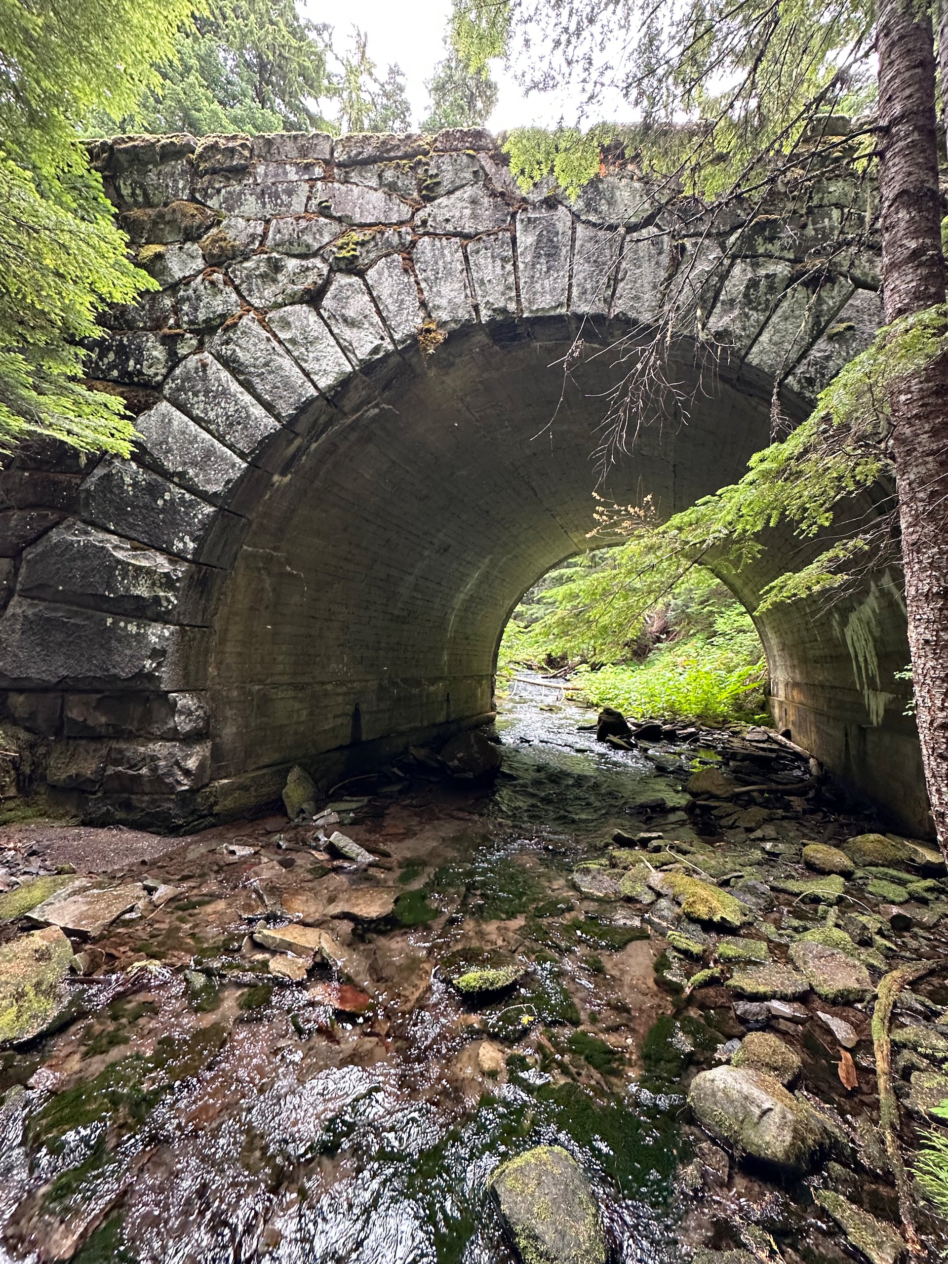
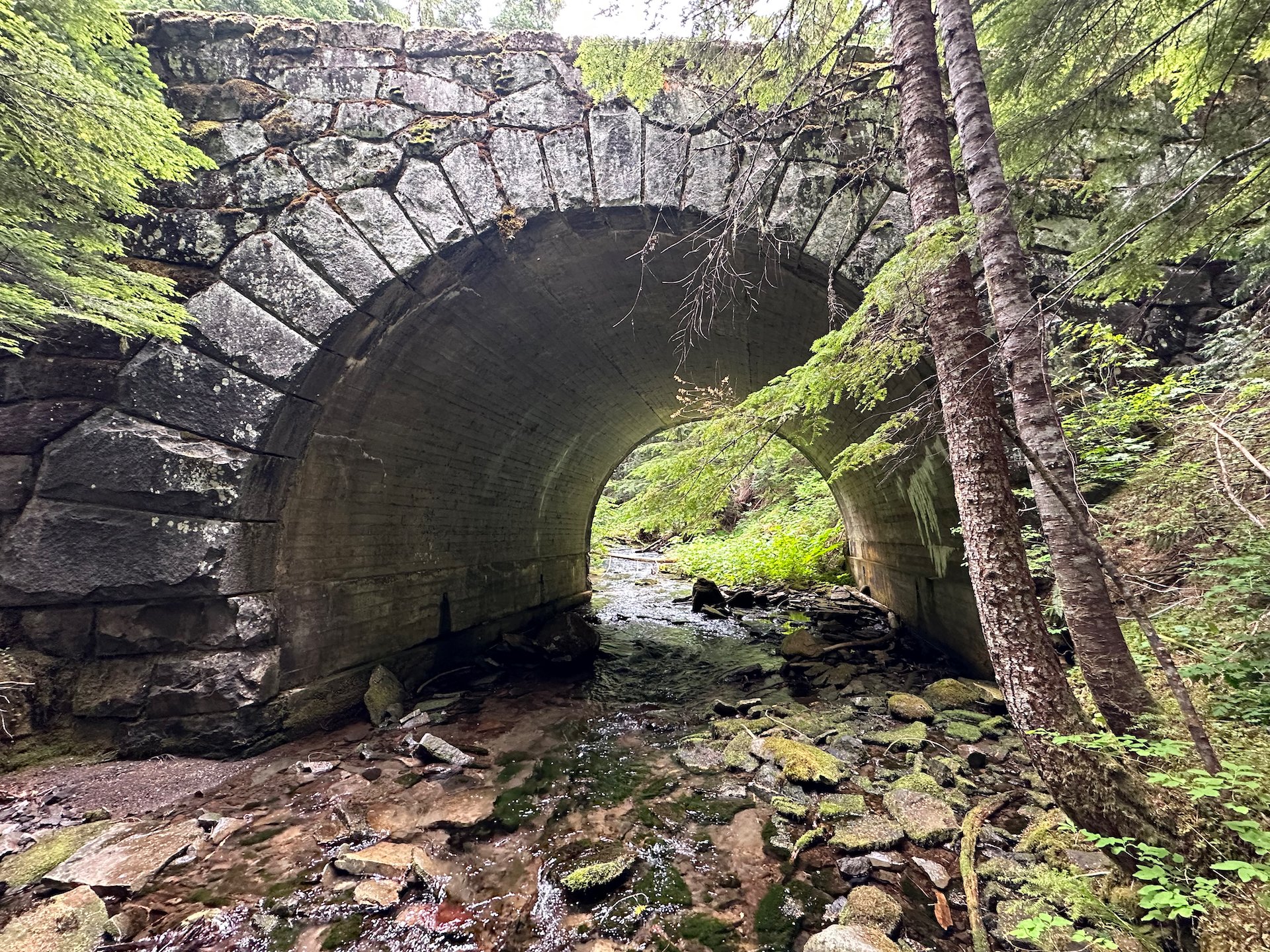
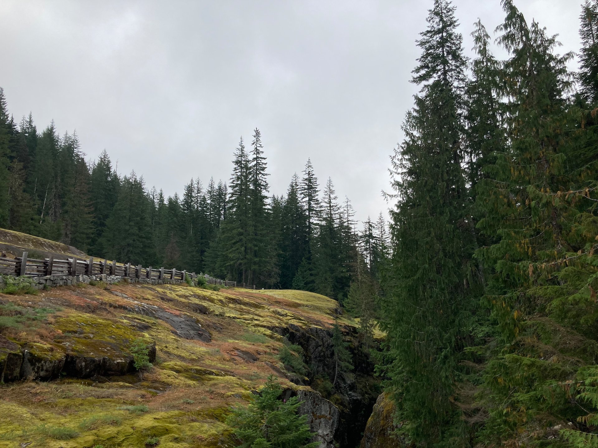
Along the way, there were some interesting sites. The park had turned this into a "trail" instead of a road, as they were not fully maintaining it any longer, and in places it was going to be tough for cars to make it. But all the original bridges and other infrastructure was still in place. It actually seems a bit of a shame that they are not continuing to maintain the road.
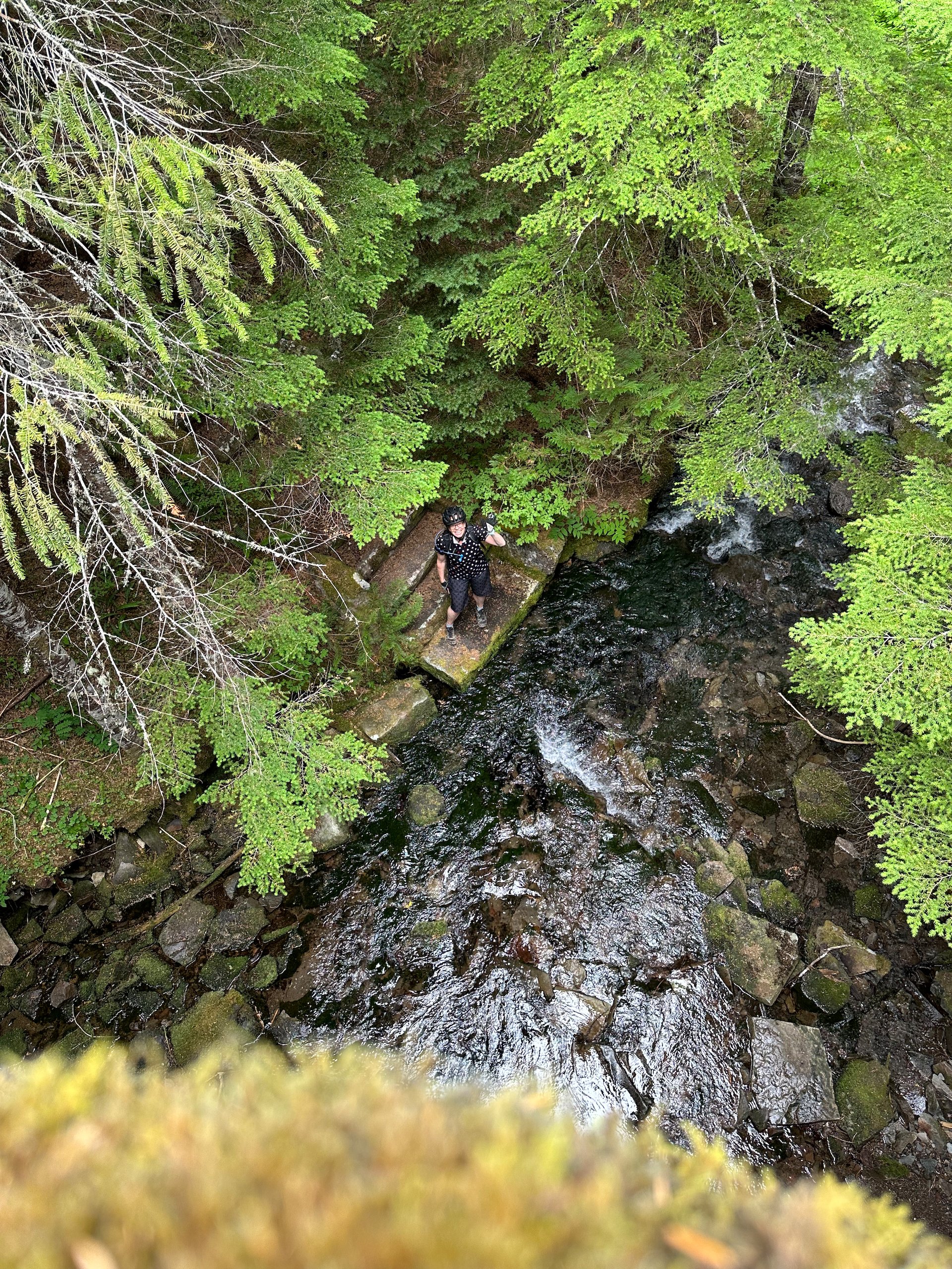
A look down into a river from one of the many stone bridges we crossed on the ride. It’s a shame they are not maintaining them - they are still so beautiful.
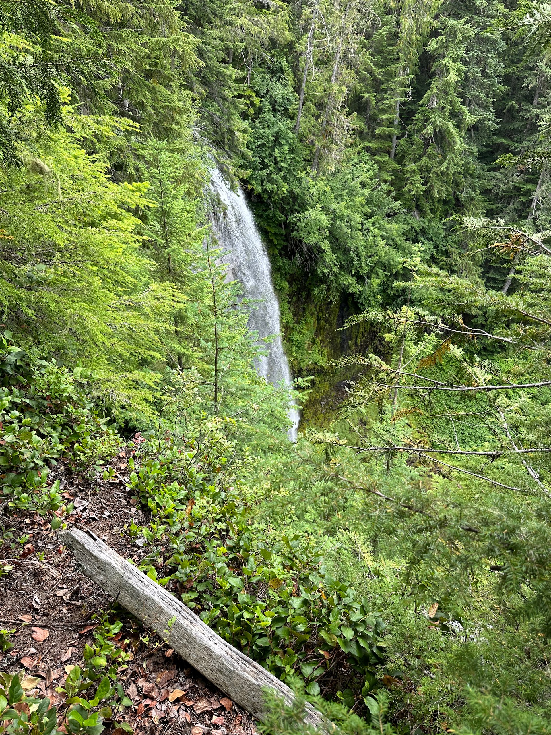
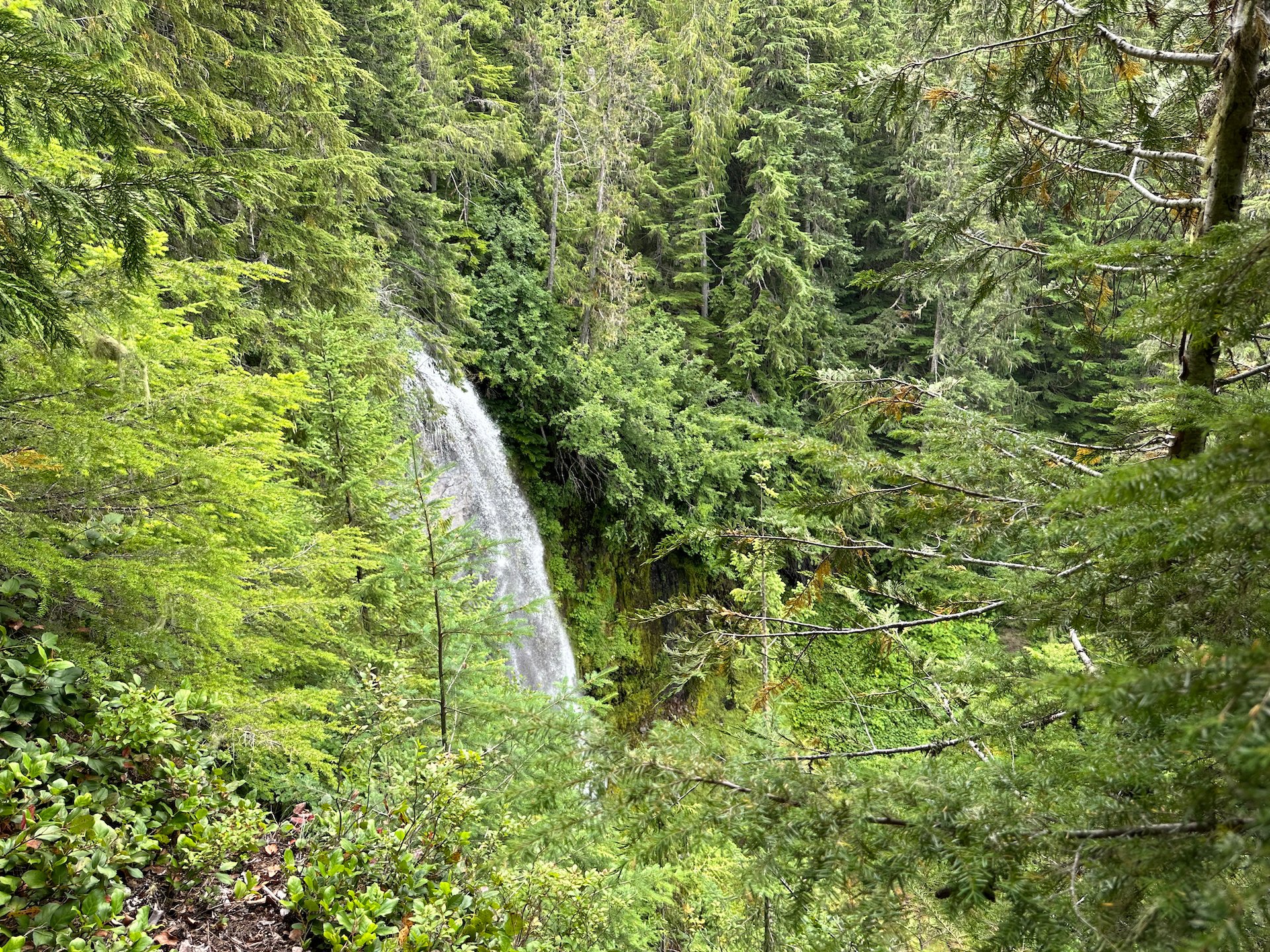
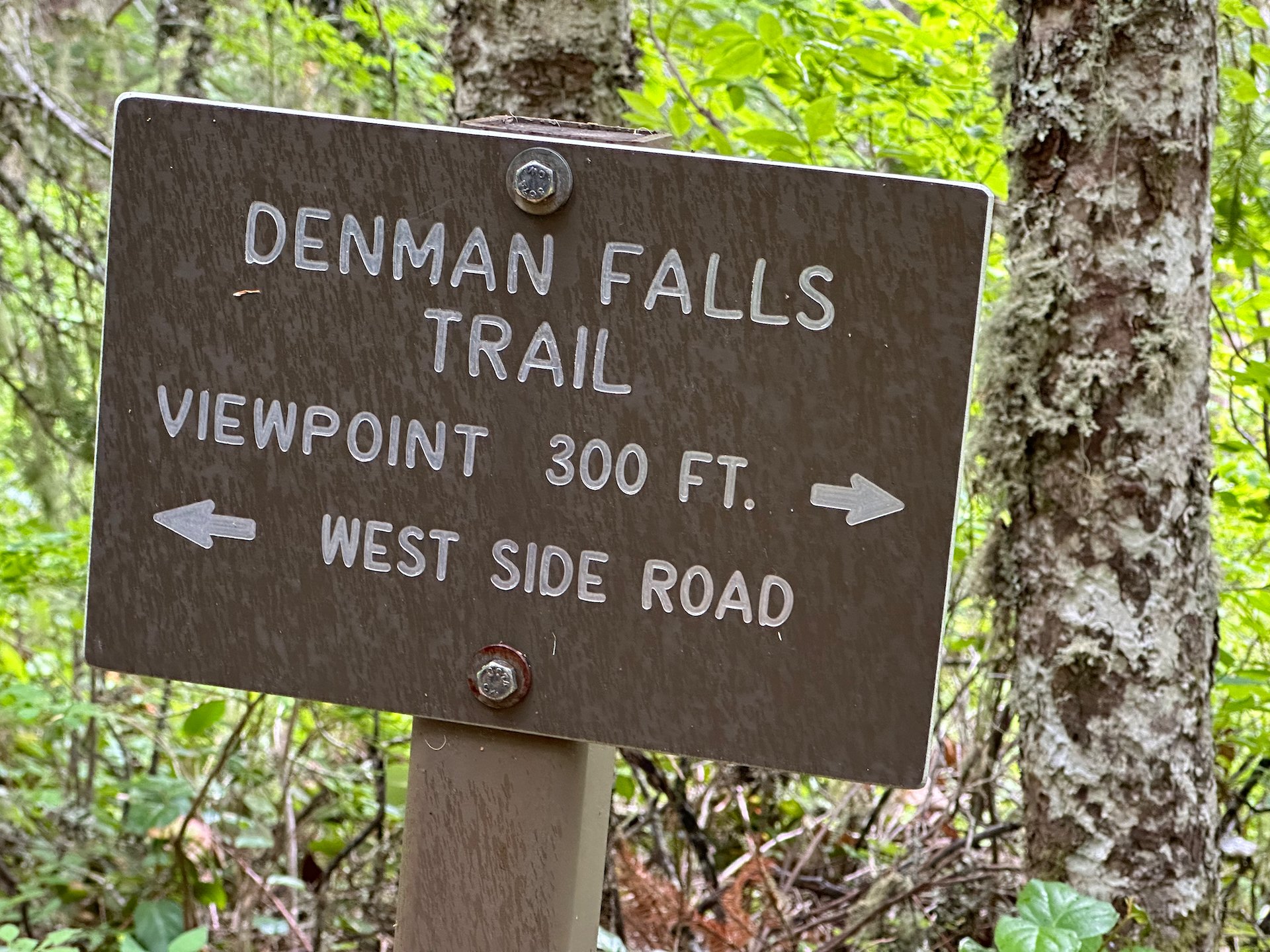
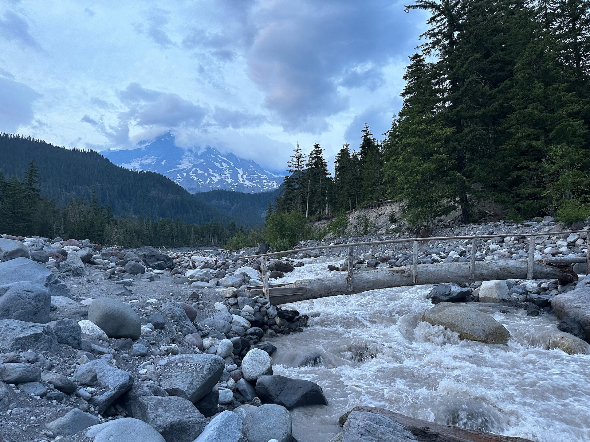
From the bottom, we climbed back up the other side, heading towards our end point of Denman Falls. This was most of the way to the end of the road at Klapatche Point at 4,120’. We didn’t get all the way up, but I’m guessing we got close to 4,000’. At Denman Falls, there was a spectacular stone bridge that made the ride up worthwhile.
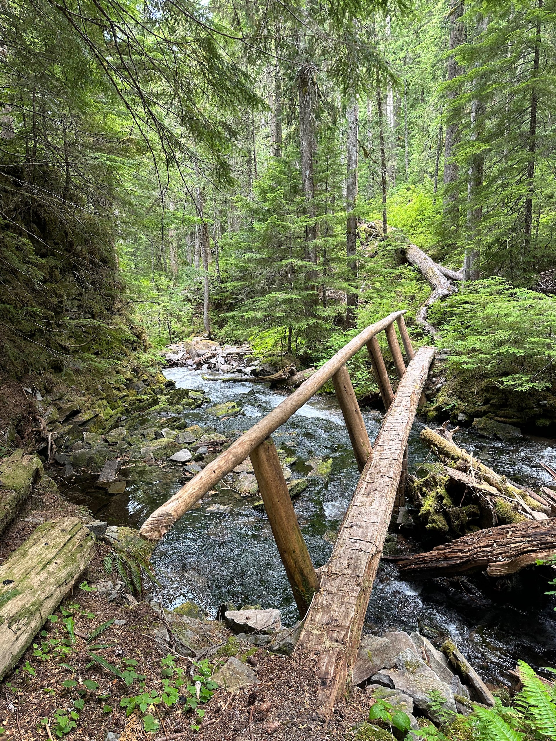
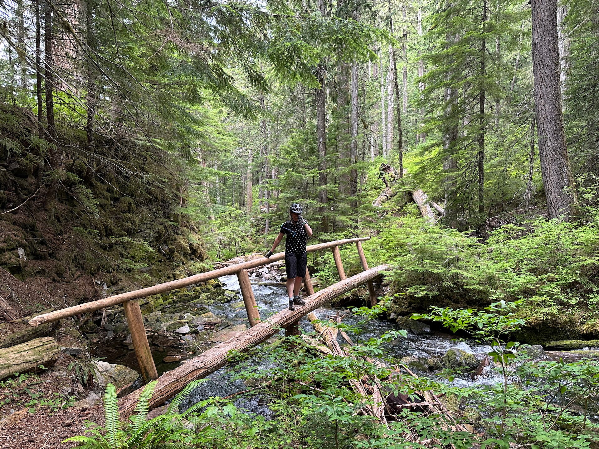
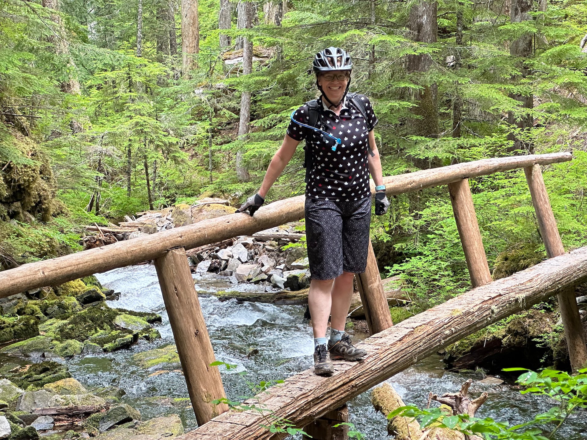
We walked down the trail to the river to admire it, then headed down the shore side trail to view the Falls themselves. It was a nice, short hike, across another log bridge, then over to a lookout point that looked across to the ~300’ waterfall, crashing into the valley below. It was quite the sight. Along the way we found some interesting mushrooms and had an enjoyable walk through the forest. The trail came back along a different path, giving us a short loop hike.
The hike at the end of our bike ride. You can see the full trek below.
We had ridden a fair distance into the park and were actually fairly close to the western boundary.
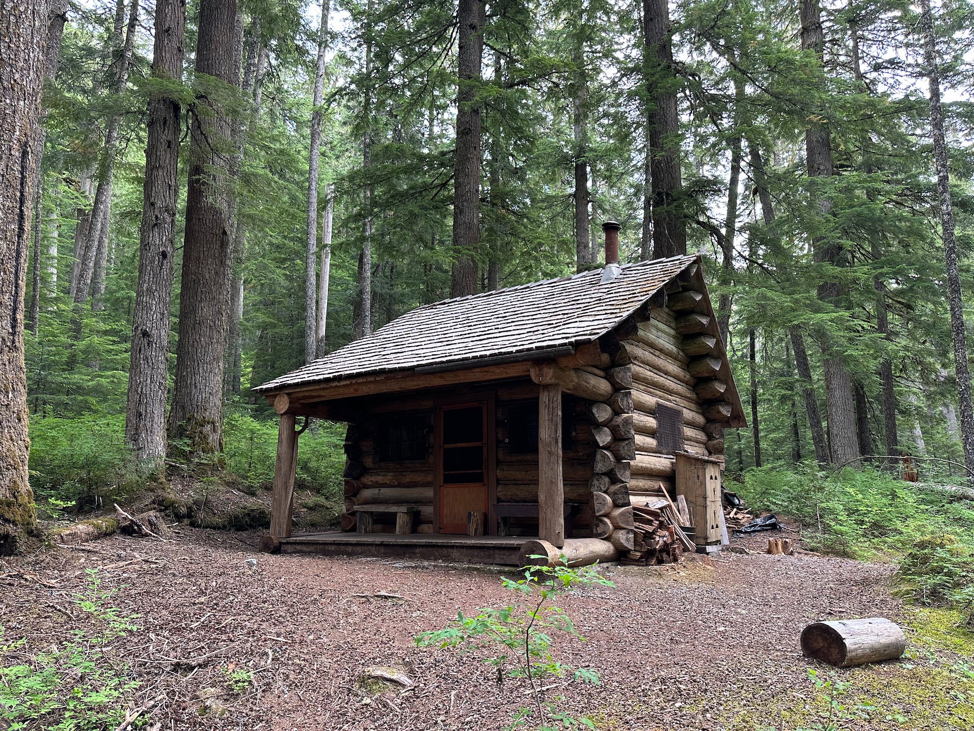
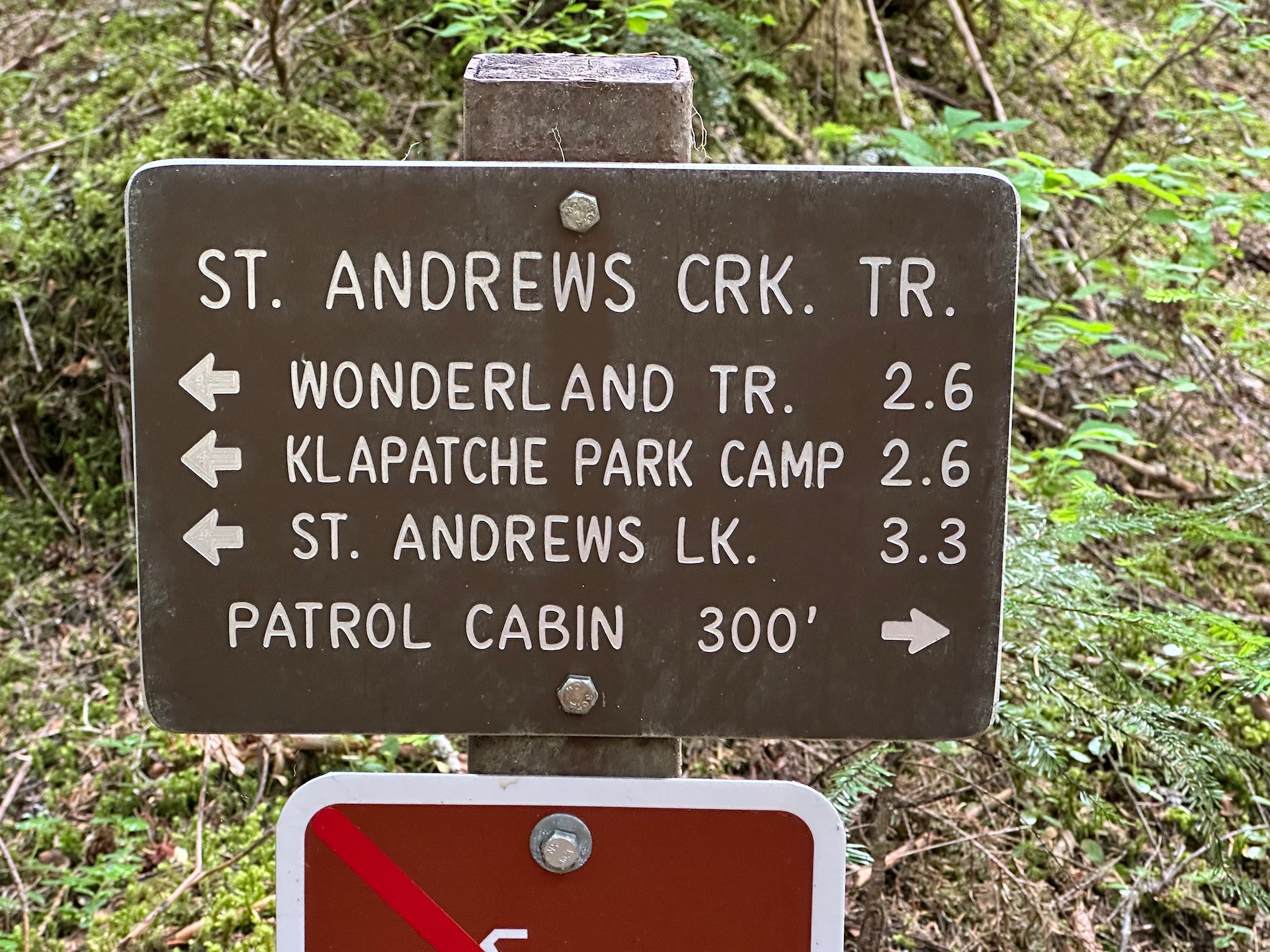
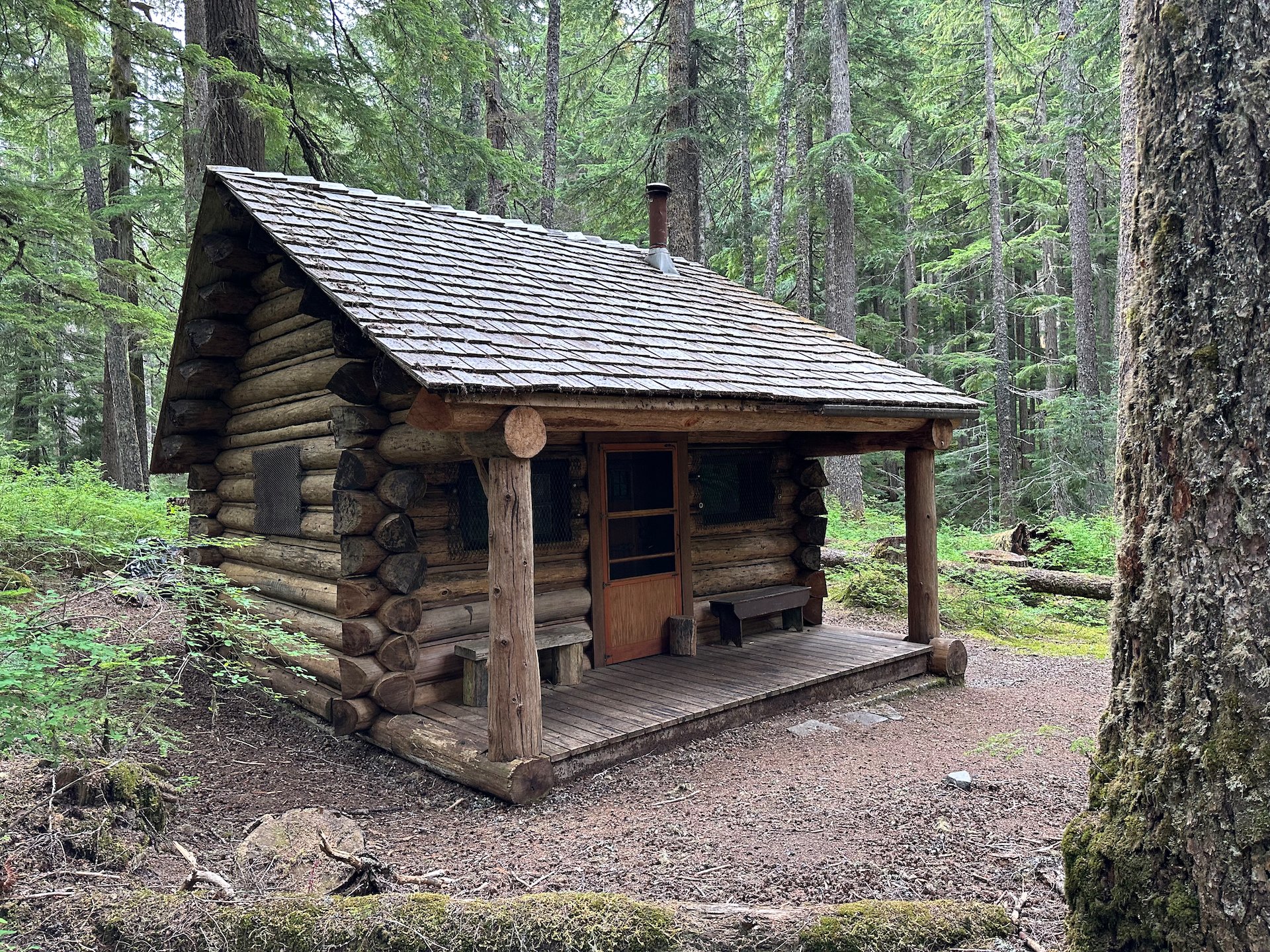
After making the short trek back, we crossed the road and did another short hike down part of St. Andrews trail to one of the wilderness patrol cabins that are scattered throughout the park.
These cabins are there to support the Rangers as they patrol the Wonderland Trail, the 93-mile trail that circumnavigates the base of Mount Rainier. We’d love to try it one day, but it takes 10-12 days to complete.
We once again were close to that trail and seeing all the interesting looking campsites around the park makes me want to come do it. I really need to retire…
Afterwards a couple people asked us if we had been swimming, so I guess some of the lakes up in this area are good for jumping in when the weather was hot. We did see quite a few bikes at the various trailheads, many of which were electric. This ride would have been a whole lots easier with some electric assist on the uphills.
After that, it was the long ride back to the trailhead. The downhill parts were fun and fast; the uphill a bit of a slog. But the incline of the uphill portions were not too bad - just long and unrelenting. We made a couple of stops but eventually got back to the truck.
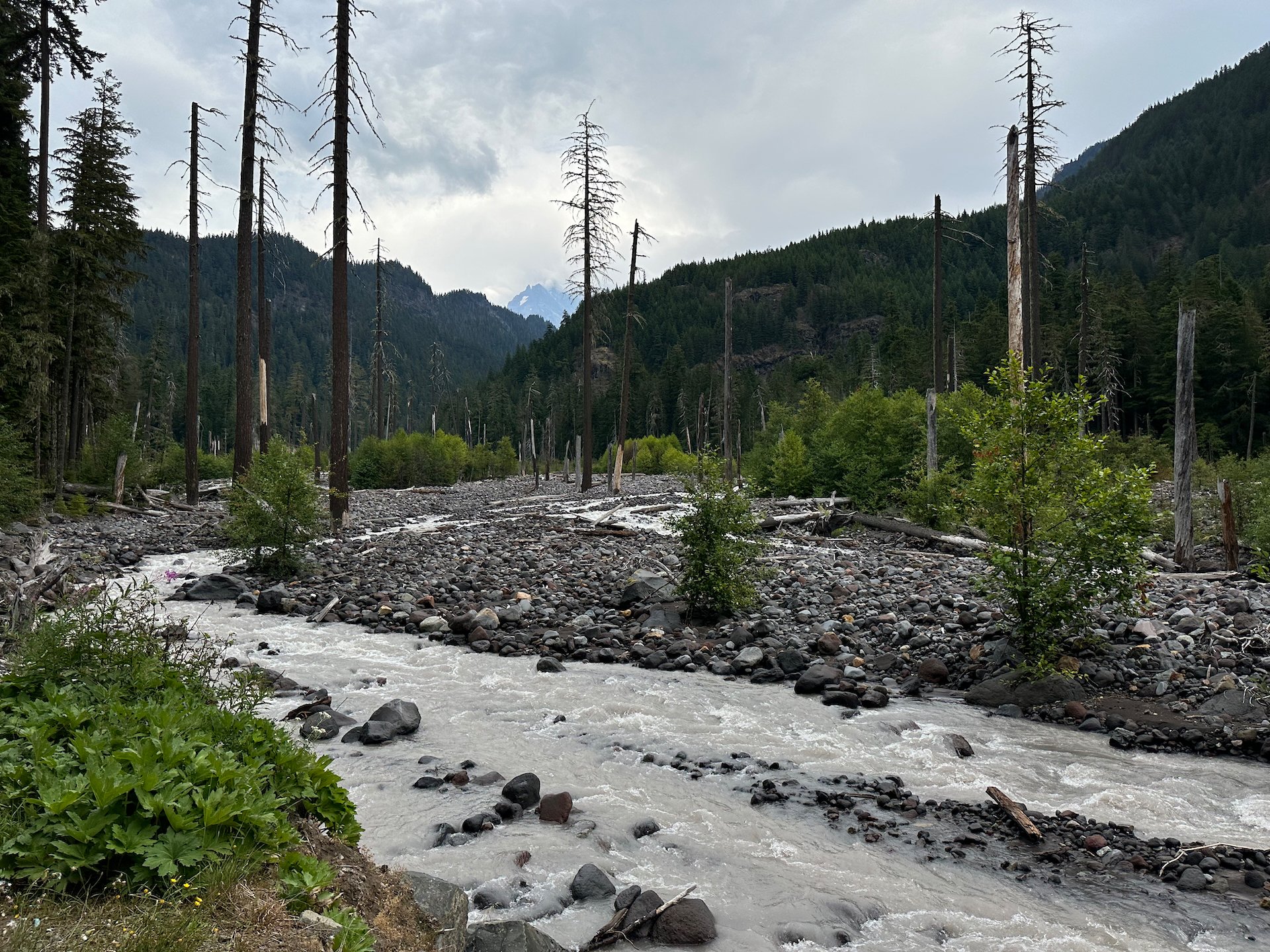
One of the few views we had on the mountain during our ride.
In a couple of locations we saw this equipment from the US Geological Society - volcano monitoring centers! The USGS is one of my customers and I suspect that some of our routers are inside that box.
The long ride up and back to Denman Falls
The elevation profile for the ride.
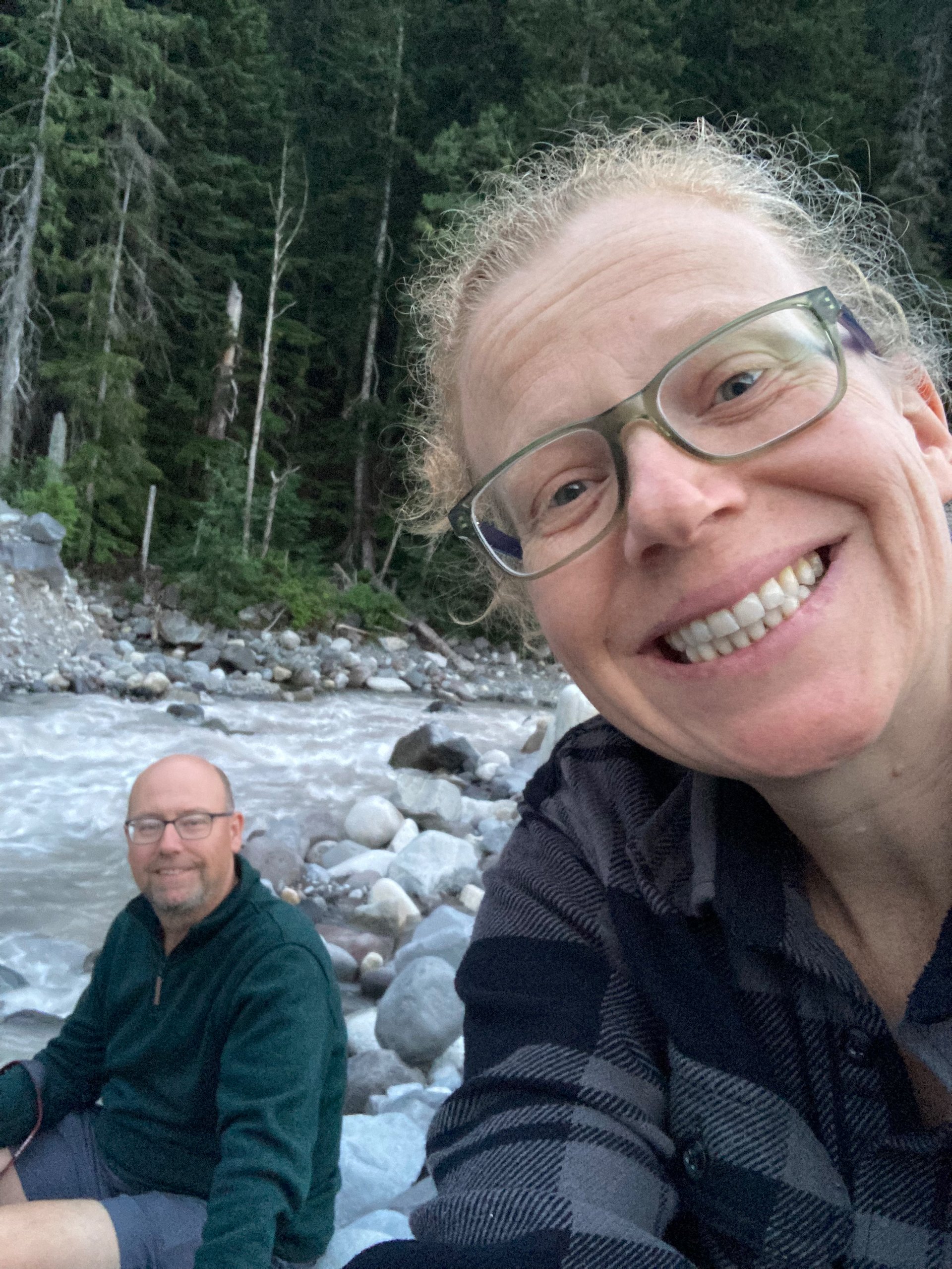
We were still feeling pretty good at the end of our ride.
I helped Justine put her bike back in the truck, and then I rode down the 3 miles to the end of the Westside Road, where she picked me up. It was all downhill, so kind of fun!
My fun little 3 mile downhill ride on the Westside Road.
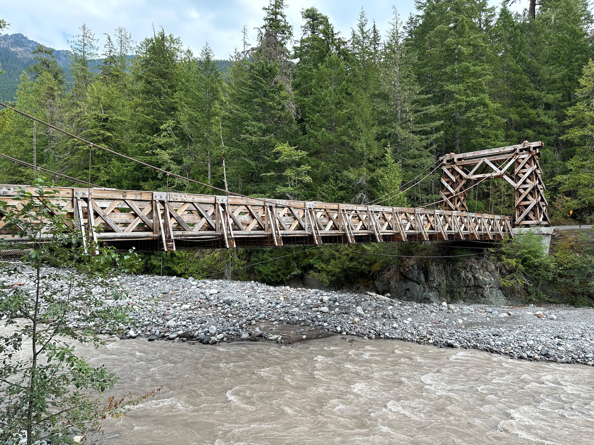
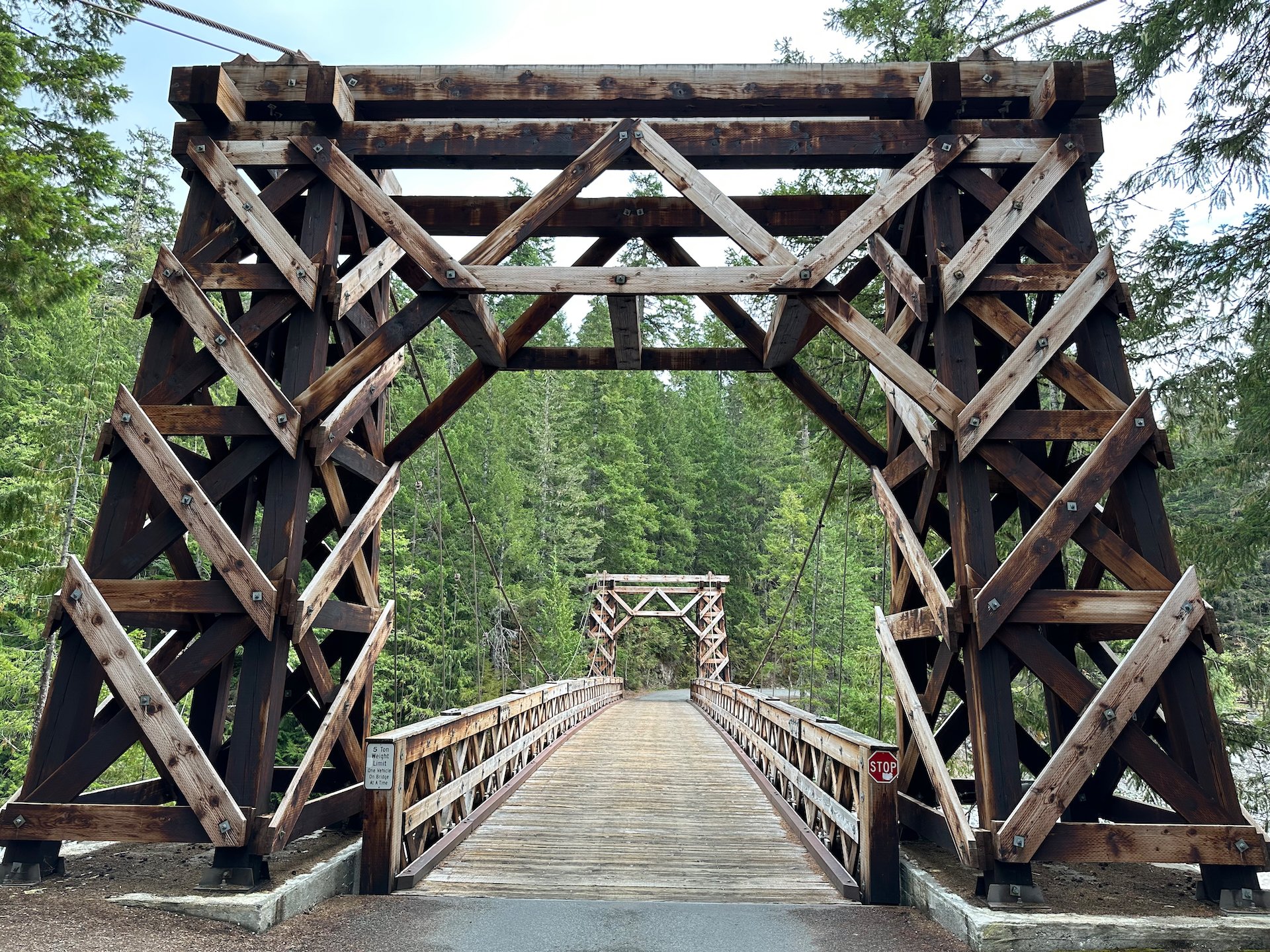
After getting my bike on the truck, we drove up to Longmire where we stopped to pick up some ridiculously expensive firewood and had a look at a wooden suspension bridge that is tucked away behind the administrative area. I’d love to explore where that bridge leads…
It was after 2:00 by the time we got back to the campsite. We made some lunch and relaxed for the rest of the afternoon. There may have been napping in the hammock. We played some cards, read our books and generally relaxed for the rest of the afternoon and early evening. We eventually got moving again and made a late dinner. Closer to sunset, we again walked across the road, hoping that with all the cloud we might get some colour on the mountain and an interesting sunset - but sadly that did not play out and the night just slowly closed in around us, without much fanfare.
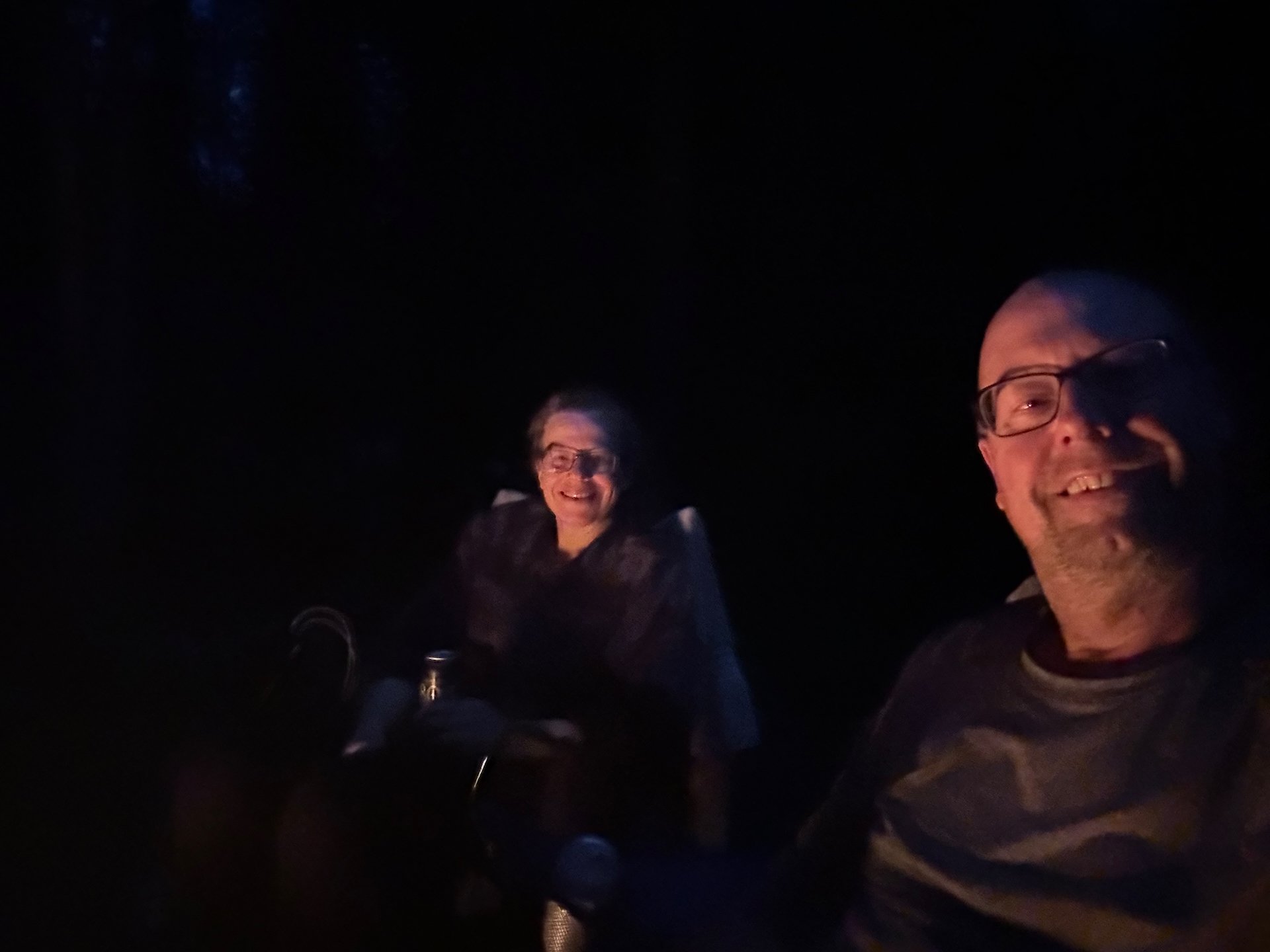
So instead, we headed back to the campsite and made a fire, relaxing until we had burned through it all and it was time to call it a night. We had big plans for our last full day in the park, and they included an early start.
Christine Falls and High Lakes Trail
Sunday was to be our last full day in the park. We started early, getting up at 6:00 - but to the sound of rain. Not what we had been hoping for. Our plan had been to get an early start to tackle the Pinnacle Peak Trail, which takes you up into the high alpine on the Tatoosh Range, up to about 6,500’. But it didn’t look like the weather was going to cooperate.
We made the drive up to Paradise as a start, to see what the weather higher up was really like. From the start, we couldn’t even see the mountain - not a good sign. But the rain had stopped, which was promising. Not far from the campsite is a pull off for Christine Falls, which might be the most perfect staged waterfall shot anywhere. There’s a beautiful stone bridge over the river that framed the waterfall perfectly. We were early, so there was no one around and the overcast and low light was actually perfect for doing long exposures on the waterfall. I’ll let you be the judge if the pictures worked out, once I have a chance to process them properly.
I think they turned out pretty well…
After that short break, we continued up to Paradise, where we stopped to buy breakfast. The clouds were still quite low, but we could see a bit of the Tatoosh range across the valley.
The views up at the top were still quite good - we could see the mountains we meant to climb. It was that cloud hanging in the valley that was the concern.
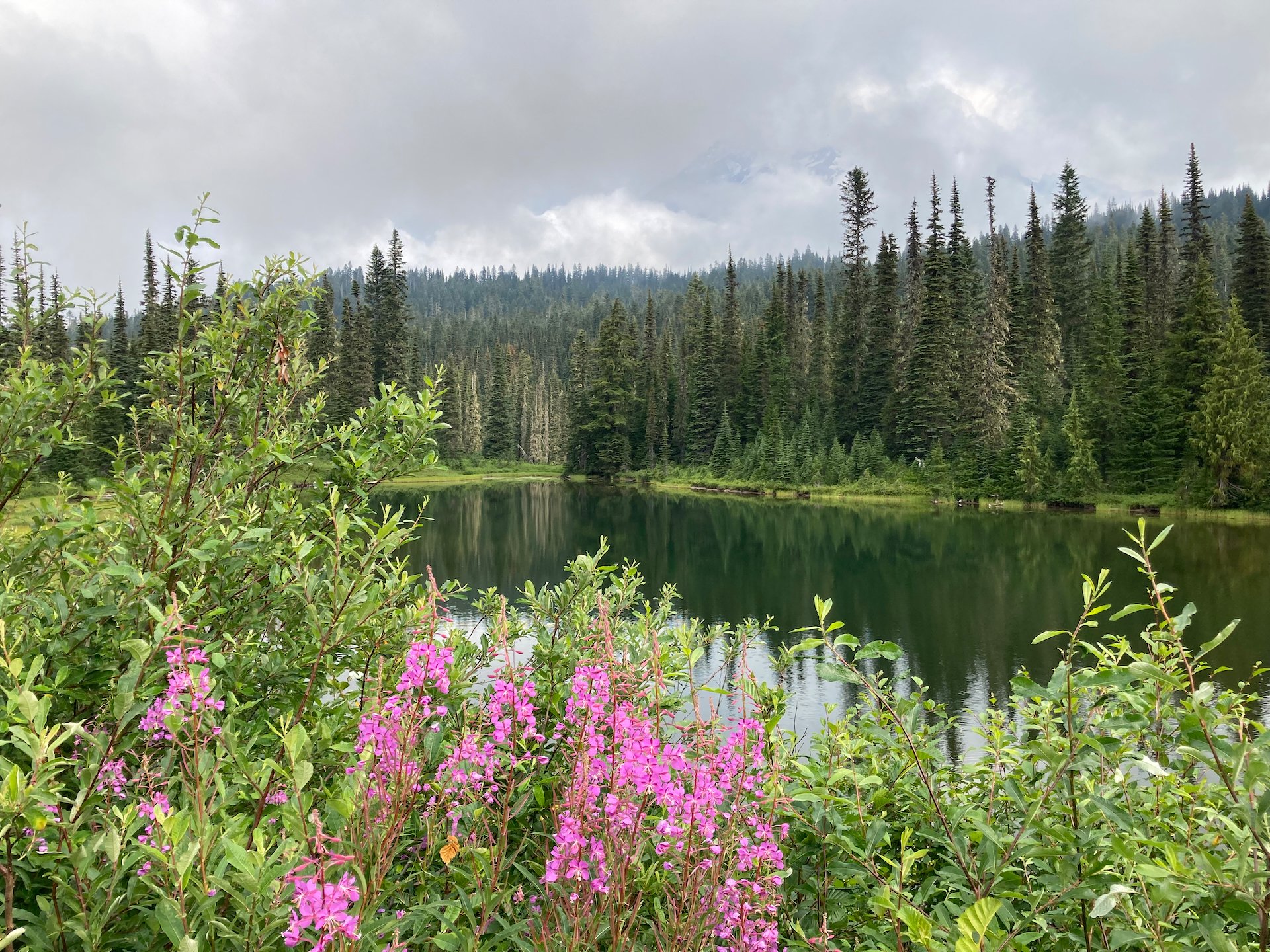
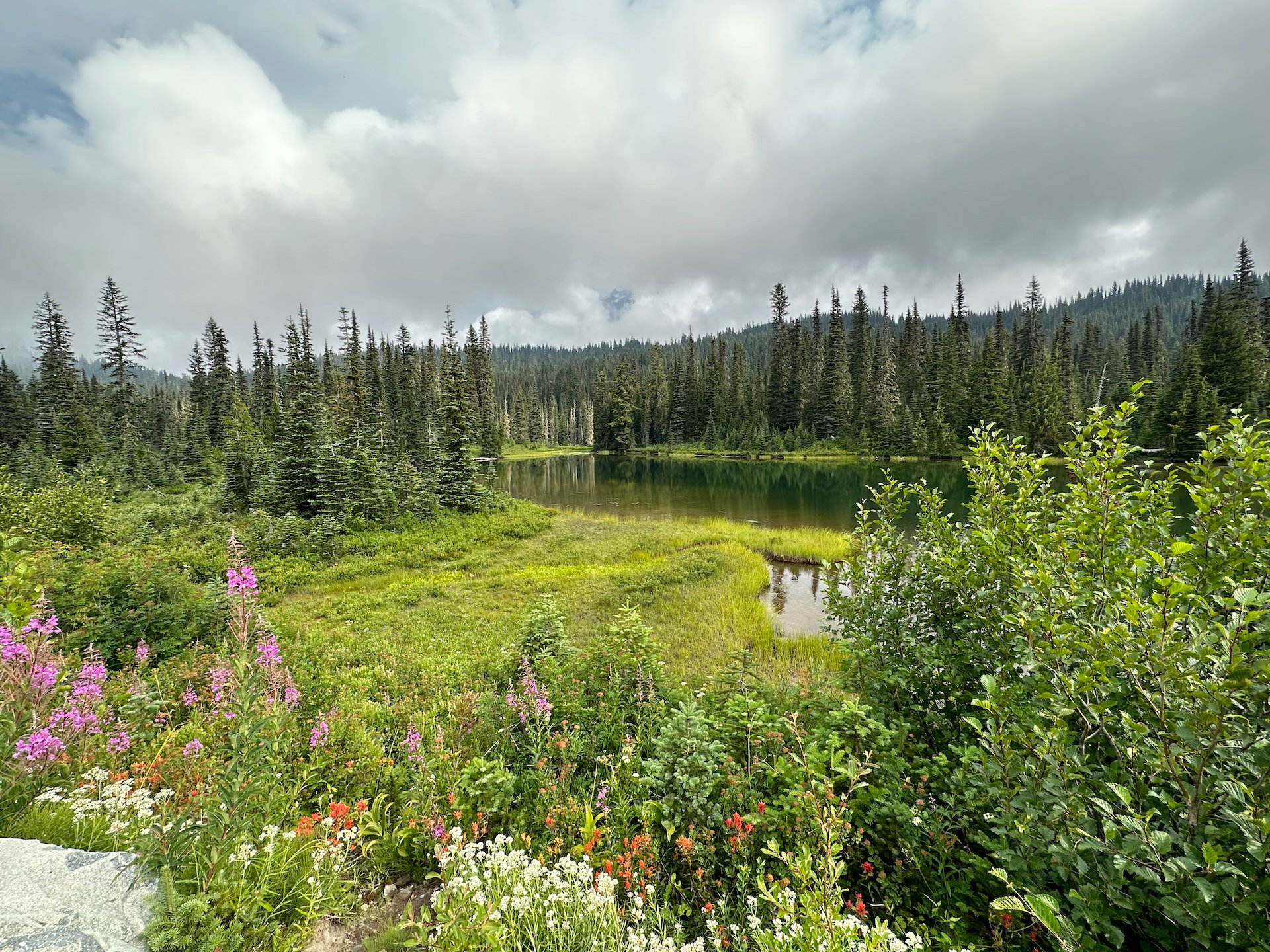
After our short break to eat a bite, we continued on down the road and headed for Reflection Lakes. As the name suggests, there are a series of lakes that provide, given the right conditions, a perfect reflection of Mount Rainier. Sadly, with the low hanging cloud, there was nothing to reflect.
Sadly, there were not a lot of reflections at Reflection Lake. The cloud was hanging low in the valley.

The trailhead for Pinnacle Peak starts across the road from Reflection Lakes, but looking at the clouds hanging in the valley, we decided to save that hike for another day. It didn’t seem worthwhile if there were no views. It was a lot of climbing…
Instead, we stayed on this side of the road and did the High Lakes Trail, a shortened loop of the longer Lakes Trail. This one was only about 3 miles in length, with moderate elevation gain. It weaved through the lower elevation forest. The trail starts at Reflection Lake, cutting around its western end. We saw a couple of guys that were doing the Wonderland Trail and we chatted with them briefly about the experience. Everyone we talked to indicated how hard it is to get backcountry camping permits for the trail.
From there, the trail climbed a ways through the forest. We had some fun encounters with Grey Jays, and generally the trail was pretty quiet, which was nice. The trail meandered once we got a little higher up, weaving through forest and small, open meadows. We kept hoping for bears or deer, but we had no luck. Not really that surprising.


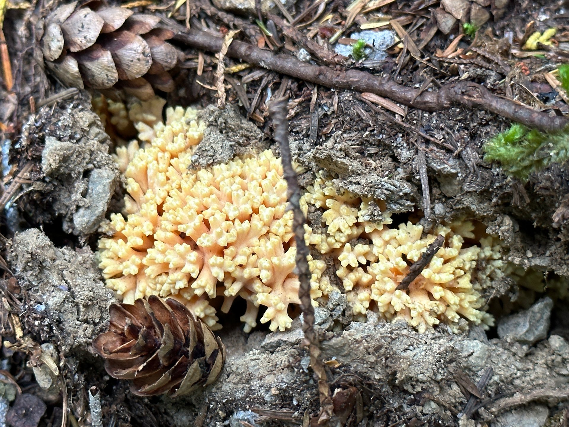
Our first real mushroom of the season!
We crossed a few dry river beds and saw lots of flowers. This hike produced better wildflowers than the Skyline Trail. And we saw and heard more birds in this leg than we did pretty much the whole trip. We had chestnut-sided chickadees, golden-crowned kinglets, nuthatches, grey jays, and even some warblers. And we heard Evening Grosbeaks, but did not see them, other than the odd flash of yellow. Once again, I’ll make a plug for a follow up post - more pictures coming!
One of the small lakes we passed by, while we were up in the clouds.
This spot was supposed to give an amazing view out over Reflection Lakes and the mountains on the other side of the valley. It wa sa huge drop to the valley floor, but you’d have no idea I was standing on the edge of a cliff.
Eventually the trail led us back down to the level of the road, and we came back past two of the small lakes, to the trailhead and where the truck was parked. While it wasn’t what we had planned, it turned out to be a very nice hike.
The High Lakes trail, on Mount Rainier.
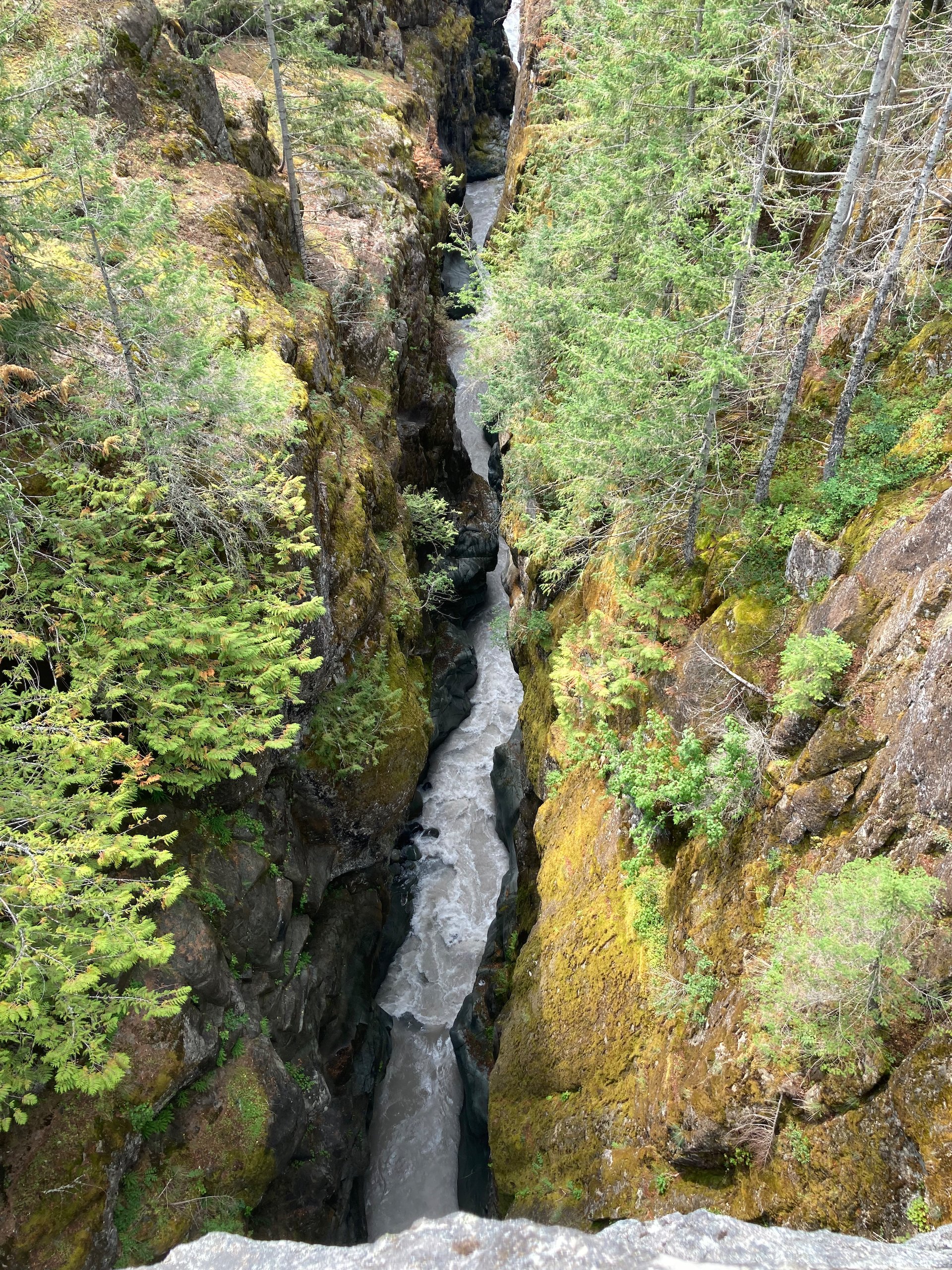
Box Canyon on the Cowlitz
Since we were out that way, we continued east and down towards the Cowlitz box canyon. The road was being rebuilt, and the drive was a bit treacherous. There were a number of places where it was down to one lane, with automated traffic lights to control traffic flow. All on the Have a edge of a steep canyon drop off.

We stopped at the canyon, pulling into the parking lot. It was not very busy and we had a fair bit of time to explore. The road and parking areas sit between 115’ and 180’ above the river, making for an impressive view down into the narrow canyon. We ended up walking both sides of it, exploring the short trails that lead to a series of viewpoints. The best view might have been from the road bridge itself, looking straight down. There were some nice views to be had, but the sun had the nerve to come out exactly when I didn’t want it. When you’re trying to photograph rivers and waterfalls, the sun is not at all helpful!
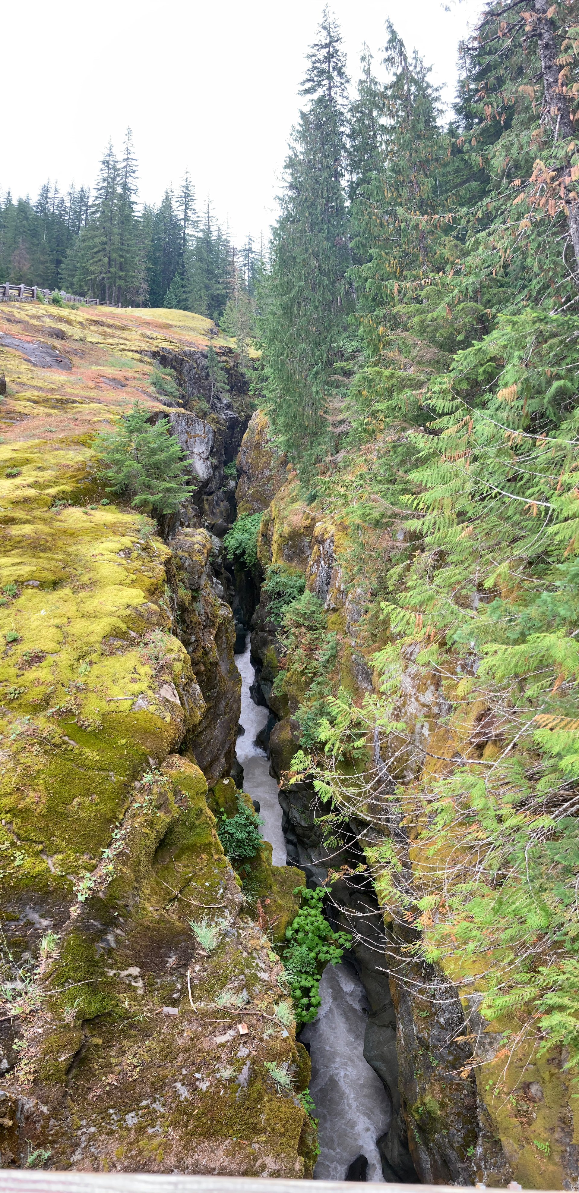
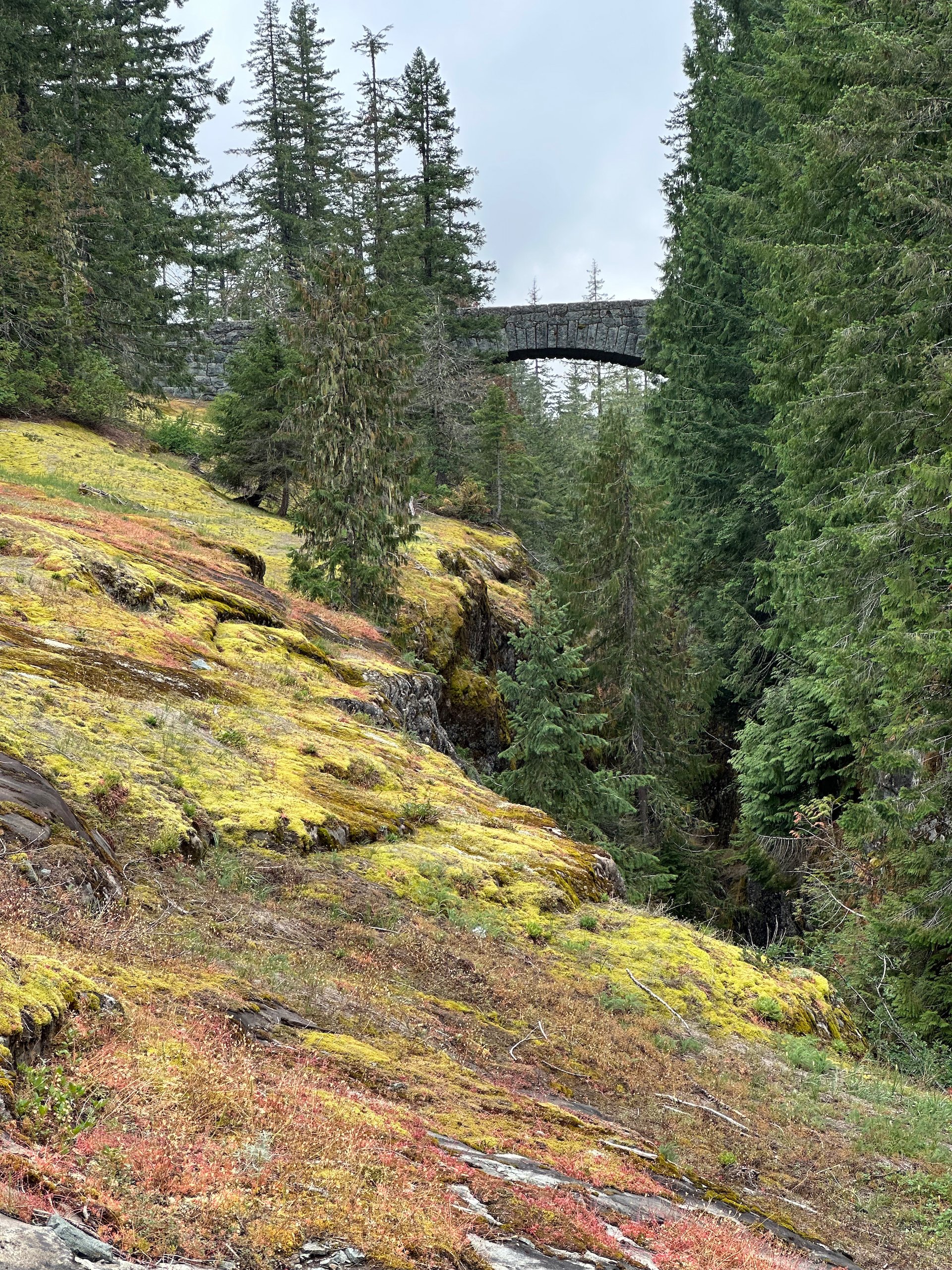
Right near the pull out, the road dives into a tunnel, making for some great subject matter in partnership with yet another beautiful stone bridge.
It’s just a short little tunnel…
We drove back to the campsite in time to make lunch. On the way back, we were in and out of the clouds, which in places provided a very eerie feel to the day. At times you couldn’t see anything. On the way down to the canyon I had noticed a small waterfall along the side of the road, with a convenient pull-out to make it easy to stop. We made the stop and had an interesting chat with a couple of guys on motorcycles as I was taking some photos of the waterfall.
The road disappeared into the clouds from time-to-time.
It was a lovely little waterfall - well worth the stop.
The sun was playing hike-and-seek with the clouds, and so it seemed like a great time for another nap in the hammock (for me) and the text for Justine. After that, we spent the rest of the afternoon relaxing.
Around 4:00 we headed out of the park. We needed gas and we were out of food so we had decided to have dinner at the Copper Creek Inn. We’ve eaten there before - it’s rustic and charming and the food has always been good. After getting gas (and some much cheaper firewood!), we were too early for dinner, so we drove a forest road near the par , exploring a different part of the forest. We drove a good 15 miles or so in, and the road wove along a couple of different river and streams. There were a four number of rustic, backcountry campsites and quite a few families making the best of the amazing scenery.
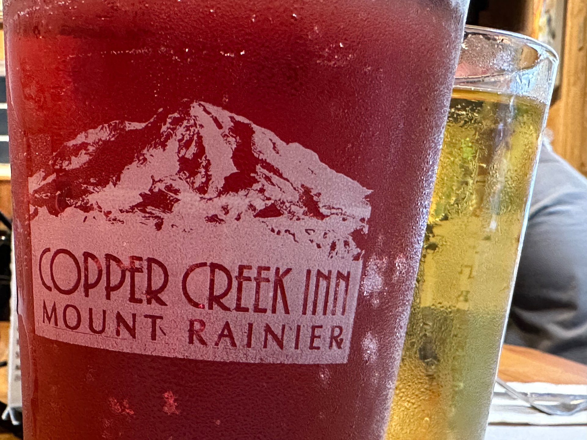
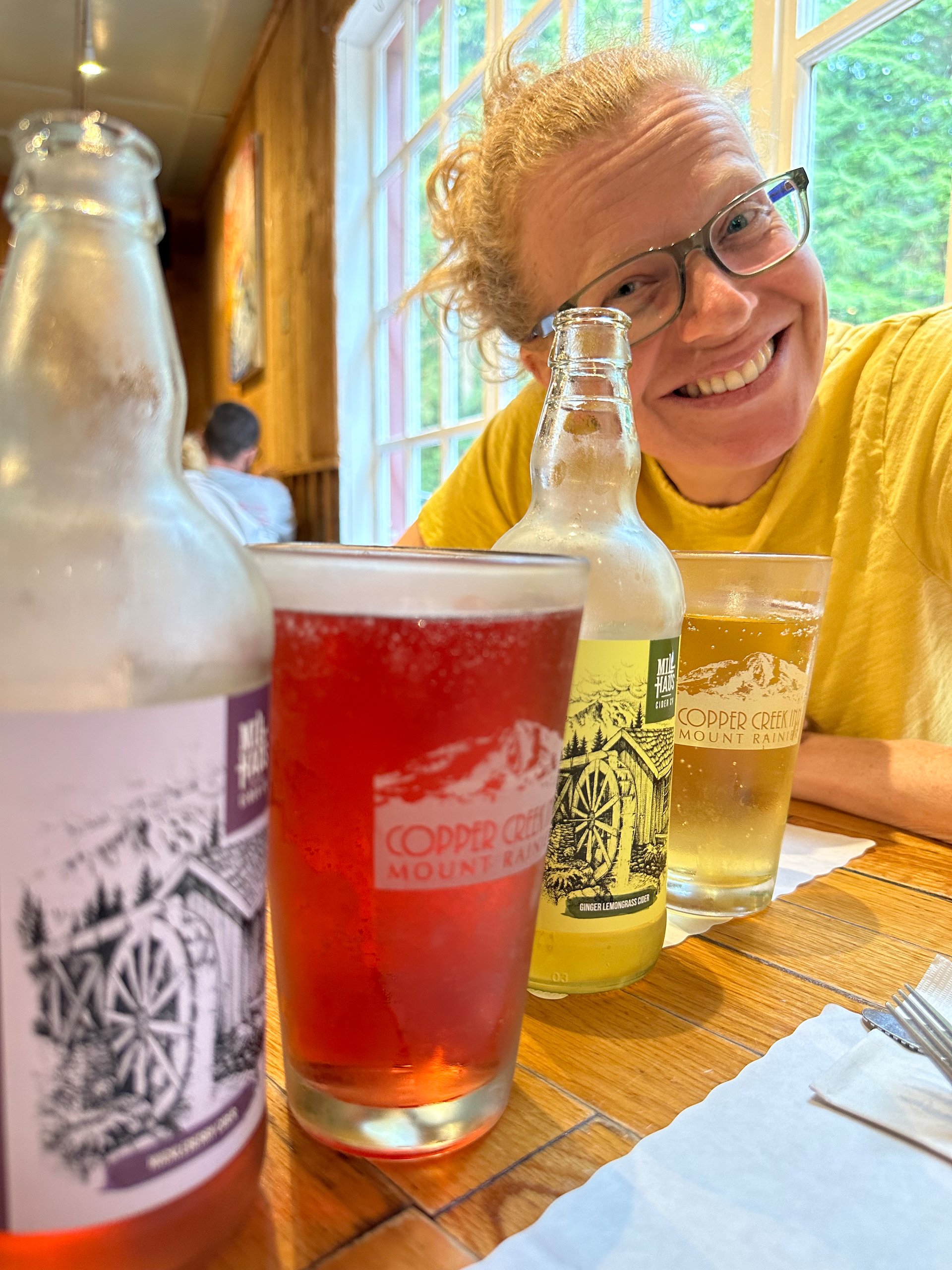
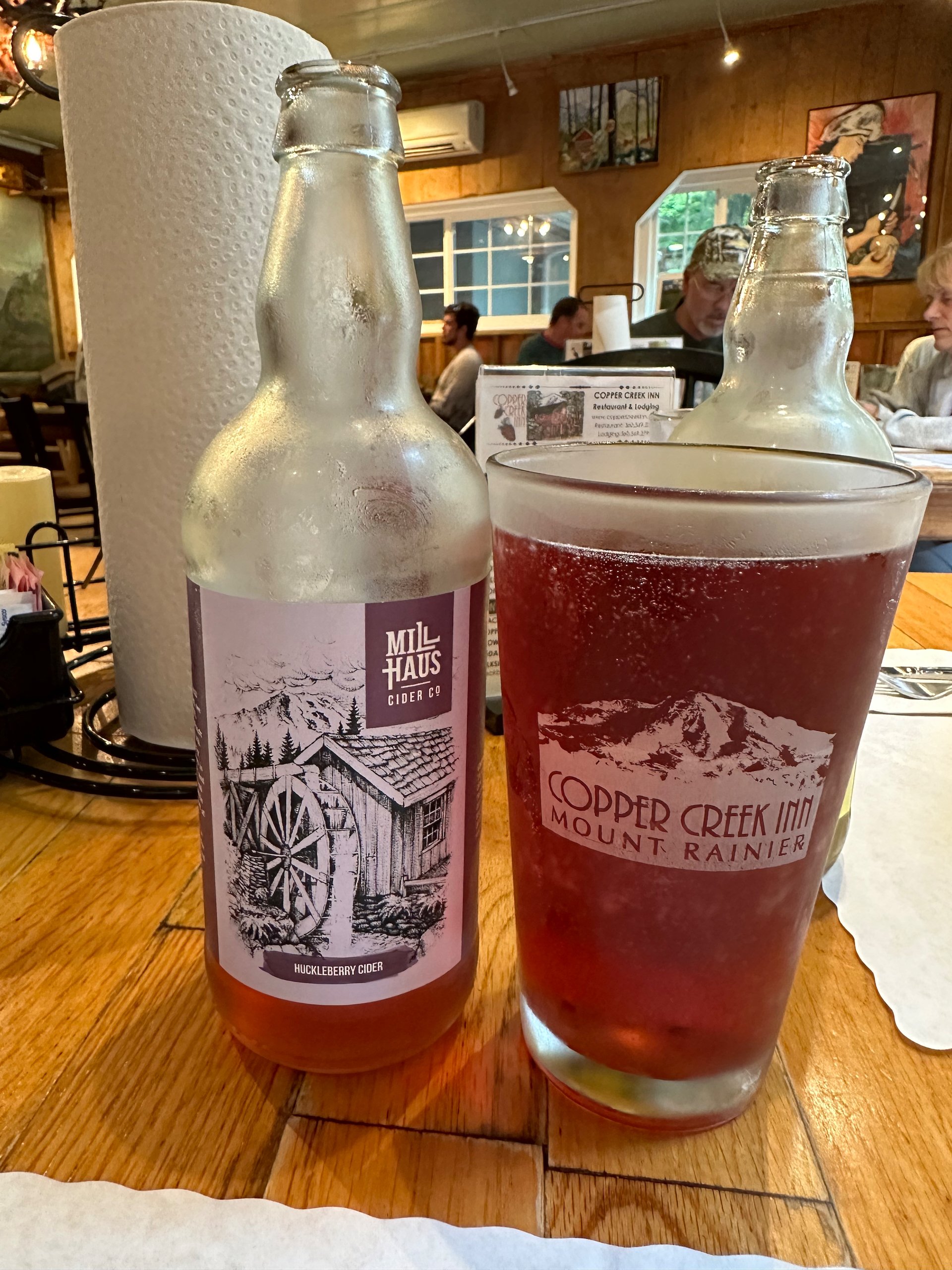
The Copper Creek Inn - always worth a stop.
Eventually we headed back for dinner. The Inn was packed and we ended having to wait a good half hour before getting a table. Which was fine, we were not in much of a rush. Dinner was good, we had some interesting local cider and were full enough to skip desert. We got out fairly quickly, hoping to turn our table over to another group that was waiting.
We headed back up the mountain to our campsite. We had been hoping for some colour to the sunset, but tonight was even worse than last night! We had a bank of high, thick clouds that obscured any sunset and also meant there would be no stars on our last night. That was really the only regret for the trip - I had really wanted to shoot some stars and maybe the Milky Way, but it did not seem to be in the cards.
Instead, we opened a bottle of wine and made a fire. The amazing-looking wood that we picked up (mostly cedar) turned out to be a bust as it was very green and did not want to burn well. But we made it work and had a lovely last night.
Monday, we awoke to the heaviest rain of the trip. Sad;y that meant packing up wet camping gear that we’ll have to deal with later on. We were packed up and on the road just before 9:00, which was great. As we were a bit ahead of schedule, we stopped for a huge breakfast at the Copper Creek Inn (pancakes for Justine, French toast for me), before starting the long drive home.
Our camp site and our gear all packed up and ready for the long drive home.
Saying goodbye to Mount Rainier for now - I’m sure we’ll be back before too long.
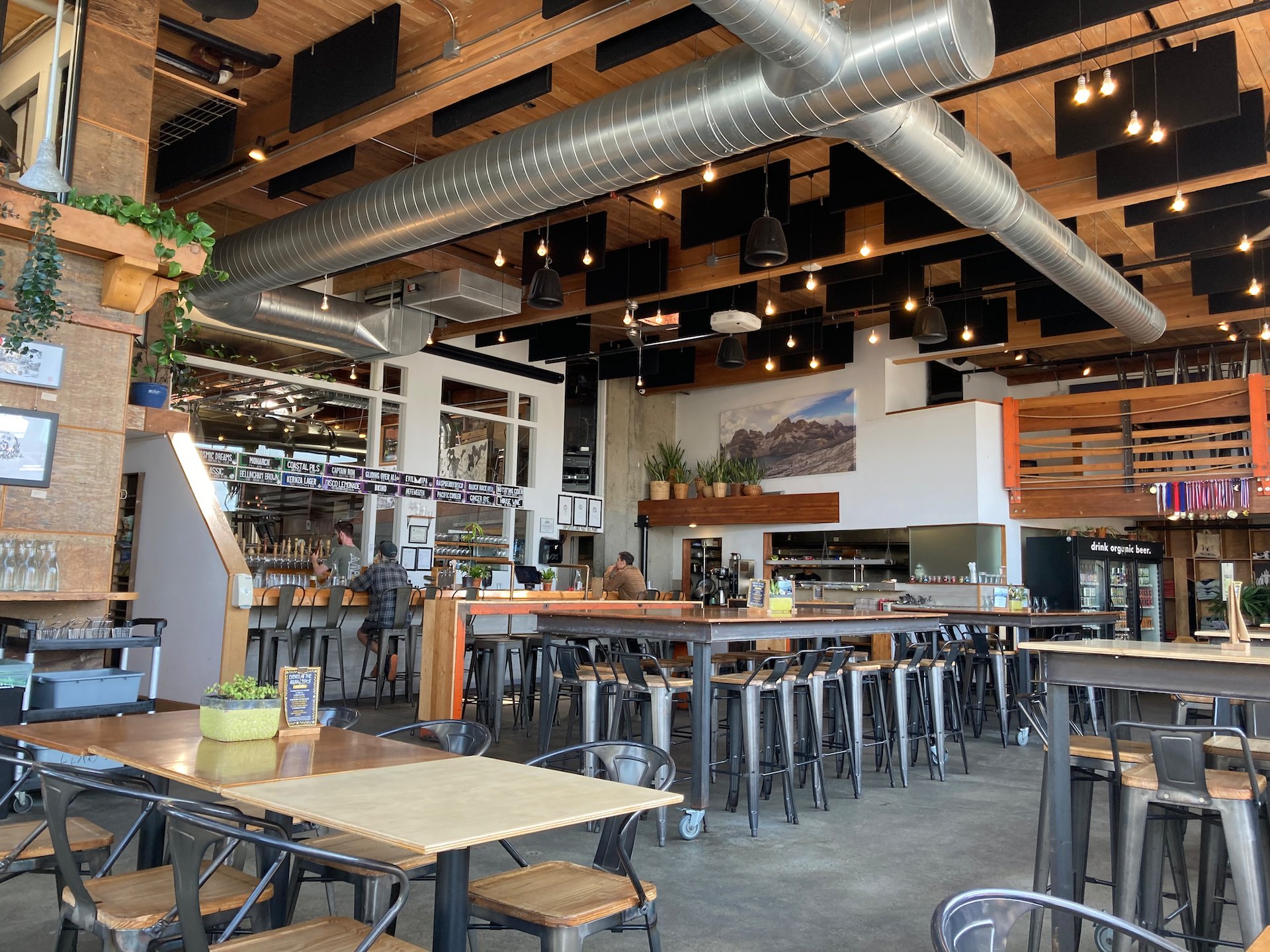
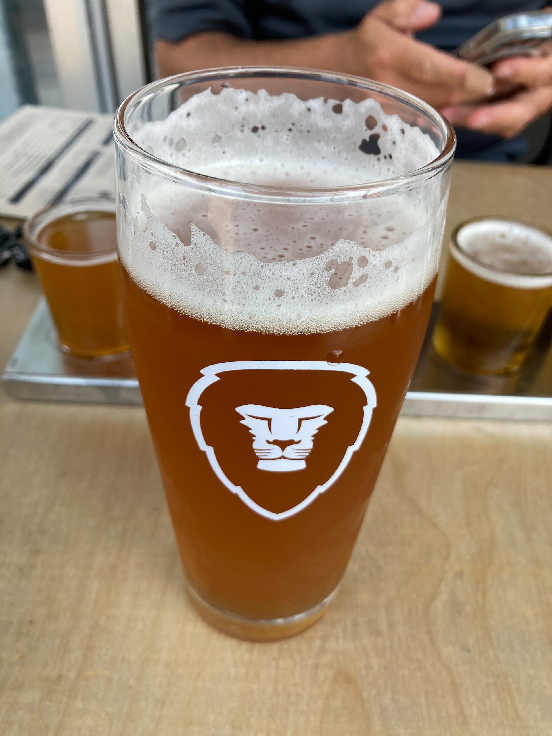
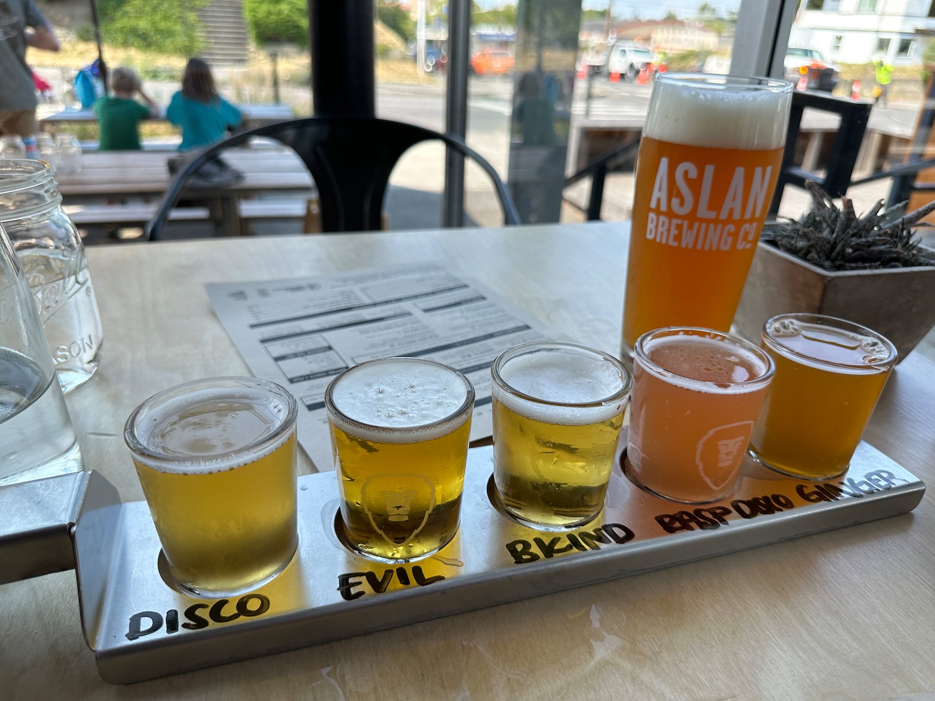
We took the scenic route most of the way, adding some time but making the drive much more pleasant. Eventually we decided that we had dallied too long, and it was time to hit the highway. While the drive was much less pleasant, it cut an hour off the trip. We made a quick stop in Bellingham for lunch at Aslan Brewery (they make this awesome ginger rye beer), before heading home.
This was an amazing trip! It was great to be disconnected for such a long stretch. The weather turned on us at the end, but the three distinct parts of the trip really made it seem like a longer adventure. We got lots of activity in, got to relax and generally really enjoyed our week and our first real road trip in a long time!
With the cellular router in the truck we got a pretty good record of our whole trip. For four days in Mount Rainier we had pretty much no cellular coverage so we lost a bit of data, but other than the one weird horizontal red line, it was pretty good. We covered a lot of ground…