For the last four days of the trip, we were camping at Mount Rainier, at Cougar Rock campground. This is one of our favorite places and gives great access to Paradise and the surrounding area. This was also planned to be a bit more relaxing, as we only had one big day of hiking planned. As usual, things did not go as planned…
Mount Rainier - Cougar Rock Campground
Thursday morning we got packed up at Tucker Park and said goodbye to Oregon. We headed out through Hood River and across the very cool, old toll bridge into Washington State. We had decided to take more of a back road trip, and had picked a route that weaved around the west side of Mount Adams.
The drive ended up being amazing! For the first hour or so, it wound through the forest and gave peek-a-boo views of Mount Adams. We stopped at a couple of spots to take some pictures. Eventually the road turned to gravel, which we were not expecting! It explained the three hour travel time. It slowed us down, but the route was still beautiful. After a while it turned back to a paved road, but it was so rutted and full of sinkholes that I think the dirt road was better. We really had to go really slowly to avoid the worst of it. We made a stop for lunch, just pulling over on the side of the road at a random spot where the river came close to the road. While it was a bit exposed, the view was amazing. It was not a long stop, but it was good to take a break and get out and stretch our legs.
Soon however, we were back onto a good, paved road, and eventually civilization. We started making better time, and eventually were on the road to the park entrance. This was where we had a bit of a snag. We needed to pick up some food for our few days in the park, but none of the little "grocery" stores in the small towns between where we turned off had any real selection. We managed to scrounge up a few things, hopefully enough to get us by!
Hello Mount Rainier National Park!
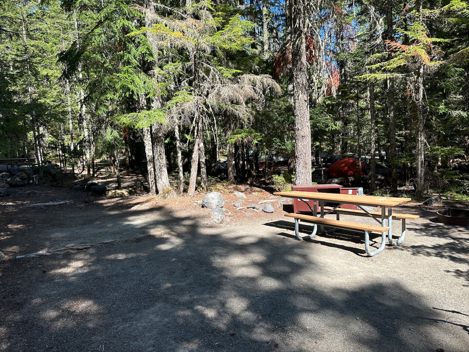
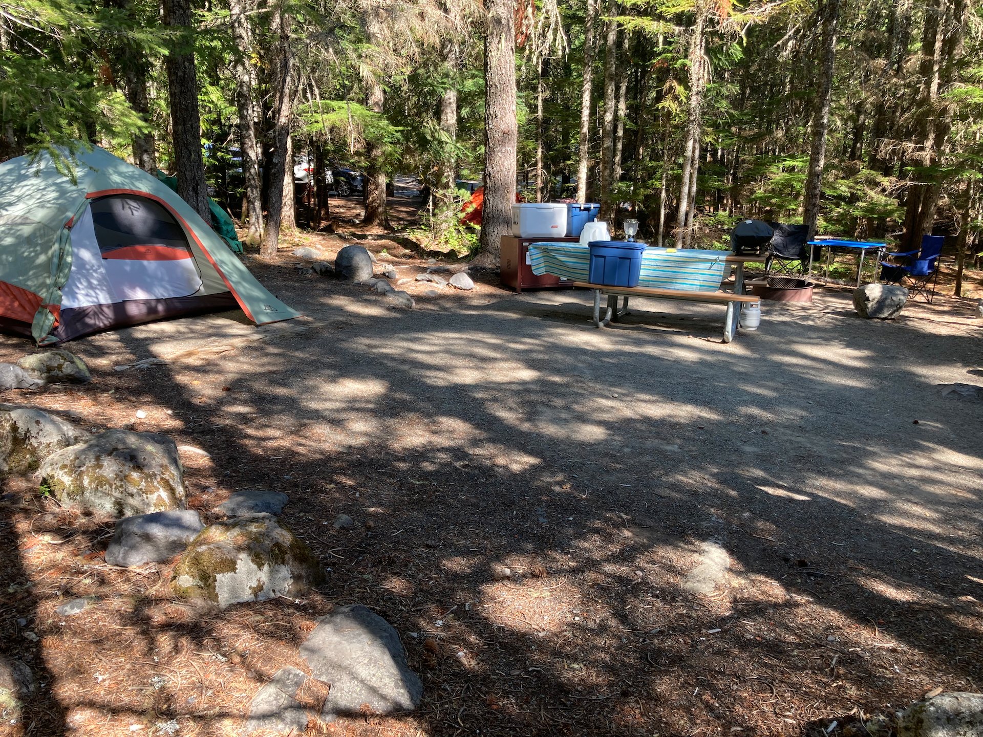
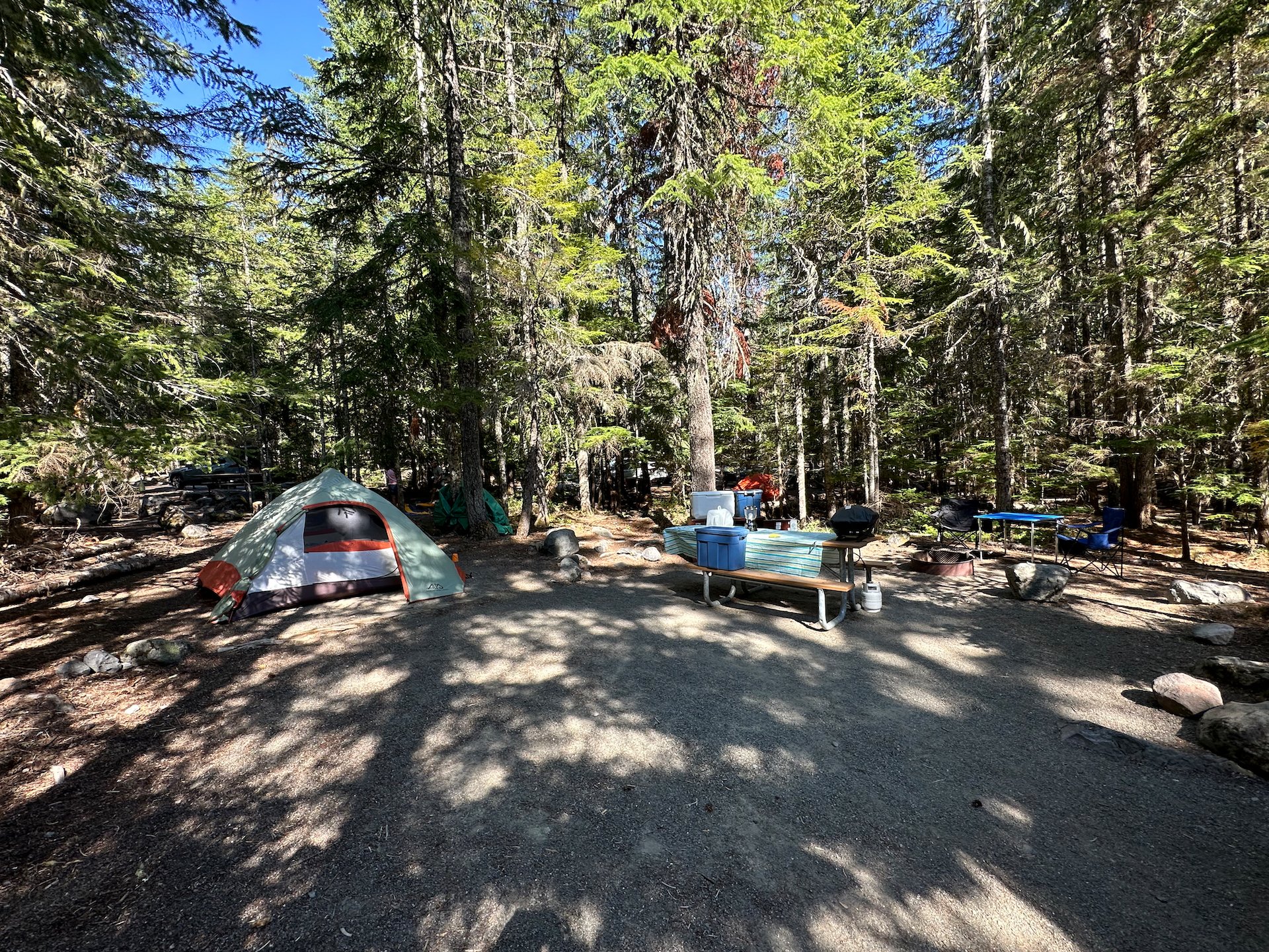
After a couple of less-than-successful stops, we had what we needed. We got to the main gate for Mount Rainier National Park and checked in for our next 4 days of relaxing and hiking. From the main gate, we headed up the mountain, to our campsite at Cougar Rock. Justine had done superb work getting us a site at this amazing campground - the best one in the park.
We found our site and got settled in. We’re pretty efficient and we had camp organized in less than half an hour. Jus picked a good site - lots of space, with a separate area to put the tent, and a good place to set-up our table and chairs.
After getting camp set-up, we drove back down the mountain to Longmire. Longmire is the administrative center for the park, and there’s a decent little store. We picked up some ice and some very expensive firewood, as much to our delight, we had discovered that campfires are allowed (for the first time on our trip!).
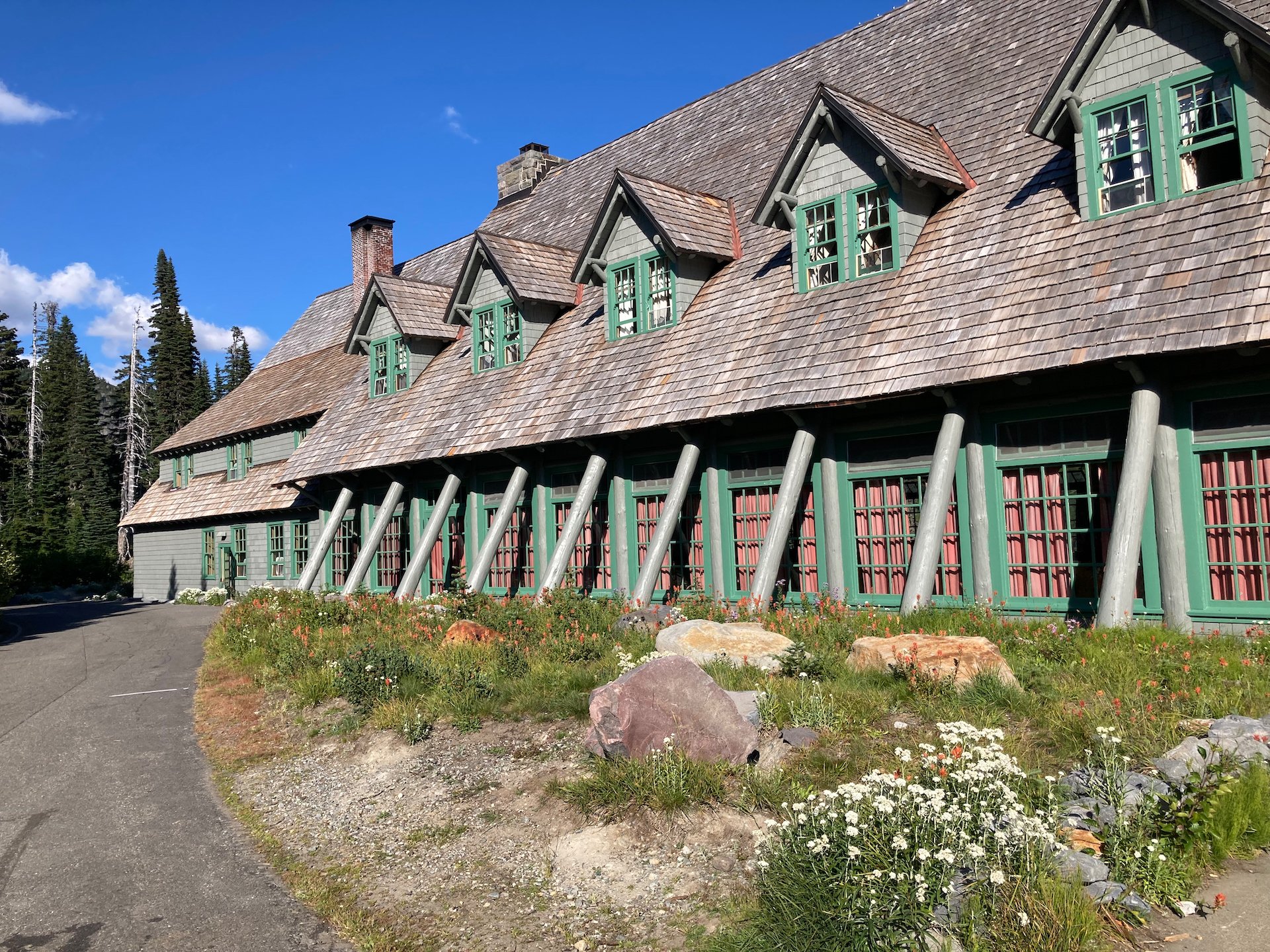
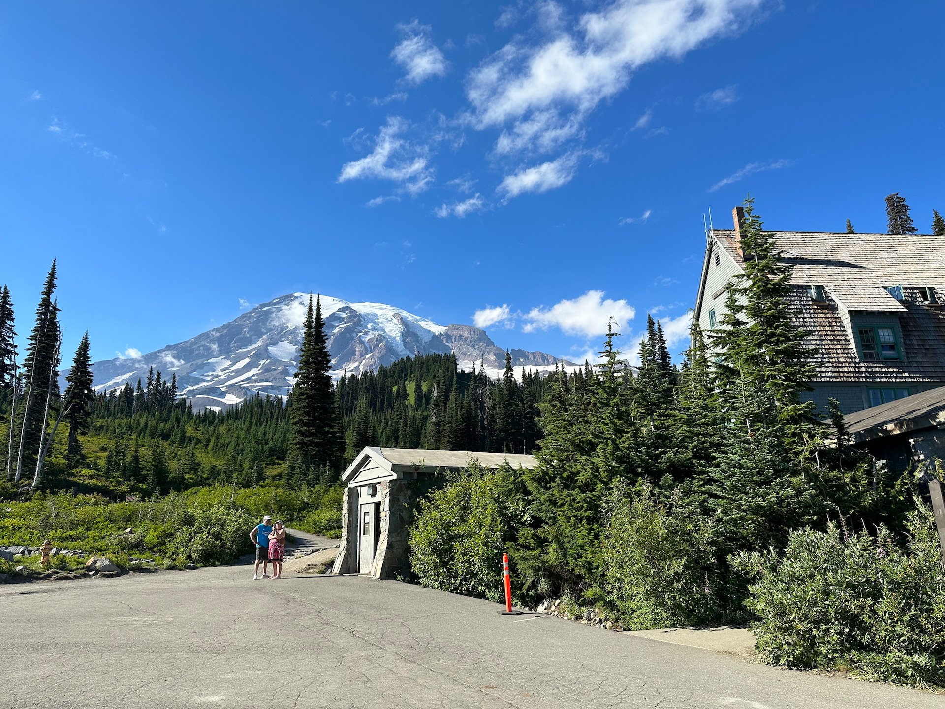
After picking up those last supplies, we headed all the way up the mountain to Paradise. While we would have loved to have stayed at the historic lodge at Paradise, it’s almost impossible to get a reservation. So we stuck with camping. But there’s a fun restaurant at the lodge and we had decided to have dinner there. We got up to the lodge about 5:30, which was too early for dinner.
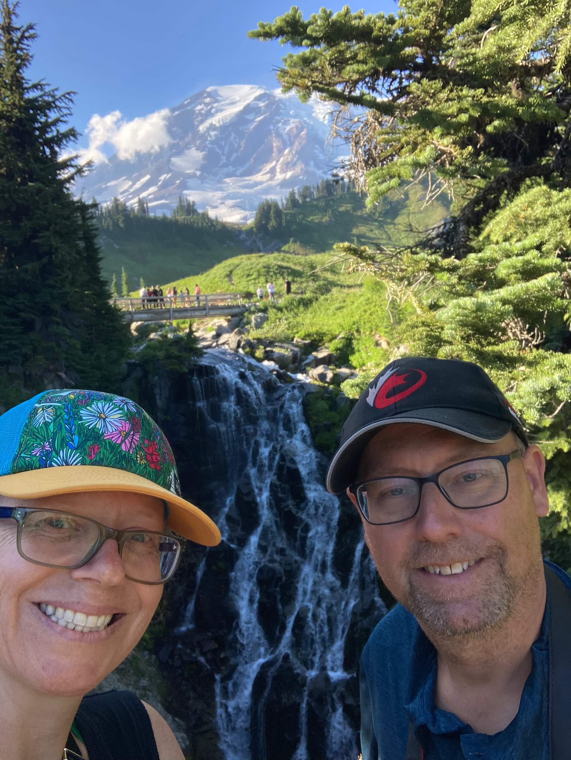
Mountain selfie
So we walked some of the local trails close to the lodge, getting some great views of the mountain. There are a lot of easy, paved paths close to the visitor center that gives everyone easy access to some spectacular views of the mountain. As it was getting late in the day, it wasn’t too busy. There were still quite a few people - don’t get me wrong, we certainly did not have the place to ourselves!
As it was getting later into the afternoon, the light was quite nice, so we walked around and took some photos. I’ll have many more, hopefully better ones to share once I get a chance to go through them all (I think I ended up taking over 3,500 photos on my proper camera on this trip). It’s going to take some time…
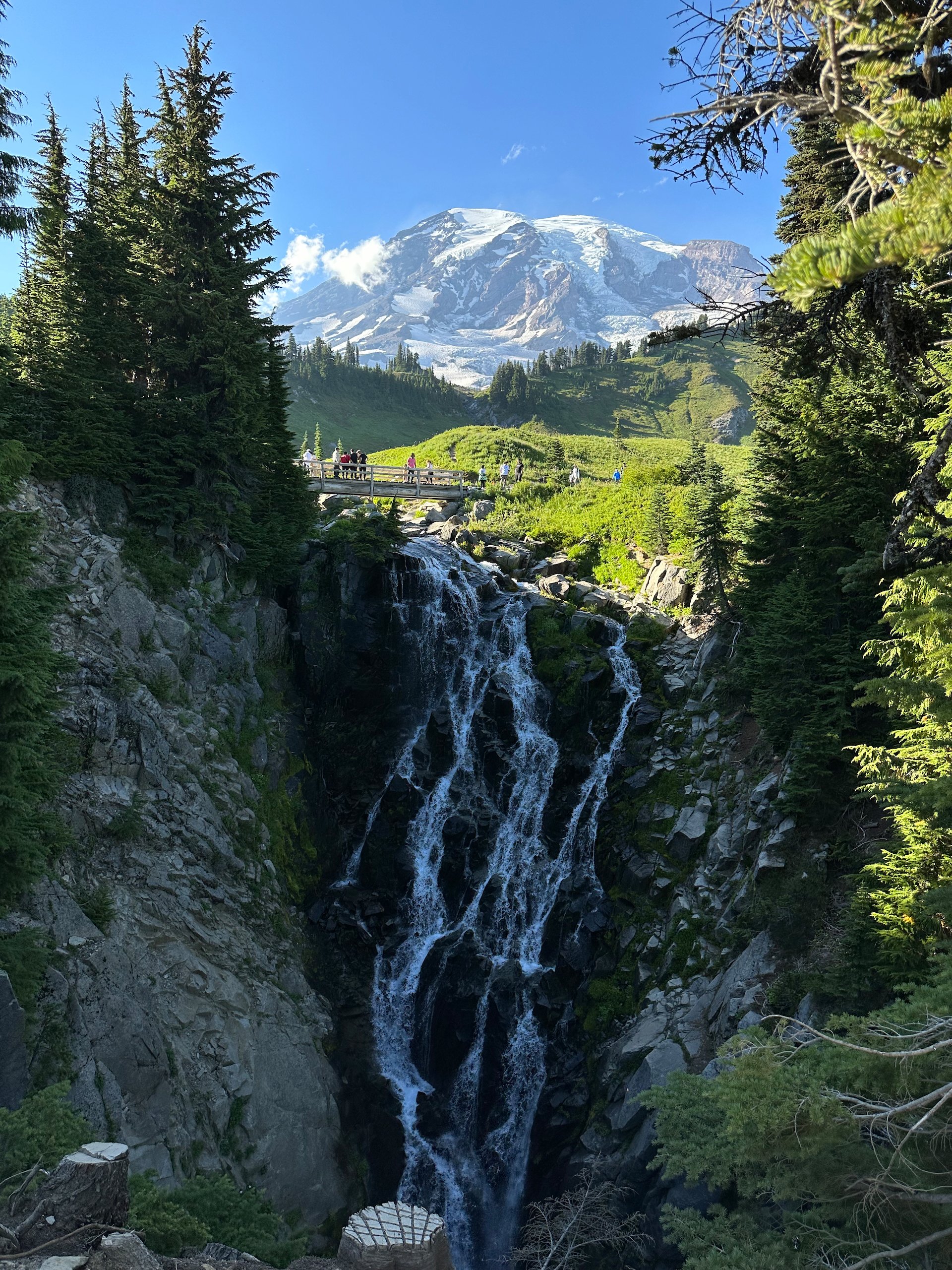
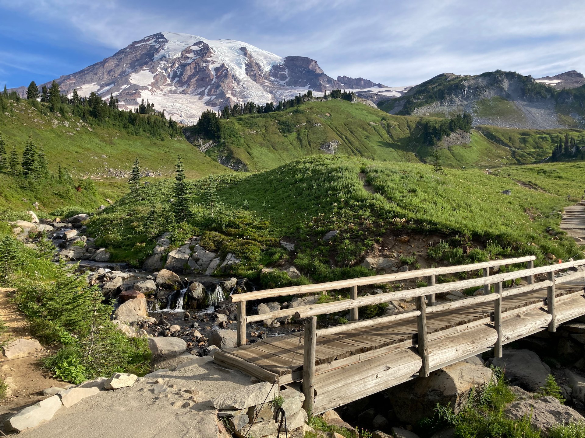
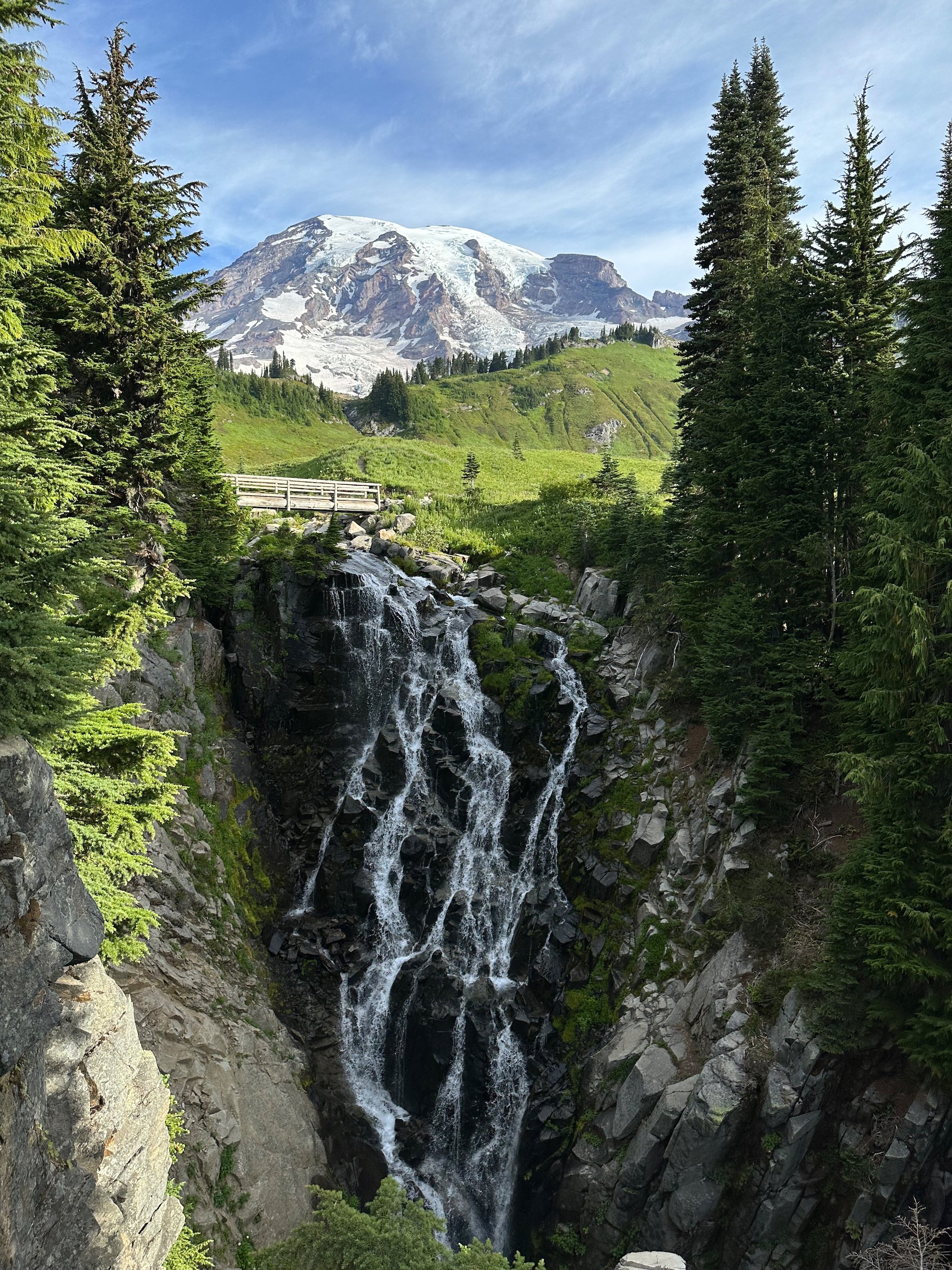
Near the lodge is Myrtle Falls, which is one of the most amazing waterfalls, especially for being so accessible. There’s a beautiful little river that runs down from the mountain, cutting a path through the valley. It winds its way down and under a bridge across the trail, before falling off a cliff to form the waterfall. As we had some time, we walked up to the waterfall and enjoyed the evening.
Looking down on part of the lodge complex from the trails at the foot of the mountain.
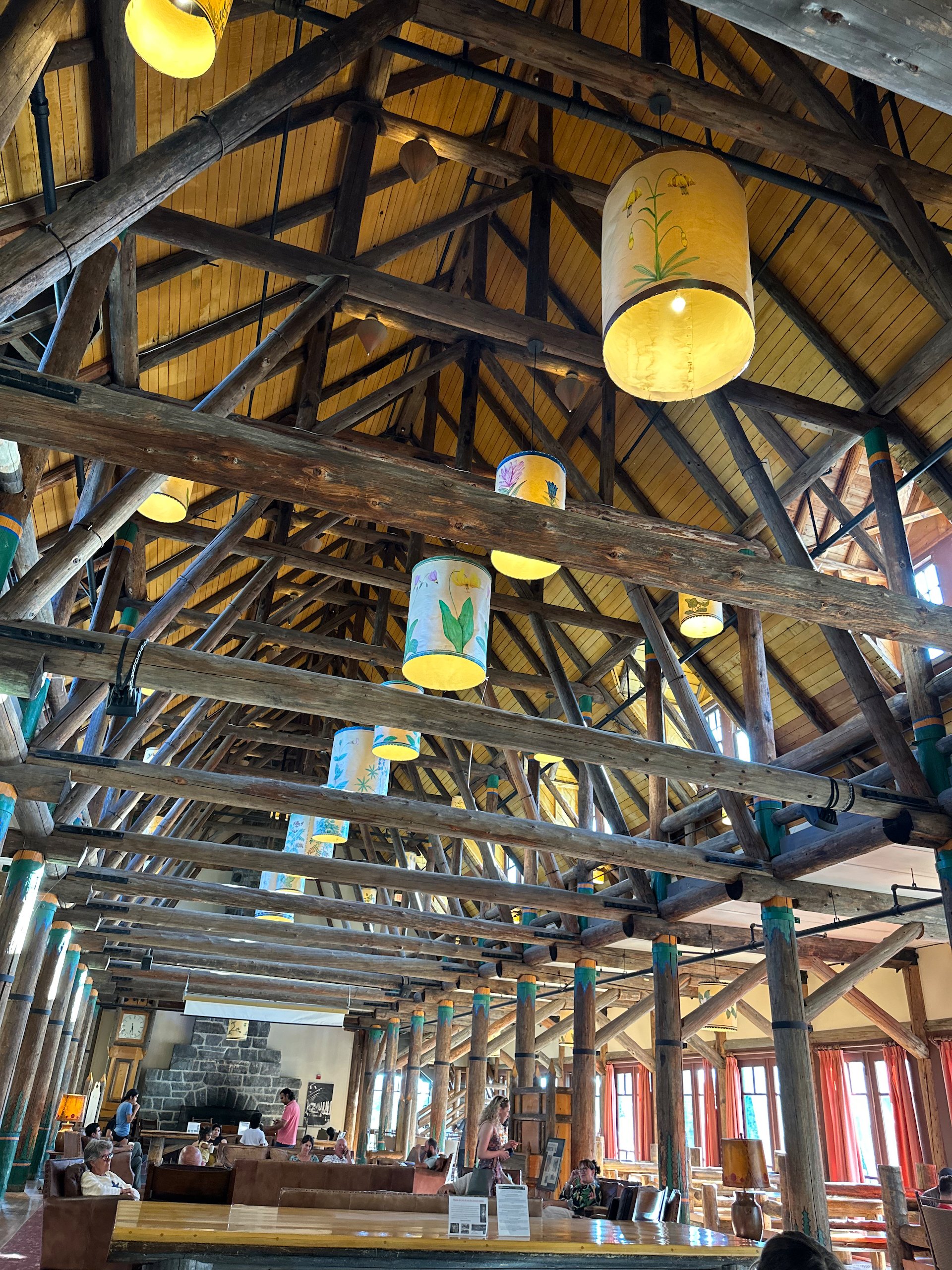
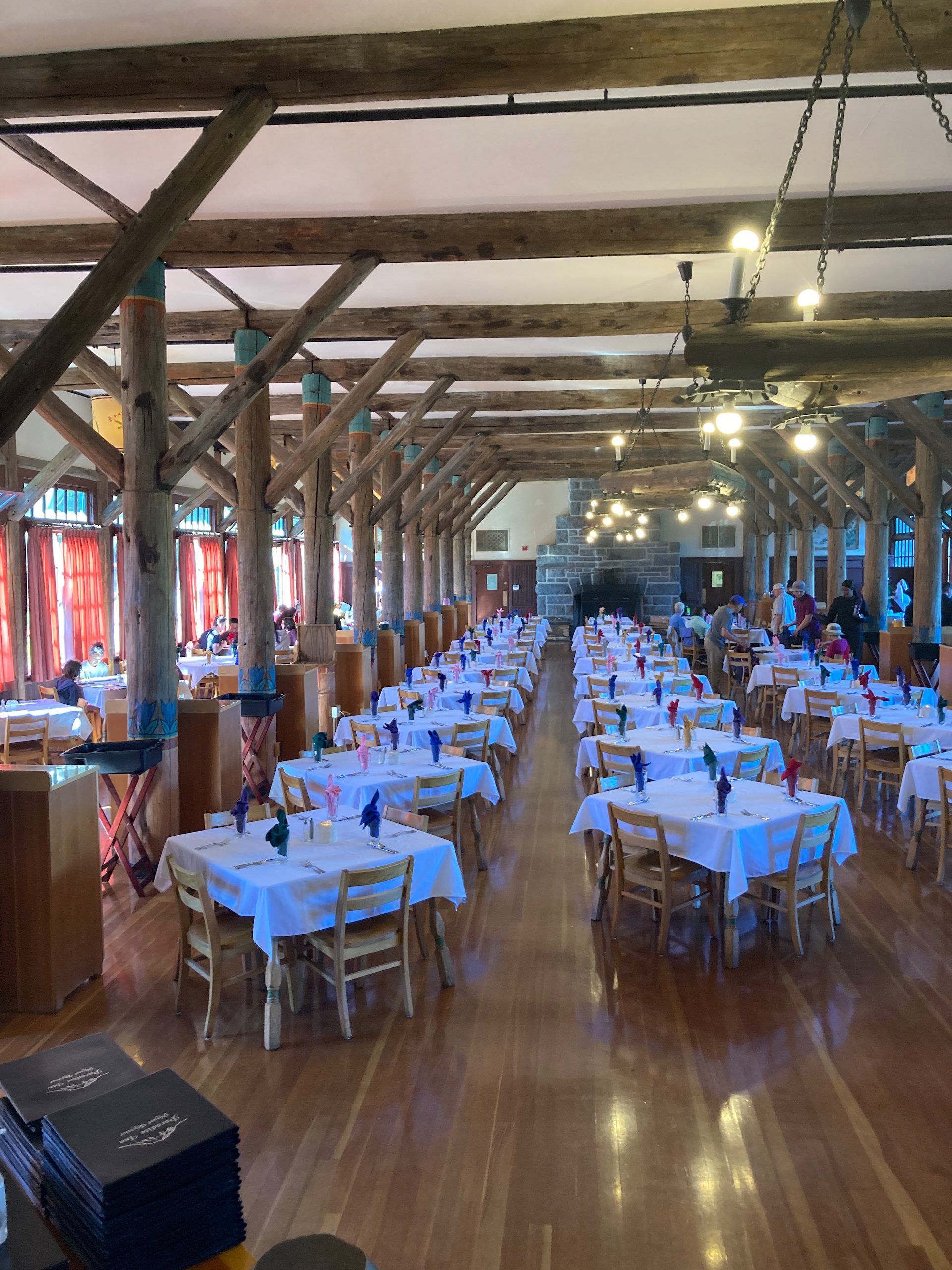
Eventually we headed back down to the lodge and the restaurant. They don’t do reservations, and it was fairly busy so we had to wait about half an hour before we got out table. We sat in the main lobby of the lodge and enjoyed a short rest. It is such a spectacular building. While the restaurant is nice, it’s expensive. So we stuck with the burgers (huge) and a beer and had a nice, casual dinner.
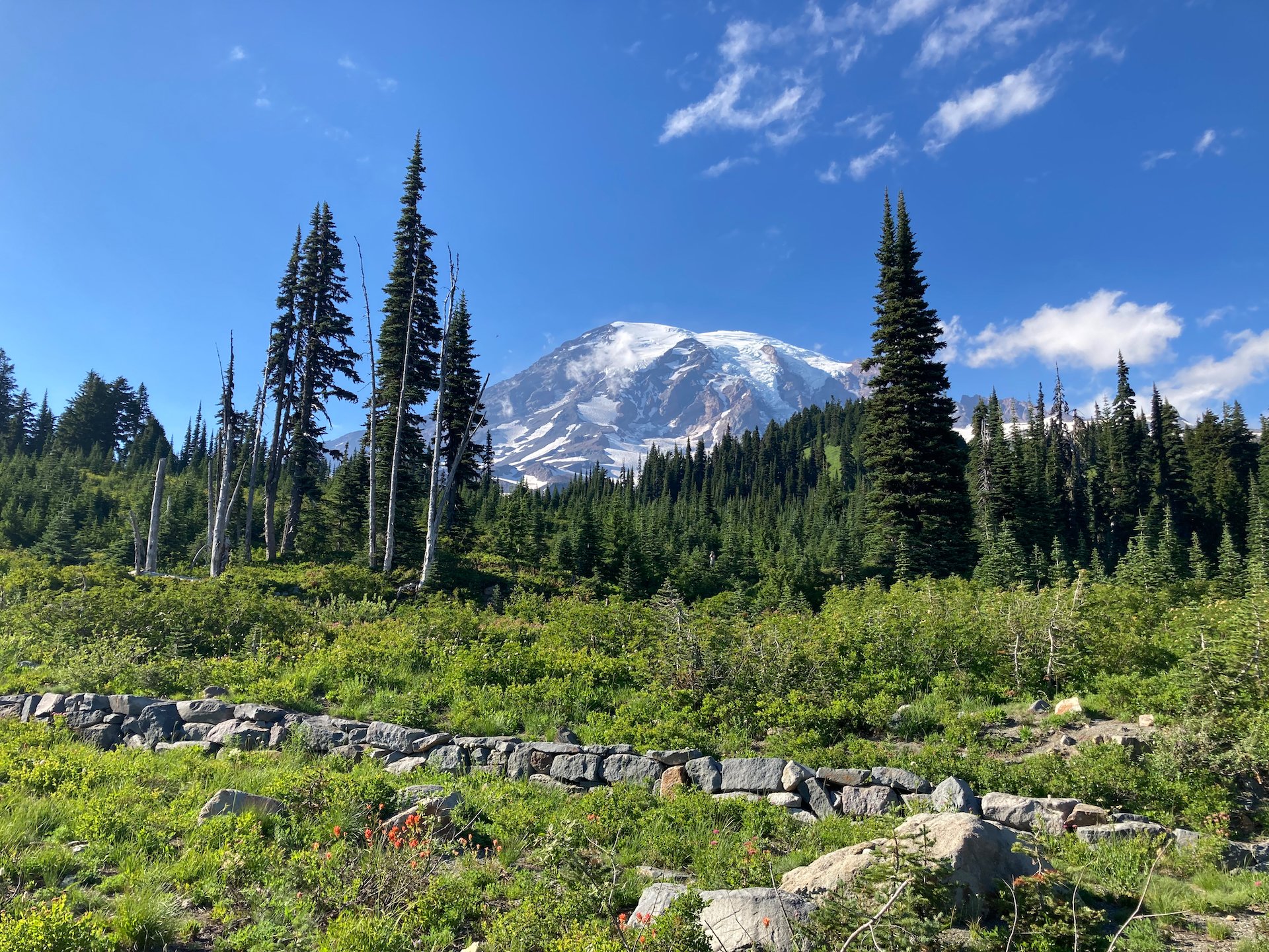
After dinner we wandered a bit around the top, as the light was fading. It was quite beautiful, and Justine found a great spot where some of the wildflowers were framed against the Tatoosh Mountain range across the valley.
It seemed promising for wildflowers, as the sun set on our first day on the mountain.
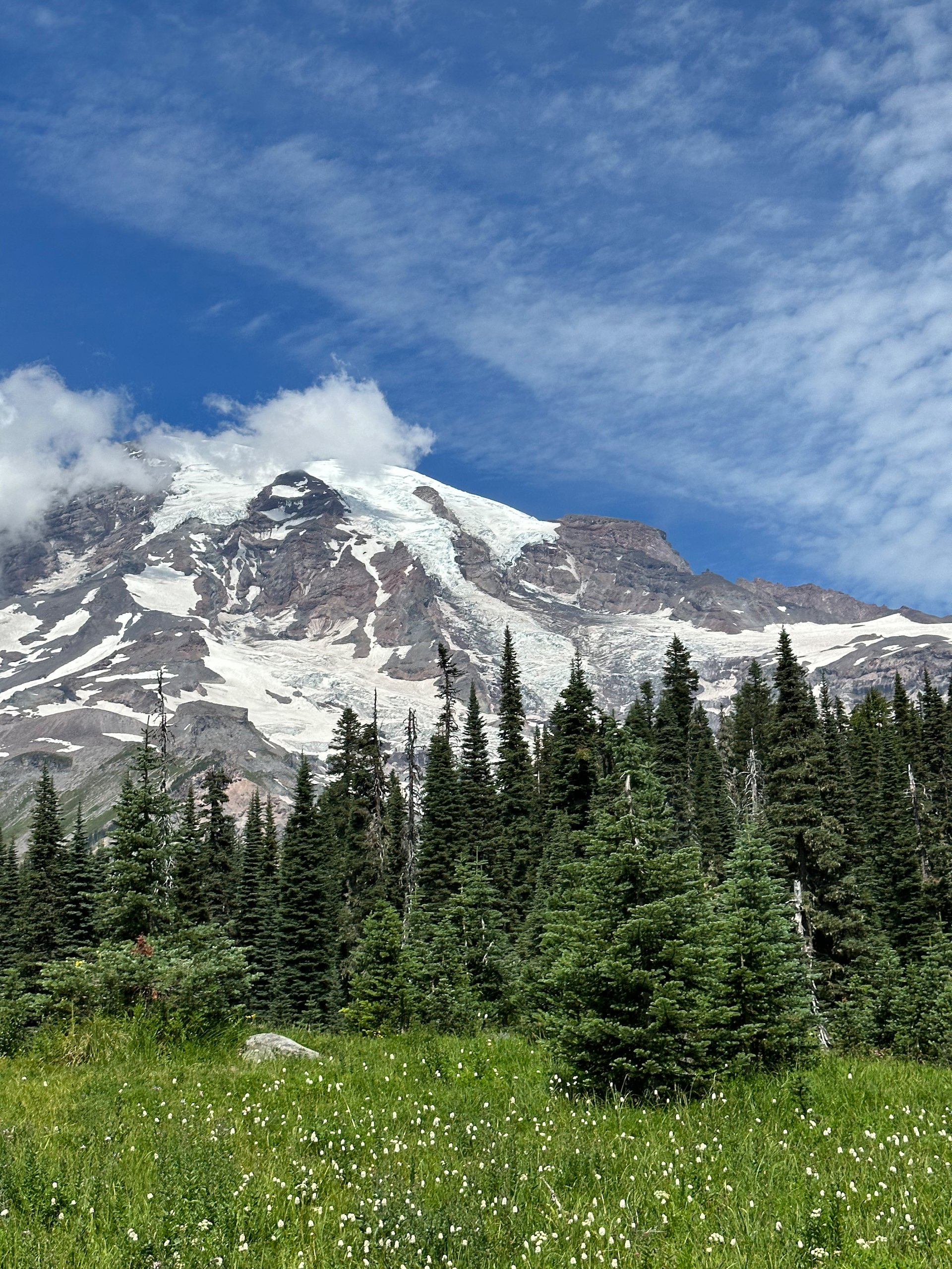
Wildflowers and Mount Rainier are just synonymous this time of year.
As we were headed back down the mountain to our campsite we were treated to a series of different views of the mountain and the sunset over the surrounding area. In hindsight, we should have spent more time on that first night on the mountain, with the clear skies, as it was to be our only clear night. BUt we didn’t know that at the time and we were tired from a long day of travel .
There was some amazing colour, looking out towards the sunset.
Once we got back down to the campsite, we were able to have a fire! It was the first one of our trip, and we had almost accepted that there would be no fires at all. So this was a nice surprise, and we sat out under the stars and enjoyed our evening. We had an early start the next day, so it wasn’t too late a night.
We finally got a fire!
Mount Rainier - Skyline Trail Hike
Friday morning we were up early to try and beat the crowds to the top of the mountain to do the popular Skyline Hike. We’ve done this hike in the past, and it’s an amazing loop around this part of the base of the mountain. It takes you up from the lodge at Paradise into the alpine meadows before the real climb up to the basecamp for the assault on the summit - not that we have any plans to climb the mountain! Despite the early start (6:30), we didn’t really make it…
Starting our hike up to the Skyline Trail.
We were up at the Paradise parking area by about 7:00 and it was already almost full! We parked and headed into the lodge to grab a quick breakfast, and then headed up to the trailhead.
We typically do the hike "backwards" to what most people and the guidebooks suggest. It’s a 5.5 mile loop, so it doesn’t really matter, but doing it counterclockwise we find works better for two reasons
Most people don’t do it this way, so you only hit the crowds on the way back down; and
The elevation gain is a bit more gradual.
The other direction you basically do this stair climb up to the highest elevation, right from the beginning of the hike. It just doesn’t seem fun. But we saw so many people on our way down that have not seemed to have figured it out.
So we headed out. There were only a few groups that were on the trail at roughly the same time, heading out our way. As we climbed, we did start running into more groups, but the first third of the hike was pretty much just us. Which was nice, as it certainly didn’t last.
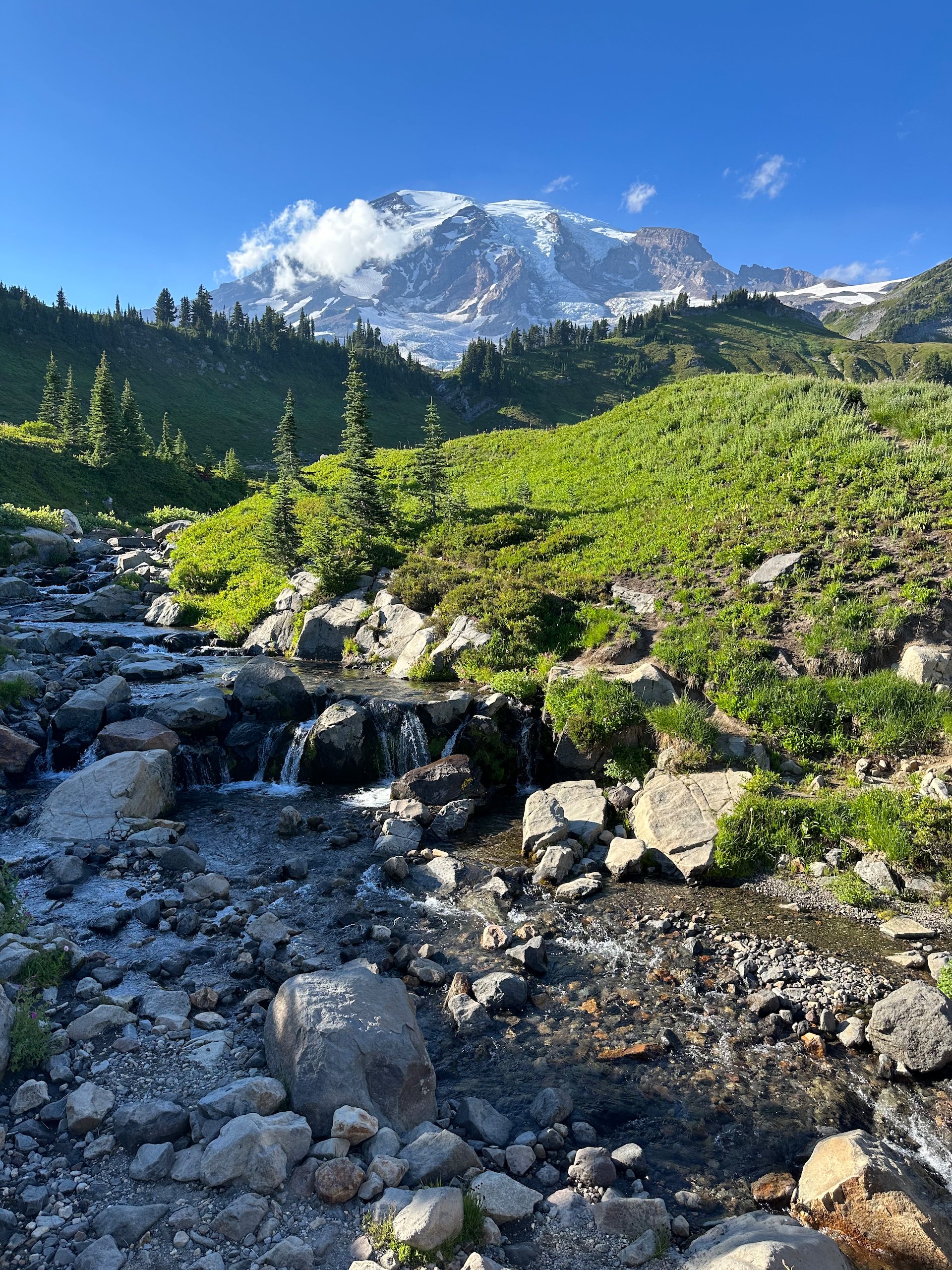
The beginning of the trail started where we had been last night - walking up past Myrtle Falls. It was much quieter this morning, so we stopped to take a few more pictures, and see how the light had changed from afternoon to early morning. It still is just a beautiful spot, made better by fewer people.
Once off the pavel “local trails”, the path heads east and up as you wind your way along the trail at about the elevation of the lodge. At that point, the trail starts to descend down the valley to the bottom of a small stream. We crossed a scree field where we’ve seen marmots in the past, but this time we got pikas! We stayed and watched the little guys for a while as they collected their nest material for the coming winter. Up here, it’s not that far away… I don’t have any photos to share of the pikas yet, but that will be coming.
Then we continued on, dropping into the valley before climbing up the other side. We had nice views back to the lodge and the mountains on the other side of the larger valley. The last time we did this hike - almost 4 years to the weekend - we had the most incredible wildflower display. This time, there were not nearly as many. Almost no lupins, which are the big draw. We later found out that there had been no big flowering event - the conditions were not right.
Mount Rainier looms over you at almost every stage of the hike. Sometimes it’s a heavy presence; sometimes if just the peak of the mountain peeking through the trees.
We had taken a side trail to see if we could find some more flowers, but that didn’t really pan out either. There were flowers about, just nothing like what we had seen previously. In speaking with a Ranger later he indicated that the weather this year had not been conducive to a massive bloom, and that they were not expecting a “peak bloom”, as they have some years. It turned out that maybe the last time we were here we had gotten very lucky the last time we were here!
For the first stage of the hike, this was a pretty common sight as the trail weaved through the mountain meadows. At this point we were actually heading away from Mount Rainier, towards the Tatoosh Range.
This stage of the hike involved a lot of climbing. As we had descended, we had to earn back the elevation and then some! The good thing about the direction that we had chosen was that the elevation gain was a lot more gradual - you went up and down a lot, but it happened over reasonable distances. It was quite pleasant.
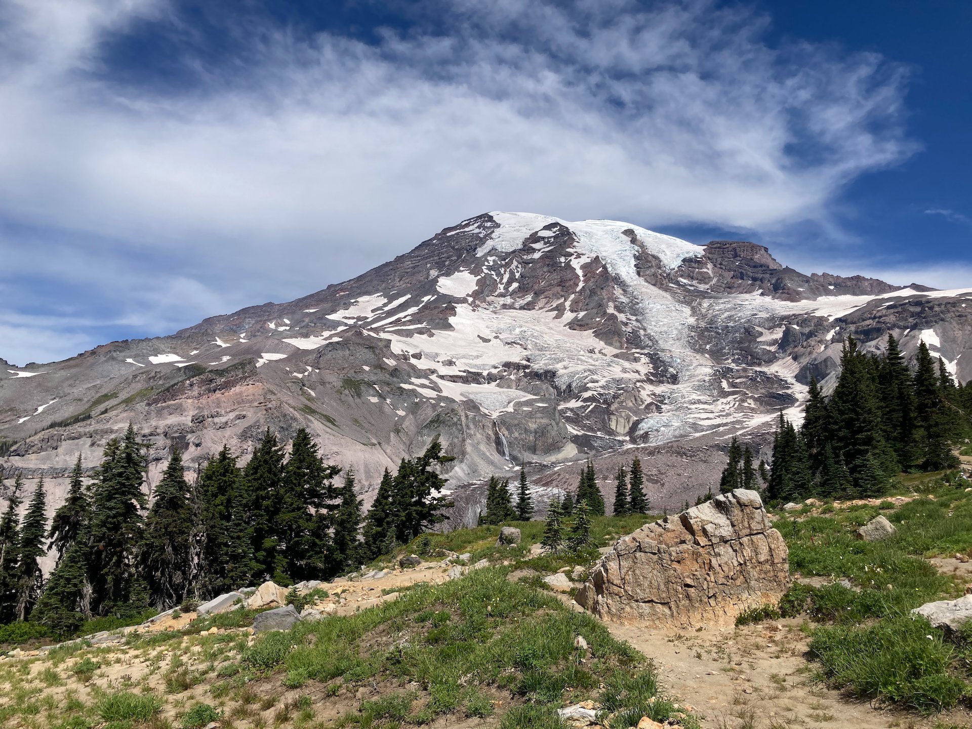
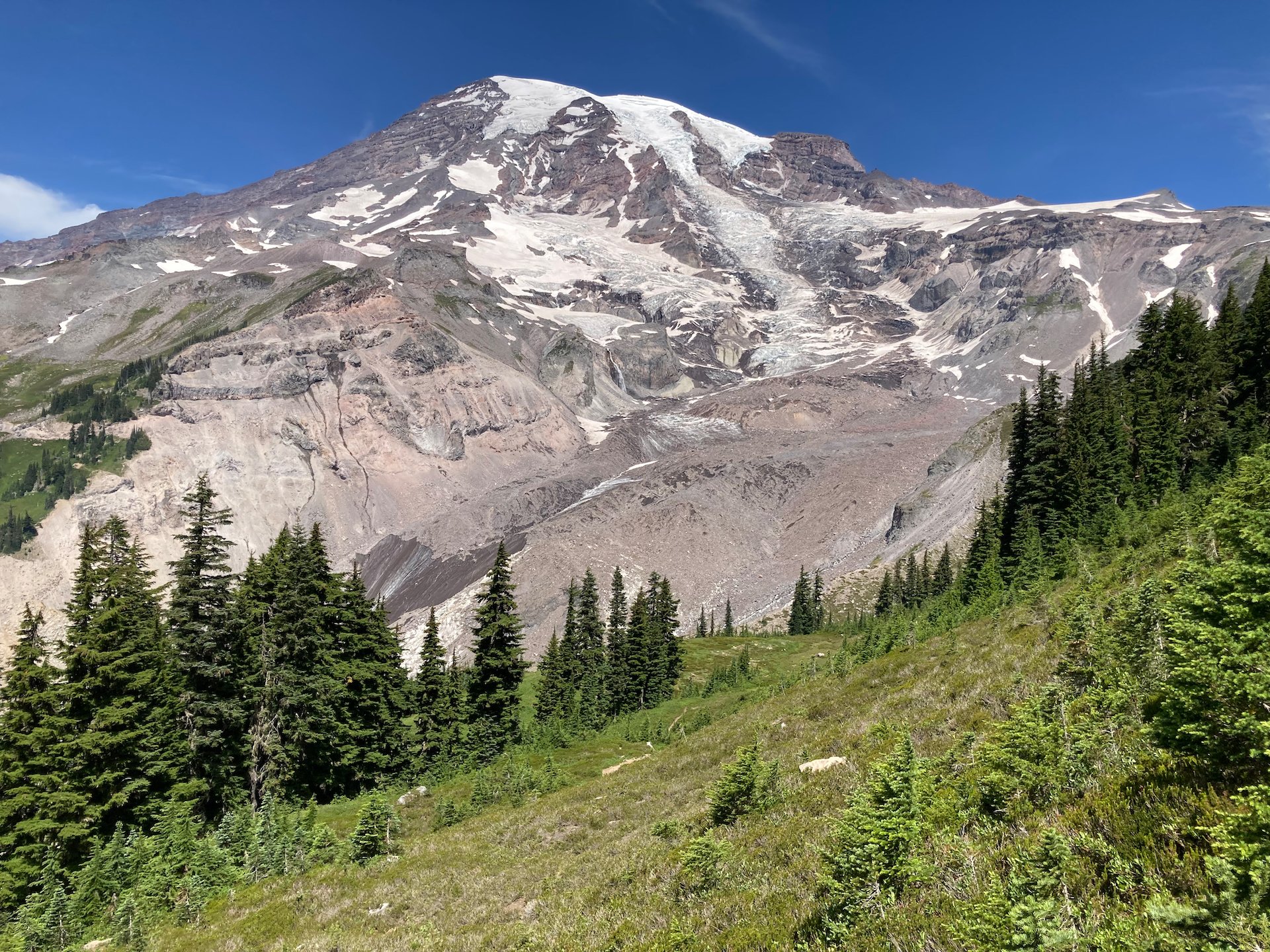
At this stage, the route heads out of the forest and turns back towards the mountain, looming over you. I know it’s not a huge mountain on a global scale, but it’s a big as they get in these parts. And it’s stunning to look at.
The route also opens up a lot, and the route traverses an open area with a view back towards the Tatoosh Mountains. The views seem to go on forever.
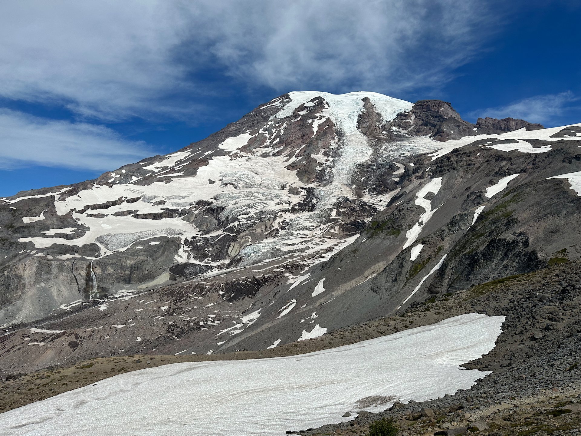
After climbing for a bit, we passed a turn off to the Paradise Glacier. It’s a 1.6 mile (one way) side trip that takes you up to the foot of the glacier. We decided to pass on it this time; we had made the trip last time we were here.
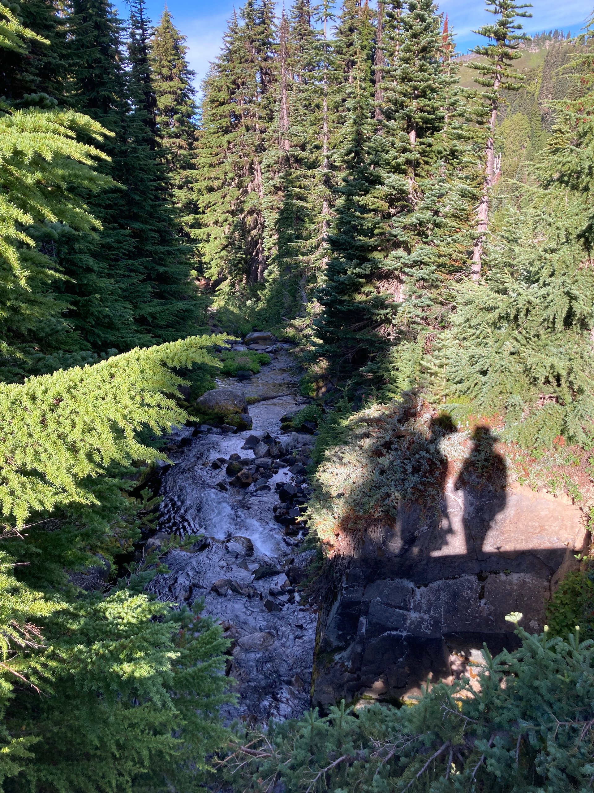
At this stage, the trail drops down a bit into the small valley with a beautiful little stream. There are a ton of flowers growing along the banks, all in the shadow of the mountain. The next stretch was all uphill again as you climb out of what was the glacier in years past (and not all that long ago frankly). So this area is all rock and sand, left behind by the retreating glacier. And this was where it also started to get busy. All those people that started their hike before us, and came from the other direction, we’re getting to this point in their hikes. And as we climbed to the highest point in the hike, it just got worse.
The small streams escaping off of Mount Rainier create these localized areas of life in the gravel where the glacier has receded as it melts. It’s quite pretty, and I love the reflection.
It wasn’t the display we were hoping for, but there was still a fair bit of colour about.
The river crossing was especially perilous - there was a board missing on our bridge!
But as we climbed, the views got more and more amazing! The first mountain to emerge was Mount St. Helen’s with it’s flat (blown off) peak and exposed crater; then Mount Adams came into view, having been hidden by the closer mountains; then finally, way off in the distance, the very tip of Mount Hood could be seen. It was the first time doing this hike that we could see the other “big three" volcanoes. And yes, all four of them are still active. You don’t like to think about it, but it is hard to forget the lesson Mount St. Helen’s taught in the early 80’s.
A pano from the hike - Mount Adams in the left/center; Mount St. Helen’s to the right, and if you look very closely in between, Mount Hood.
It’s a pretty amazing place…

At the height of our climb, we came to a great lookout over the surrounding mountains and valleys, at the price of a lot of people. So we had a snack (fighting off the ground squirrels), and some water, but didn’t stay too long.
Someone was looking for a treat…
And then it was time for the descent! It reinforced our decision on the "right" way to do this hike. While there are some interesting things to see, and some great views of the mountain, it’s basically a set of stone stairs that (in our case) descends something like 1,400 feet back down to the lodge. It’s not the most pleasant, but overall the hike was amazing and why we do it every time we come here!
It’s an epic hike, and well worth doing. The views were amazing - so cool to see all the volcanoes at one time!
The crowds going up as we were descending were insane. I have no idea where they found places to park, but they seemed to keep coming. As we got closer to the bottom, other trails started to emerge, and so we gratefully headed off onto the less busy ones. We turned off onto Dead Horse Creek Trail, then onto the Moraine Trail, which was an unexpected gem! We had been bemoaning the small number or marmots that we had seen on the trail, but this trail paid all of that off.
Almost immediately, we found a small family group - three adults and four young ones. One adult seemed to be excavating a new burrow; "mom" seemed content to head out into the meadow to feed; but the babies were hilarious, exploring, chasing mom and generally having a fun time. At one point, one of them set off a warning call and they all disappeared for a short time, but I guess it was a false alarms, as they were back in no time. All the marmot pics are on my other camera, so you’ll have to wait on the next post for those -and there are a lot!
We watched them for a while, taking some photos and enjoying their antics. We continued on the trail for a while, finding a new longer trail to explore in the future. For today, it was time to call it a day and head down to the truck.
We grabbed lunch and walked down to the picnic area, where we found a table that was unoccupied in the shade and had our lunch. After lunch, we drove back down to the camp site and relaxed for the afternoon.
Nap time!
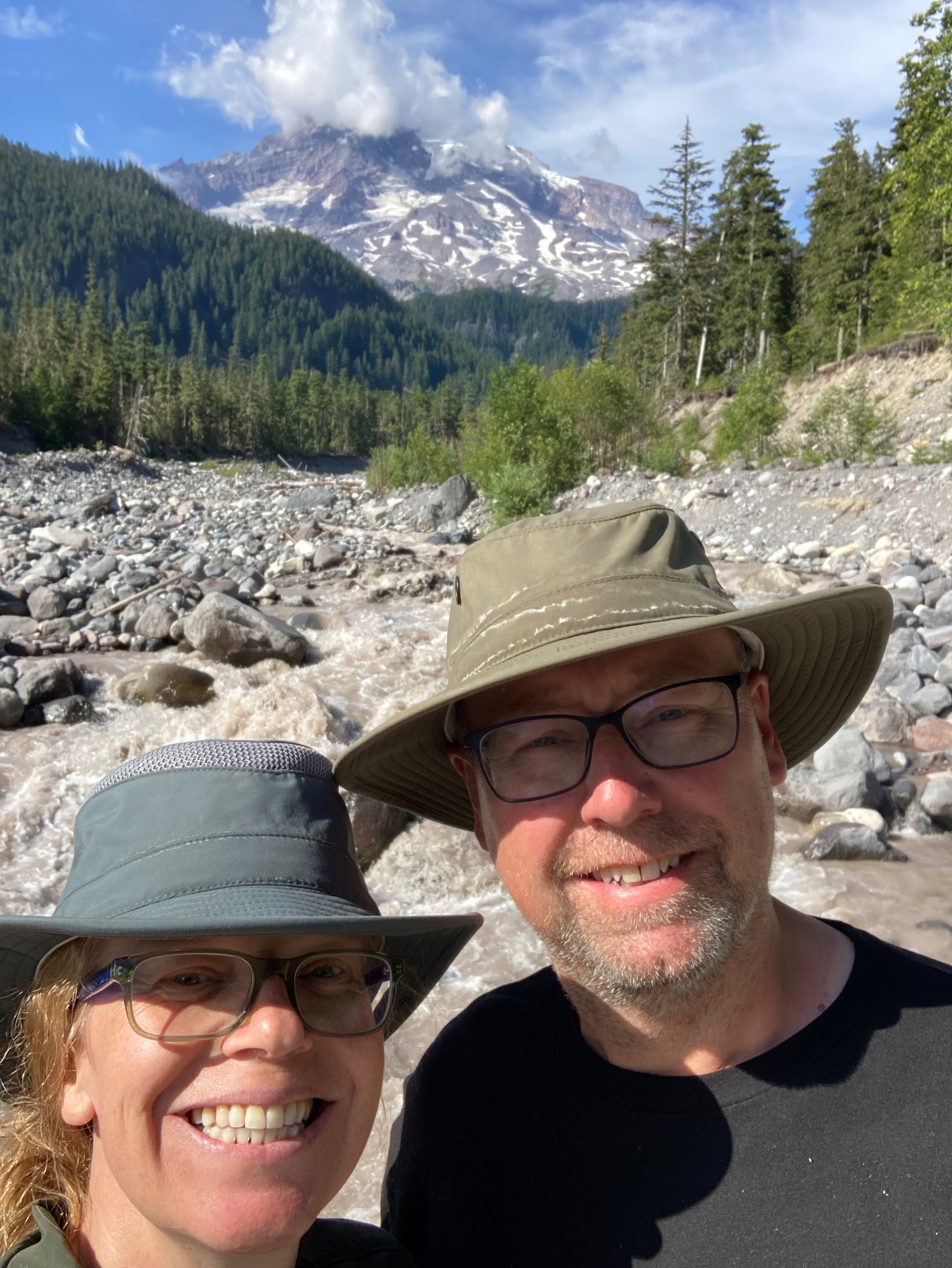
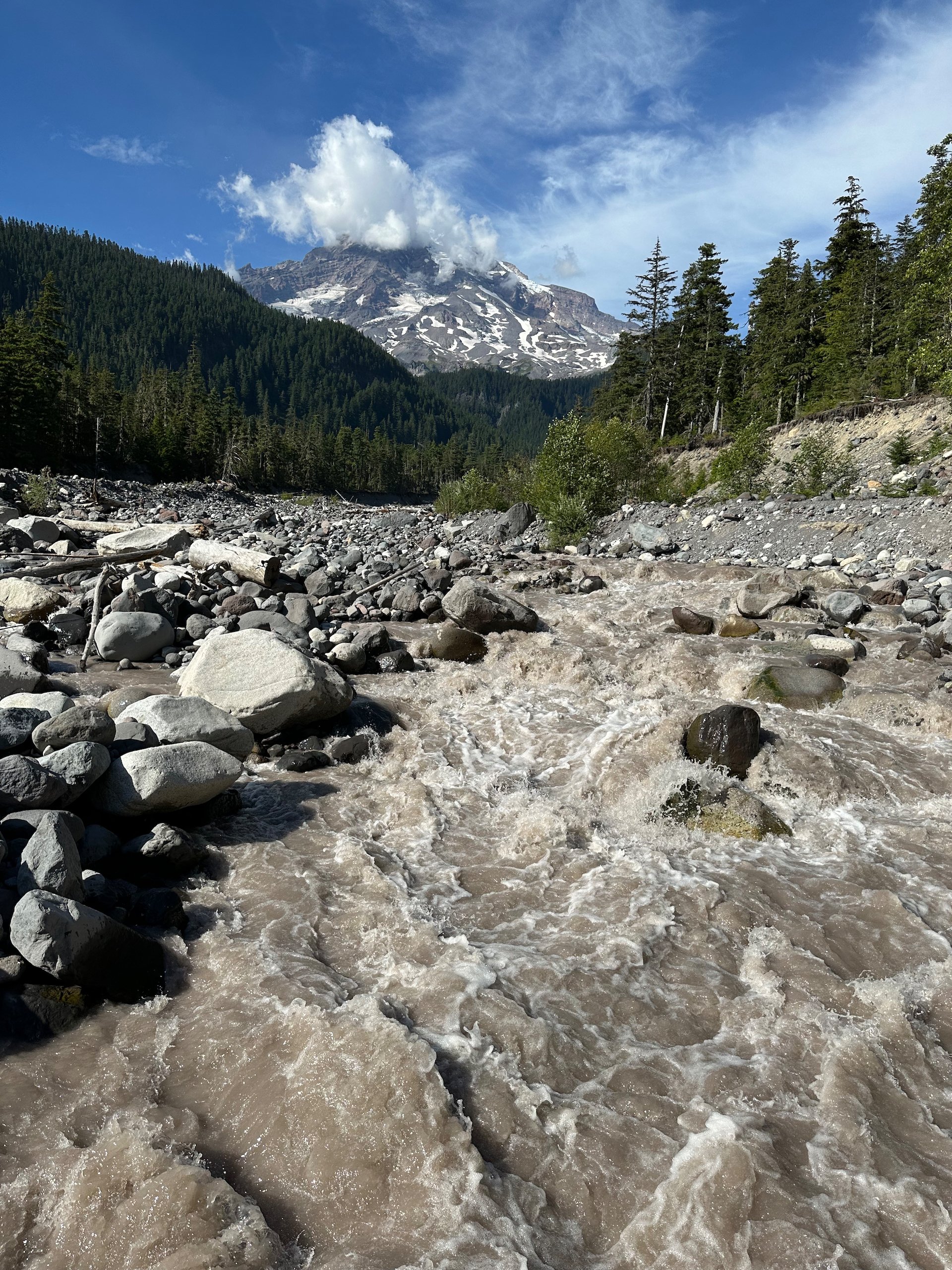
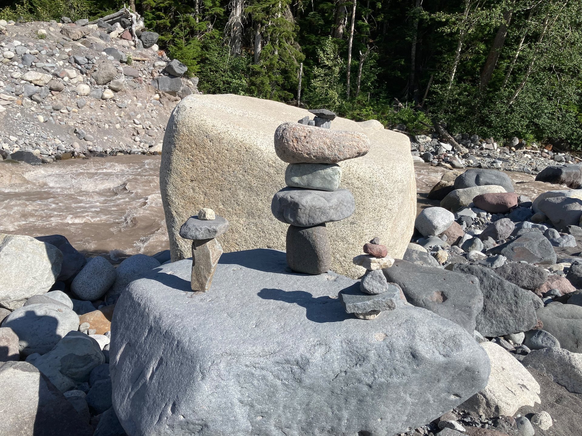
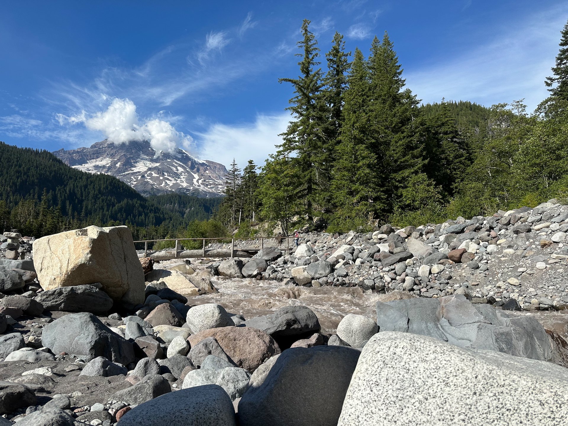
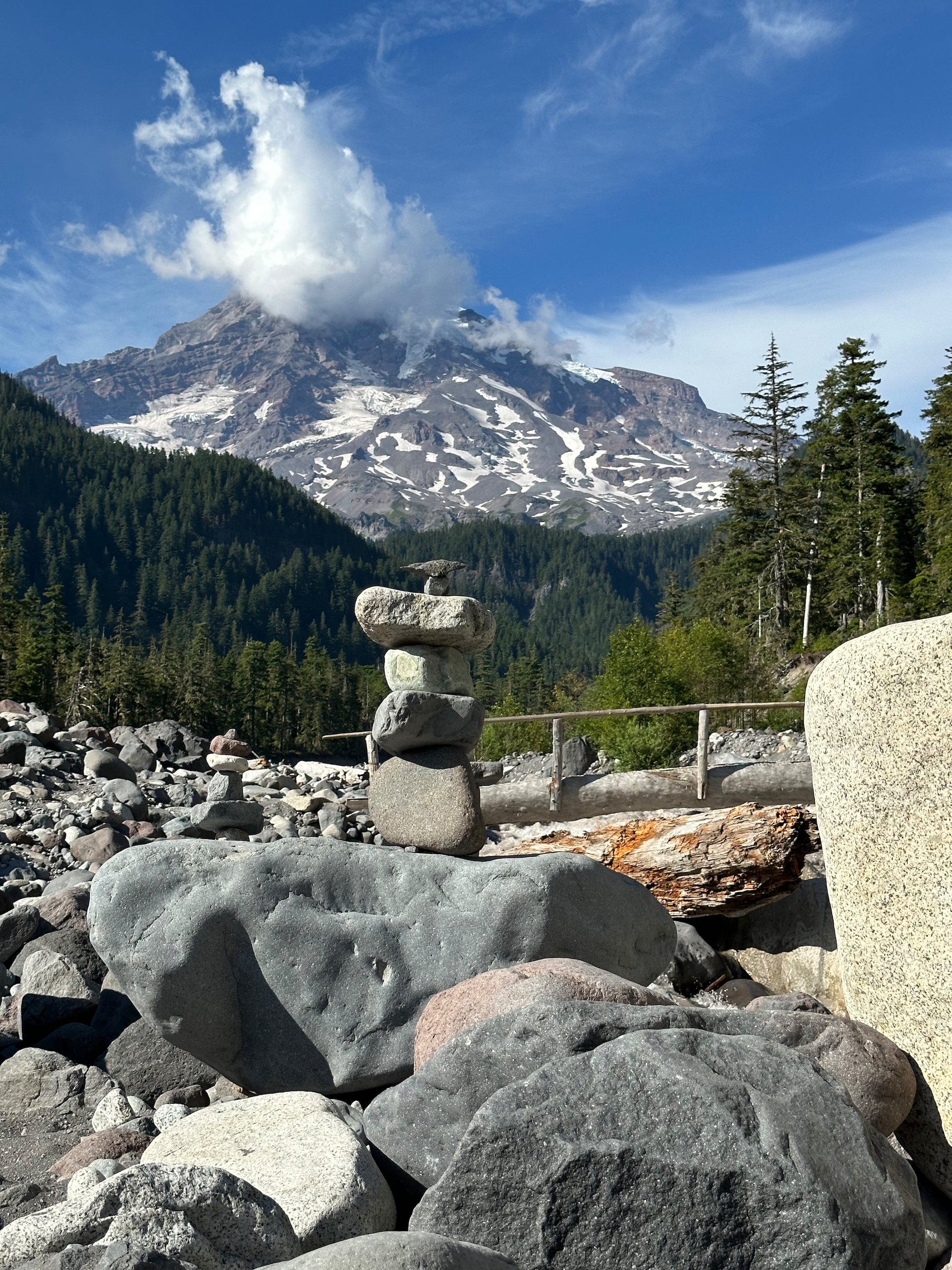
Across the road, the Nisqually River rows down the river bed. It’s a fraction its maximum at this time of year, leaving a wide river bed of large stones.
To get there, we took a bit of a wandering path through the campgrounds and then across the road. There, we found another trail that led us towards the river where it connected with the Wonderland Trail for a while. Eventually we found our way to the river, but we were too far downstream, and needed to work our way back up to find the proper trail that led down to the bridge. We found our way eventually .
I’m surprised the log bridge survives the spring torrent, but every time we’ve come it’s been in the same place.
There’s a trail on the other side of the river that you access by crossing a bridge made from a huge log. We didn’t cross over, but we did walk down to the river in the afternoon to explore a little bit. Unlike the Hood River, there was no getting in the Nisqually - it was torrential, heavily silted and frigid!
We eventually made dinner, then walked over to the amphitheater to sit through the ranger presentation. It was OK - the ranger was mildly entertaining, and did a presentation on old-growth rainforests (Mount Rainier National Park is 60% old growth, which is amazing); the ranger pick some volunteers, so Justine and I both ended up with speaking parts.
There was a good crowd for the Ranger talk.
After the presentation, we drove back up to the top to attend an astronomy evening. The rangers have telescopes and we were hoping to see some cool stuff. Sadly, the clouds had moved in so they had to cancel. I guess we’ll try again another night.
So we made the long drive back down (this is why you stay at the summit), and called it a night.