For the second part of our trip we headed south through eastern Washington State and across the border into Oregon, for our stay in Hood River. As expected it was hot, bit we had a good campsite on the river, and we had lots of activities lined up for our four nights in Hood River.
We left our cute cabin north of Leavenworth about 10 a.m. Sunday morning. We had a pretty easy time of checking out and getting packed up. We had about a 4-hour drive ahead of us and we really didn’t want to get to Hood River too late, but we also wanted to enjoy the drive and not rush.


We headed south along Highway 2, which as mentioned previously is very beautiful and follows the river. Justine had noted an interesting stop so we pulled off for a few minutes to take some pictures. From there we headed into Leavenworth and made a stop at the fish hatchery.
Interestingly, the Leavenworth Fish Hatchery was once the largest in the world. When they dammed the Columbia River in the 1910s, they built this to help deal with the impact to salmon spawning. They do 1.2M chinook salmon a year now.
When we arrived, a volunteer hunted us down and gave us an excellent tour of the place. One of the most interesting facts was that their salmon production was limited by the amount of fresh water they have access to. They are doing some experiments with recycling to see if they can double their production. Very cool.
Their adults had already returned, so we got to see them in a holding tank ready for spawning in a few weeks. They hold the fry for 20 months, so we could see the little fingerlings as well. Overall, it was a very worthwhile stop as we headed south to Hood River.
The adult salmon in their holding tank.
From Leavenworth, we headed south on the 97. The drive was lovely, winding through the mountains , through the dense coniferous forest. As we headed south and East, the landscape started to change and become more grassland as we started to head into the dryer eastern part of the state. It such a different, but beautiful landscape. Eventually we stopped for lunch at a rest area just north of Yakima.
There are two rest stop - one on each side of the road (heading north and south) and each is on either side of this huge, very cool bridge. We’ve stopped at the one heading north in the past, but this was the first time at the southbound stop. They still have the fun "watch for rattlesnakes" signs (not that we’ve ever seen one…), which limits the desire to explore too much.
A great view of the very cool bridge.
At this point, the mountains were starting to come into view. Adams, St. Helens and the very tip of Hood were visible at various points. We stopped at a pull out to look at the huge wind turbines (they are everywhere down this way) and this old rundown house. They also had an old sign that showed all the mountains and how far away they are. We’ll see how the photos turned out, to see if it was worthwhile or not!
Mount Adams in the distance, beyond the fading cabin.
From there, it was a fairly short run down to the valley and the Columbia River. Once crossing the river, we headed west again and took the scenic drive long the mighty Columbia. There were a ton of birds on the river - osprey, eagles, vultures, swans and even pelicans! Sad;y there was no place to stop for pictures.
Soon, we had the pull off towards Hood River. We were not going into town directly, but heading south to Tucker Park, this privately owned campsite we stay at when we come down. Justine’s been coming here since 2007; she’s been bringing me since 2009. We’ve come almost every year, with a recent 4-year break thanks to COVID. This is our first time back.
The campsite is right on the Hood River, and has a few very nice spots, then a whole bunch away from the river that are not as nice. Arriving on a Sunday, we hoped that we’d get a good site. And we did!
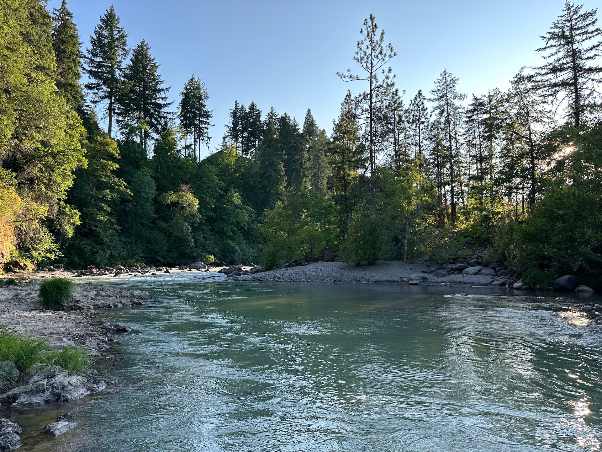
The Hood River, from the edge of our campsite.
Our home for the next few days.

We managed to score one of the river side sites. This means they are generally a little cooler and all you hear is the river rushing by. It limits some of the noise of other people around. We got the site next to the site we were at last time, which we really enjoyed. So we were off to a good start. We spent about an hour getting our tents set up, BBQ and stove next other kitchen stuff organized, and generally settled in.
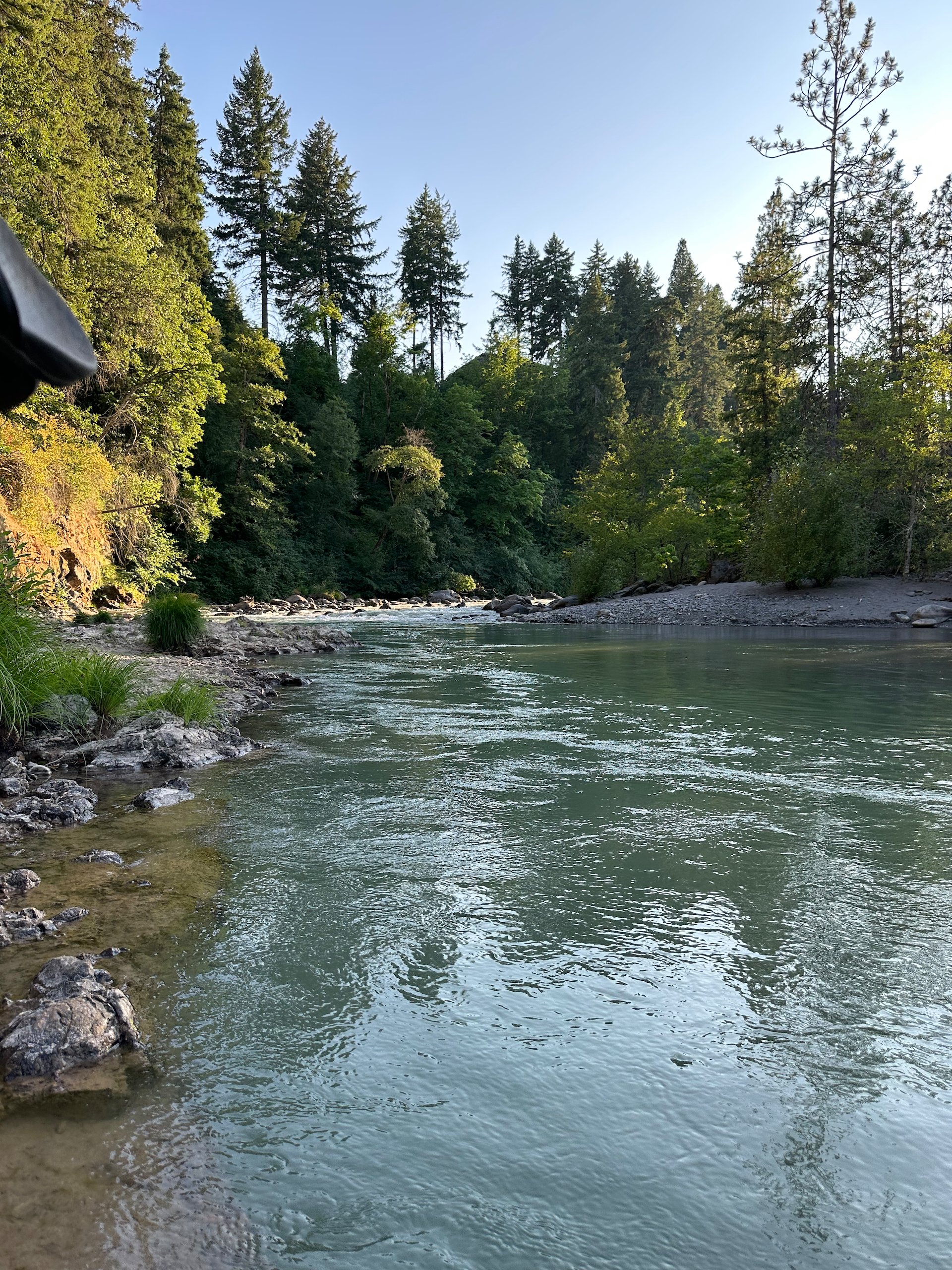
After getting settled, we popped a bottle of bubbly, poured a couple of big glasses and walked to the river. There’s a trail at the end of the camp ground that leads down to an easy access point on the river. The water is cold - it has that glacial look to it - but wasn’t that cold. We decided to not go in that night, but certainly will in the next few days.
After a it of relaxing we drive into town to do some grocery shopping. We got what we needed for the next few days, including a monster steak for that night. It was huge! We did not need a lot, so it was a quick trip.
After returning back we cooked our steak and corn and had a lovely meal with a bottle of wine. After dinner, and after cleaning up we sat out and played cards until it got dark and the stars came out. Then it was off to bed.
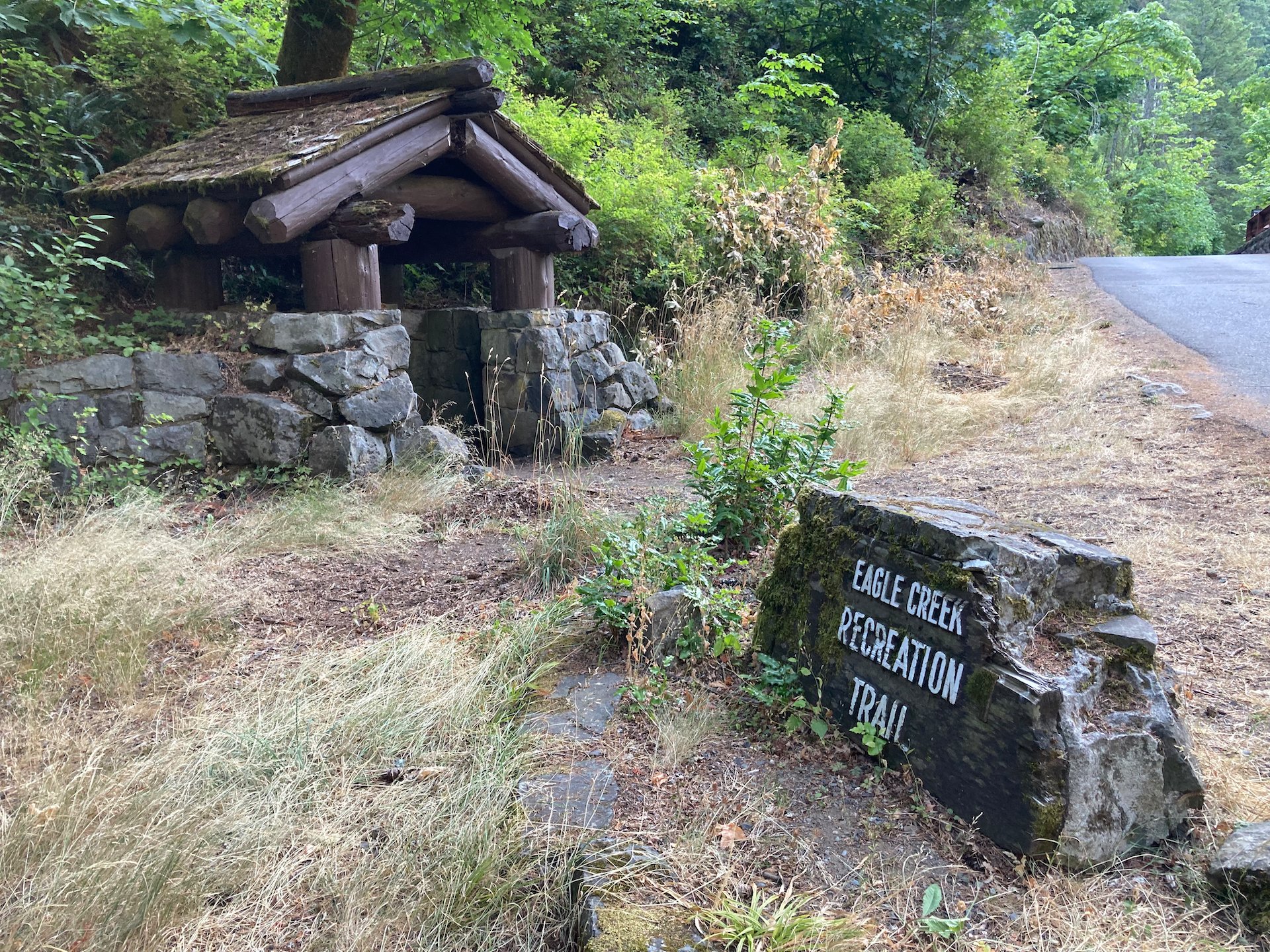
Eagle Creek Hike

Ah, where to begin. We’ve done this hike a few times in the past. It provides views of something like 11 waterfalls and is one of the iconic hikes on the Columbia River gorge. And in September 2017 it was devastated by a huge forest fire that burned approximately 50,000 acres (202 km2), set off by some jackass with fireworks. Seriously.
The trail was closed until 2021 for them to repair and restore, and I’m sure COVID had something to do with the duration of the closure. It’s a pretty epic out-and-back hike - you can make it by length you want as it’s also a section of the iconic Pacific Coast Trail. Most of the locals seem to only go as far as Punchbowl Falls, but we were headed over 3x that far, planning to go to all the way up to Tunnel Falls.
Heading out on our hike.
I had heard that the trail was getting very busy at all times of year, so we tried to get up and off early. Our goal was to be at the trailhead by about 8:00, and while we were a little bit late, it ended up being a non-issue - there was lots of parking. In fact, we ended up parking in the "overflow" area by mistake, adding almost 2 km onto our hike. It didn’t end up being that big a deal.
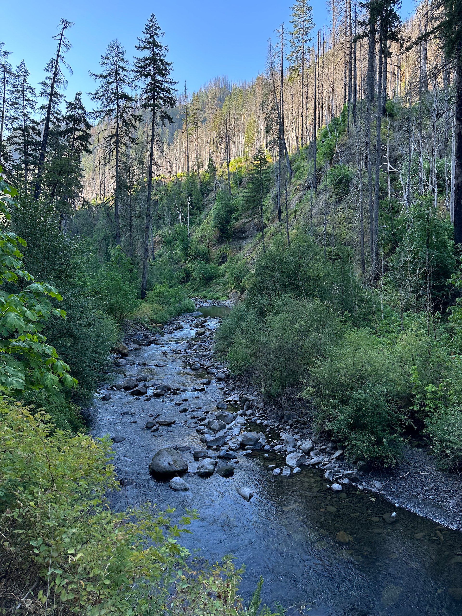
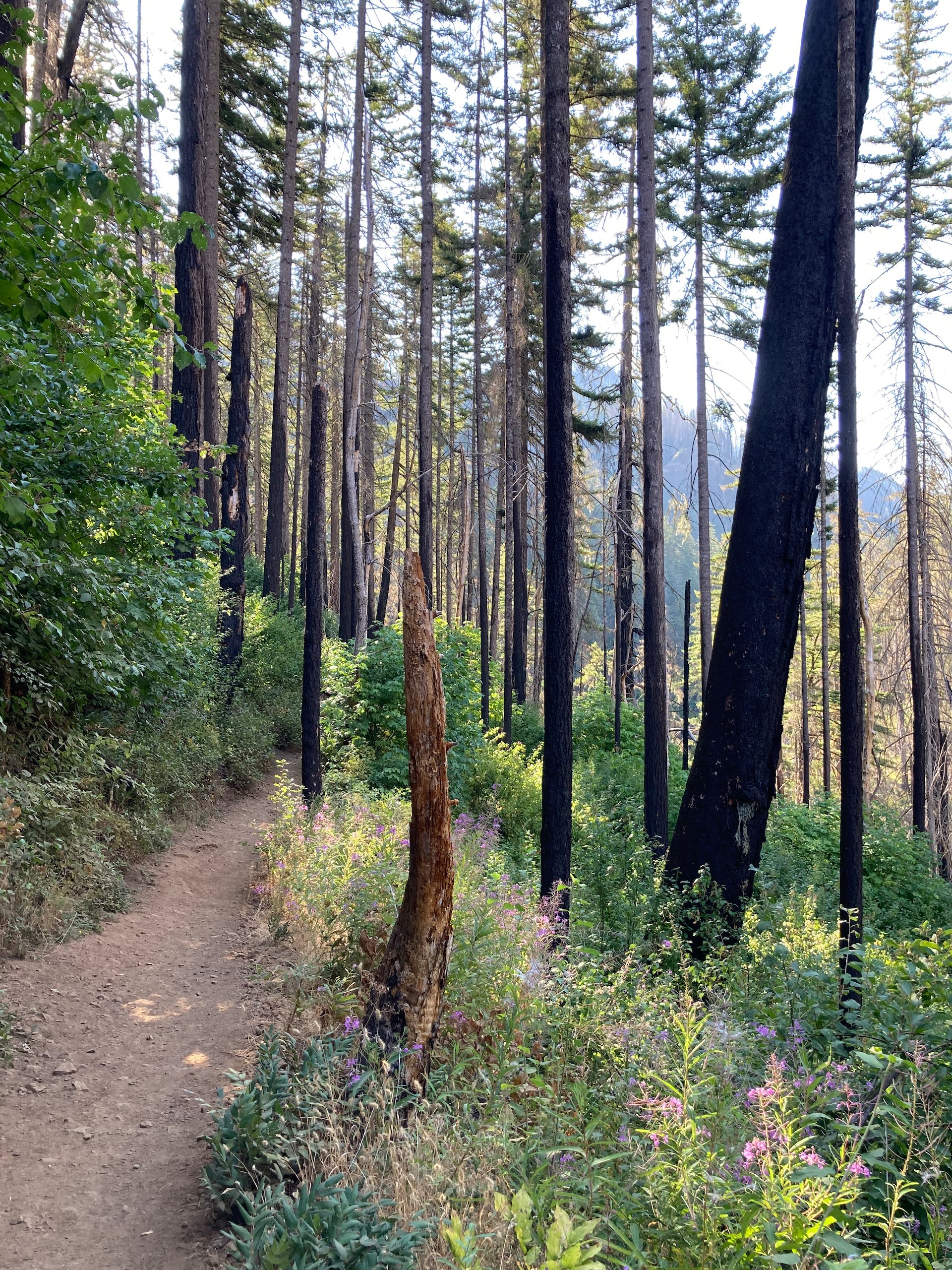
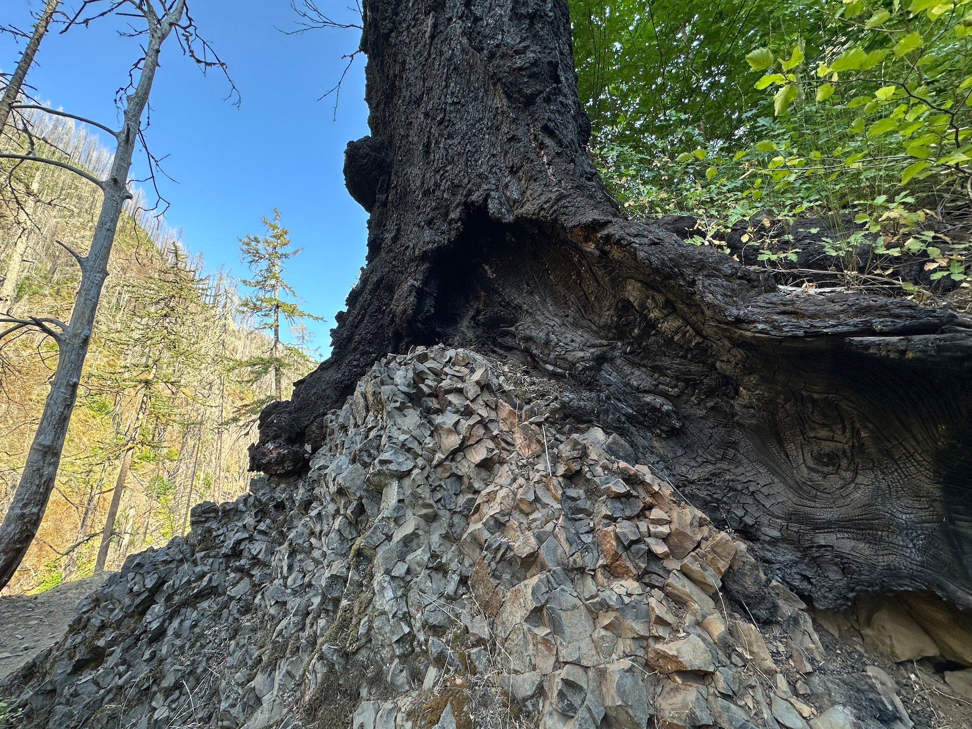
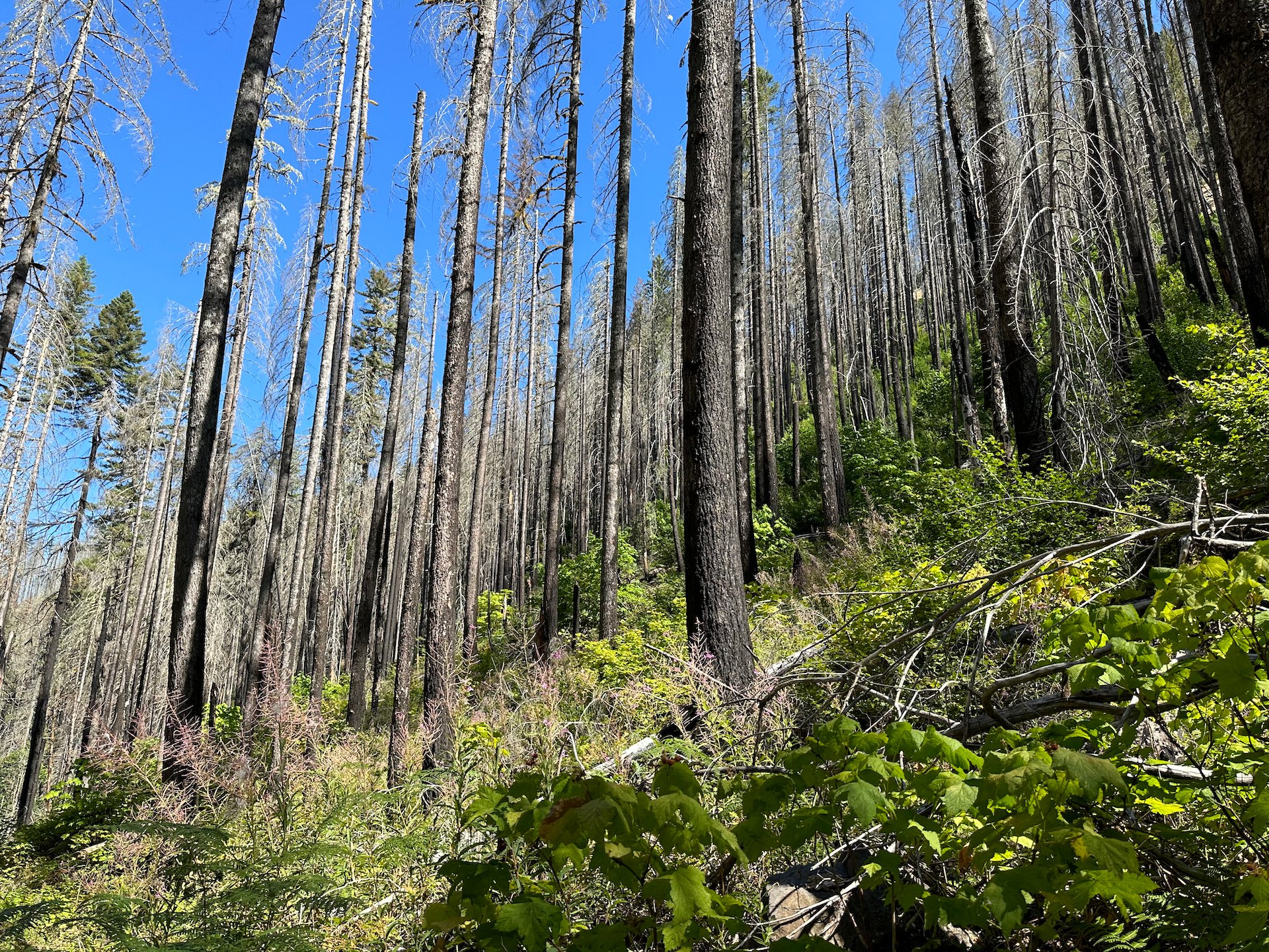
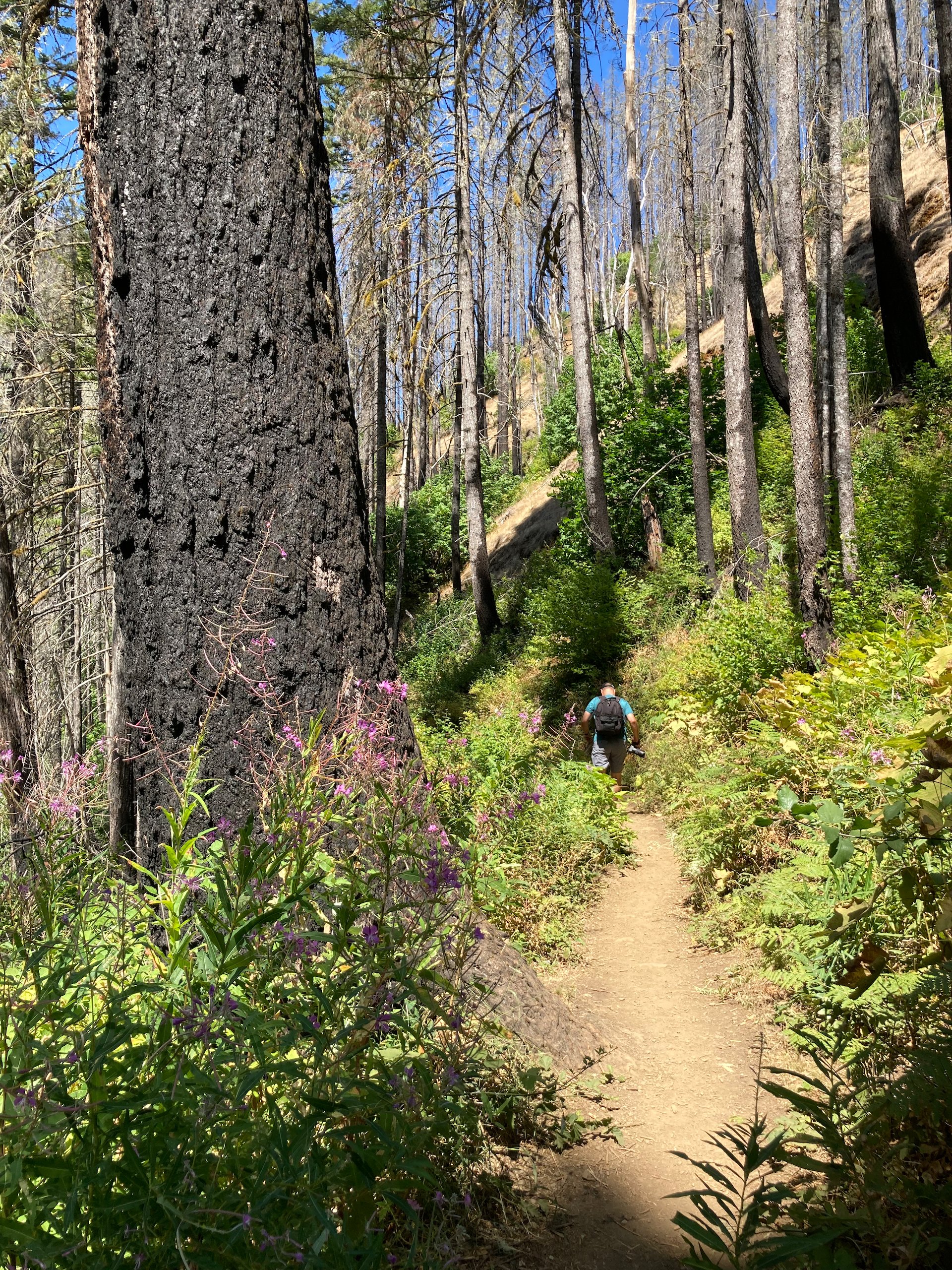
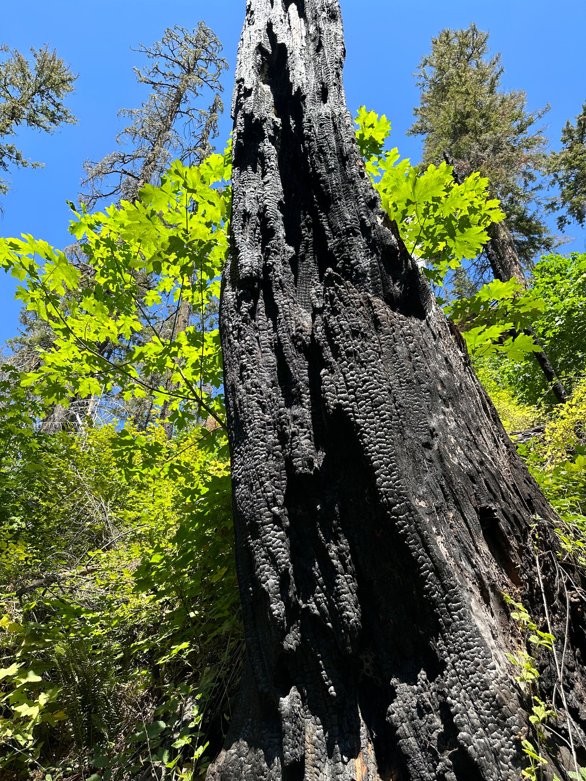
We started up, and it was still nice and cool. That didn’t last long, as the day heated up fast. Almost immediately, you could see the deviation of the fire. It had raged over the entire hillside and travelled up the mountain sides. Pretty much all the fir and one trees were burned. The fire was almost 6 years go now, ad the recovery of the forest was also apparent. The understory was coming back strong, and you could see all the deciduous trees growing like crazy in the now-available light.
The fire did a lot of damage - everywhere you look are dead trees.
That was probably the biggest change that we noticed - what had been a shady hike through the forest was now much more open and sunny. Especially further up past High Bridge; but I’m getting ahead of myself.
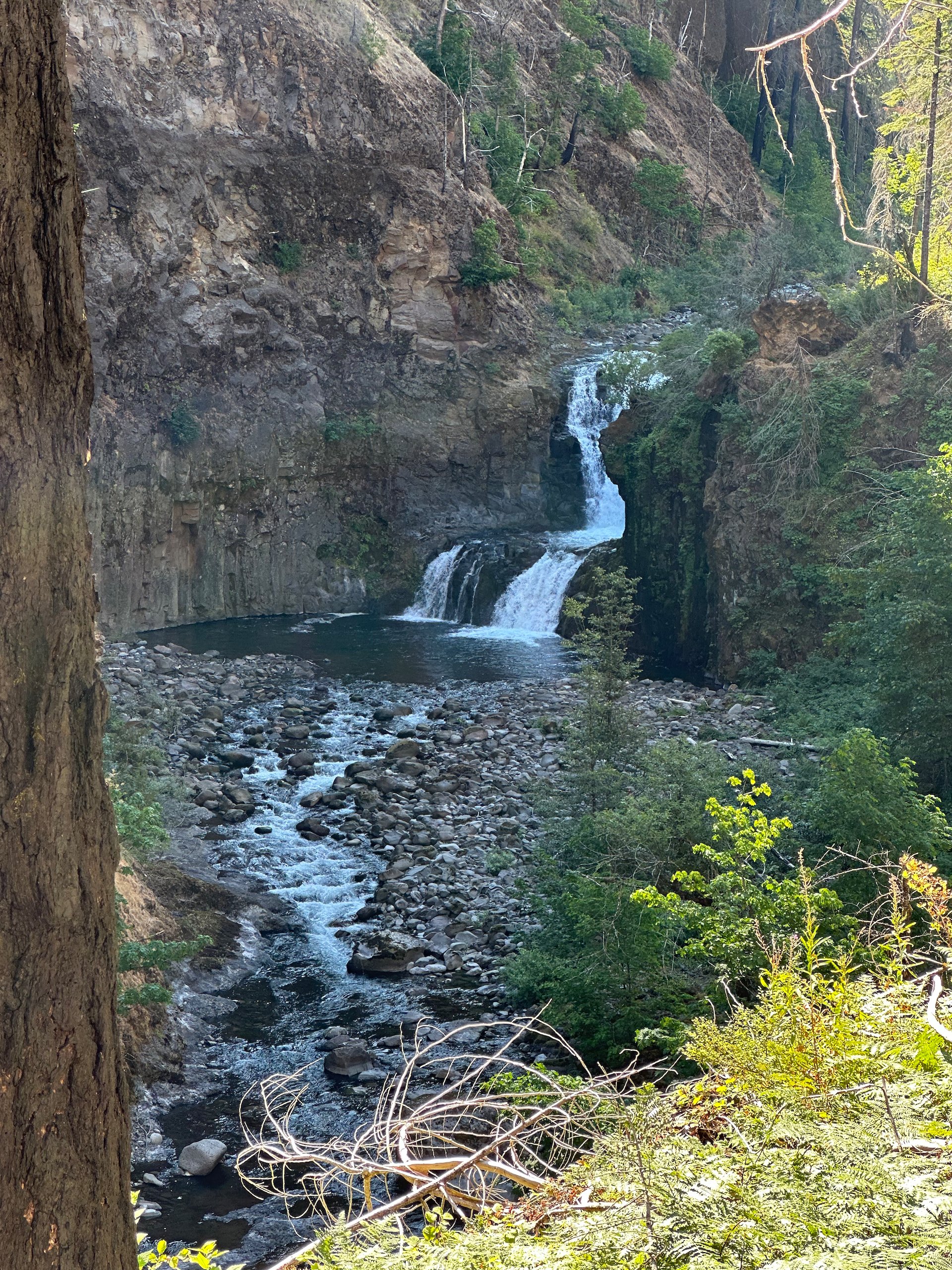
Before long we made it to the Lower Punchbowl falls side trail. We headed down to have a look, but decided against hiking up the river to see the main waterfall. I kind of wished we had, for when we came back down, it was absolutely jammed with people. We took a few pictures and had the place to ourselves.
A couple of views of Lower Punchbowl Falls.
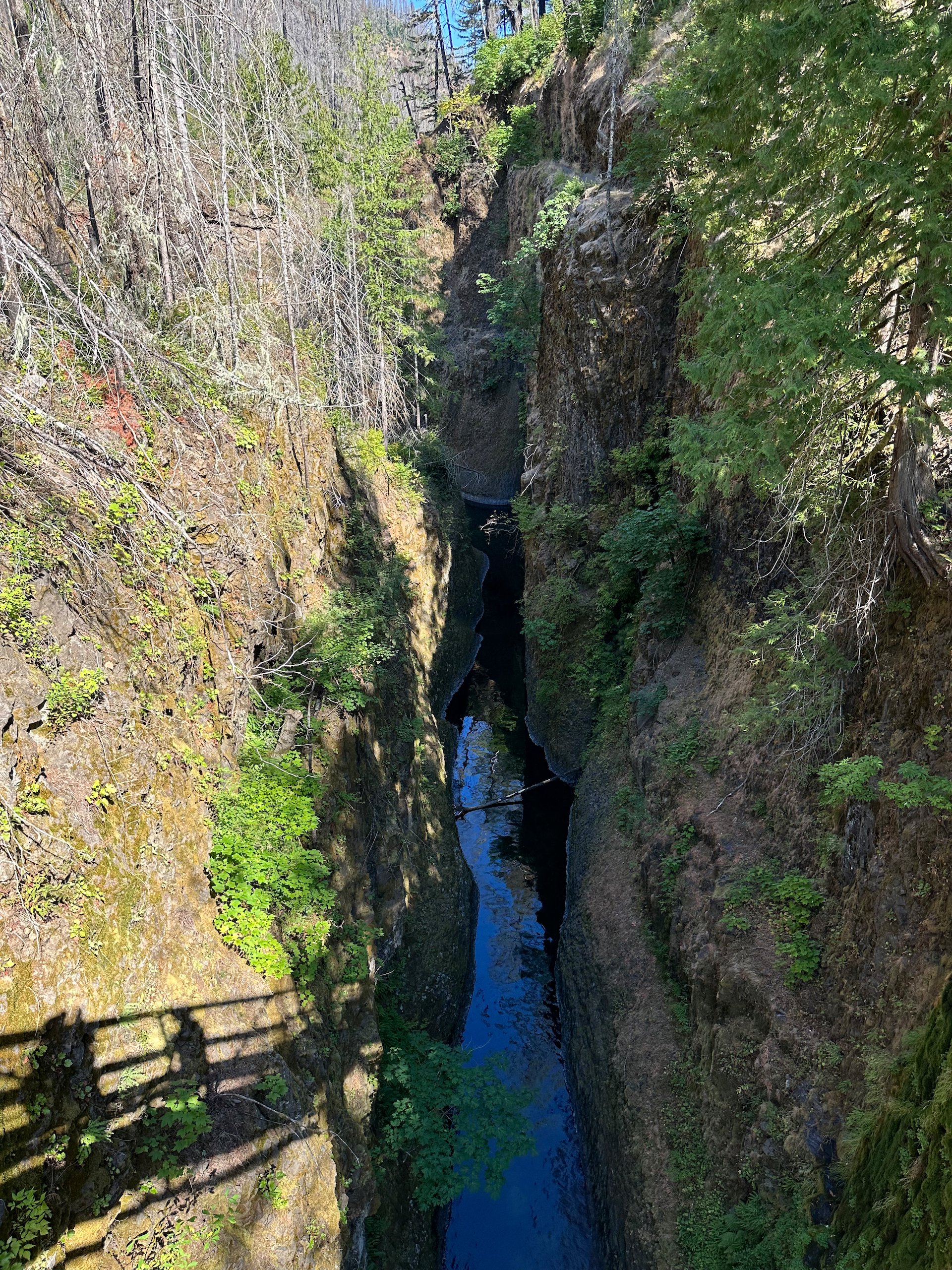
After climbing back up, we continued on past the lookouts for Upper Punchbowl Falls, a straight drop down into a huge canyon. From there, the trail climbed pretty steadily but gradually.
The view of Upper Punchbowl Falls, from the overlook.
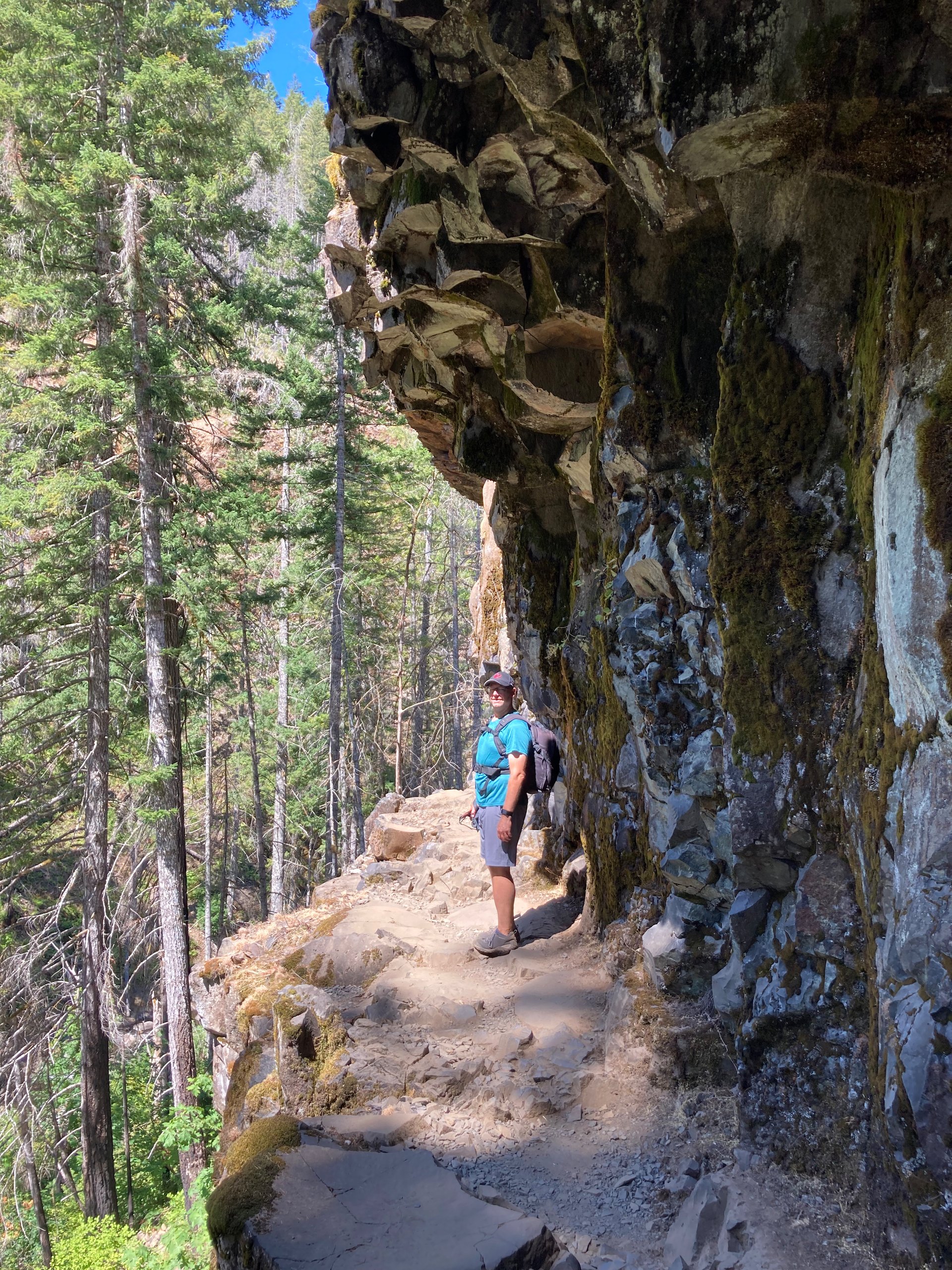
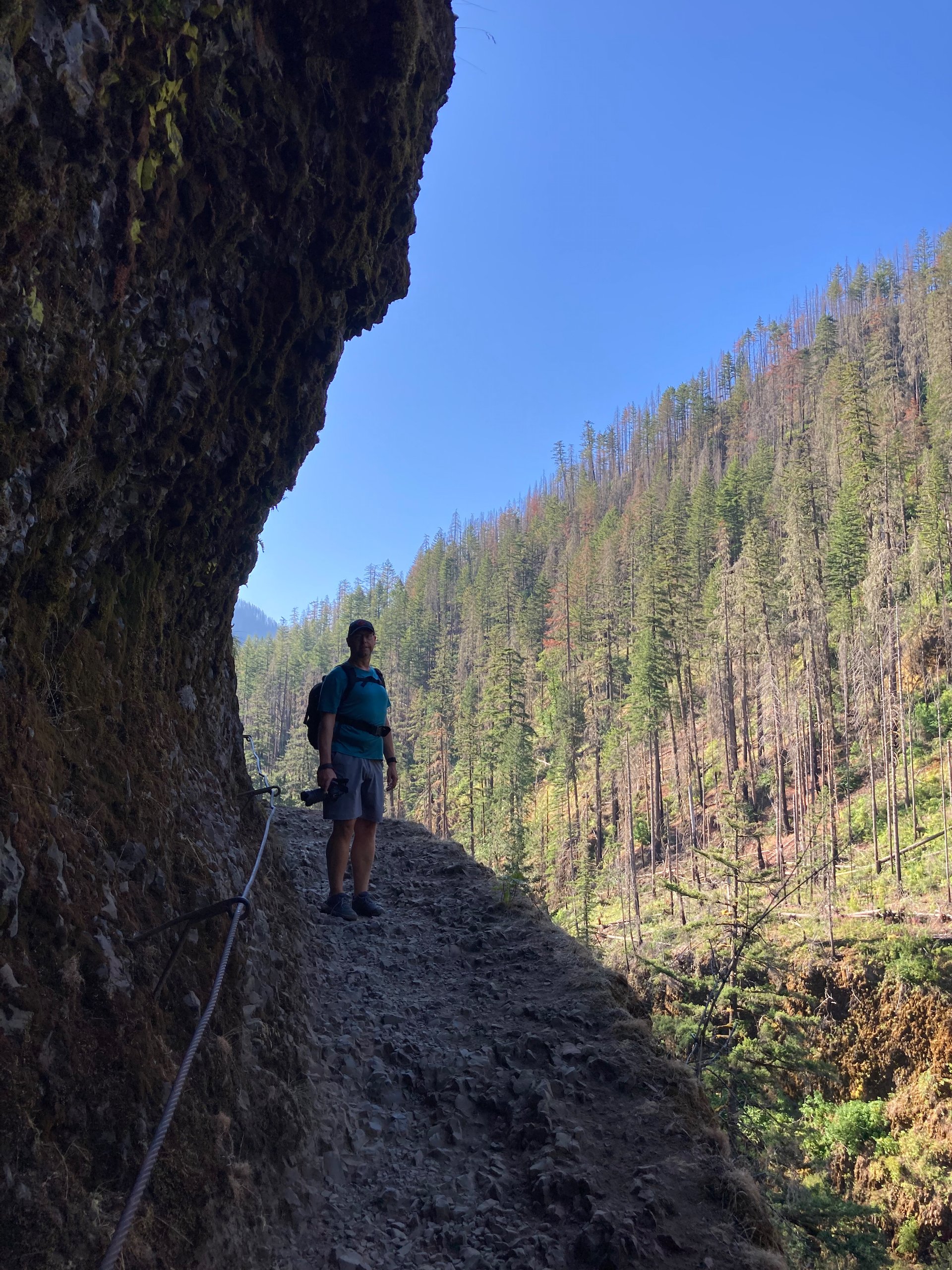
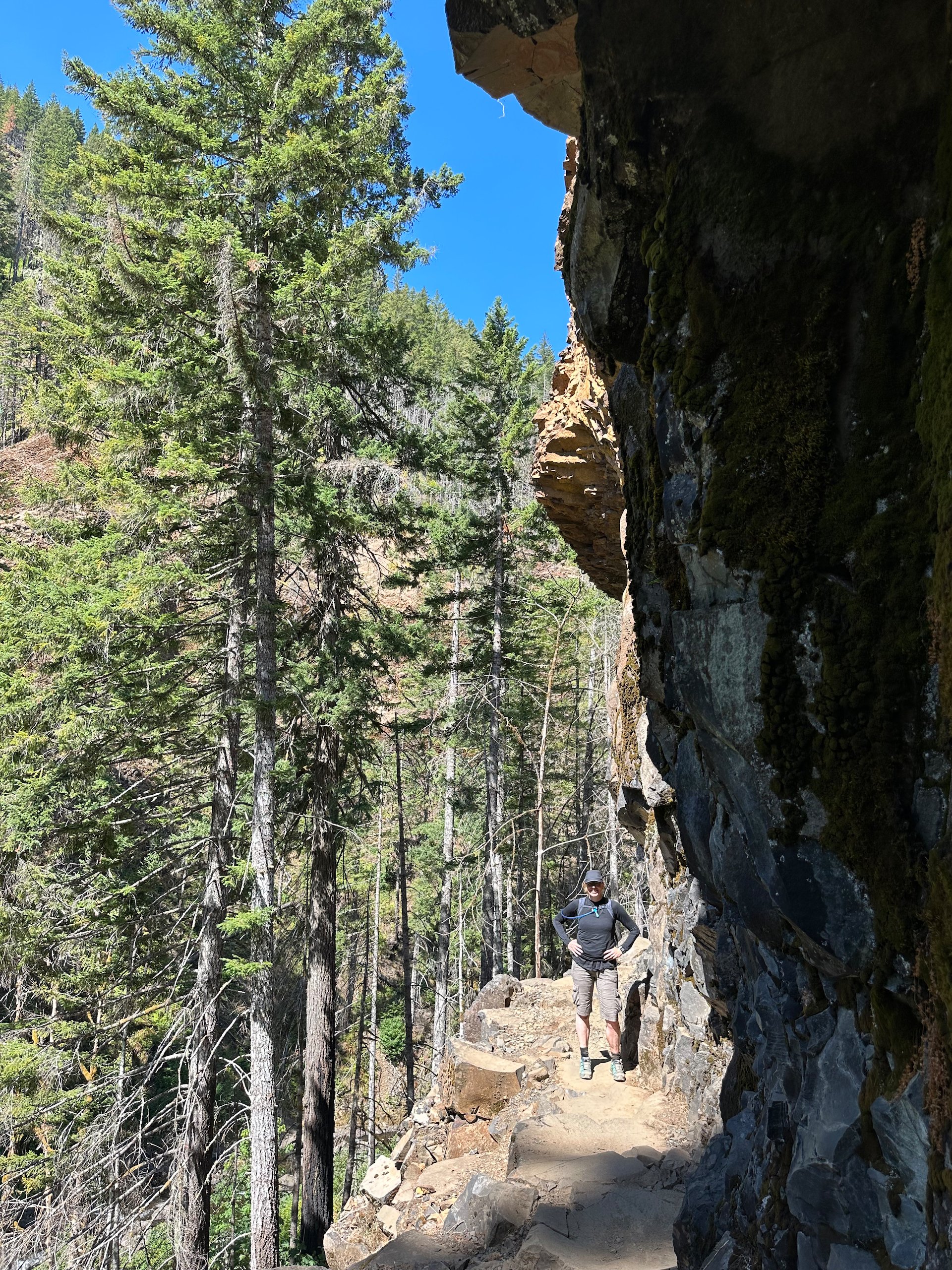
From time to time, there were exposed scree fields that made it tough going, and in places the trail was just a narrow ledge blasted into the rock. They even add cables for you to hold onto in places. It ca be vertigo-inducing.
One of the narrow, cliff-edge sections of the trail.
Crossing one of the bridges on the trail.
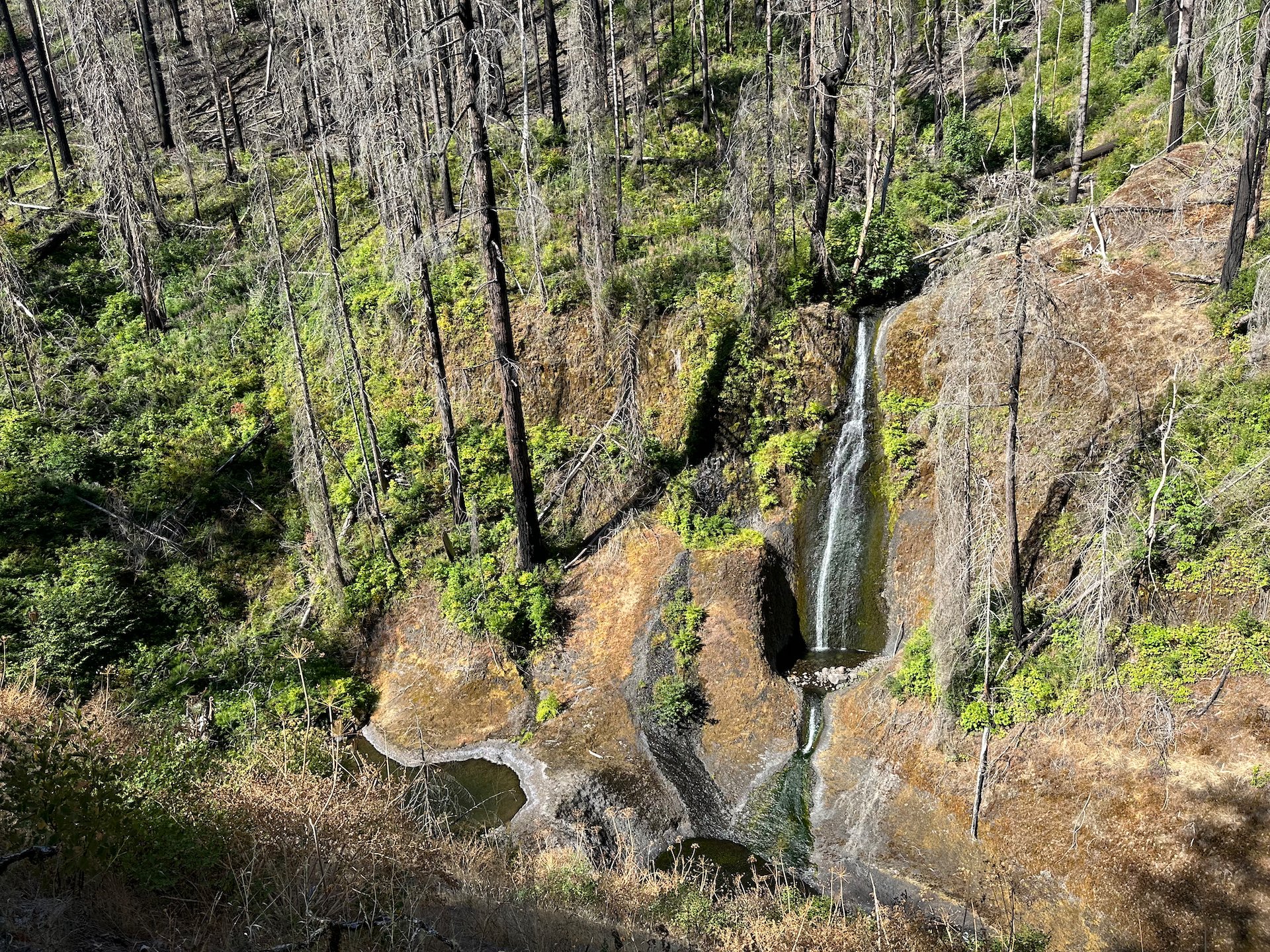
One of the many (and one of the tallest) waterfalls along the hike.
After a time, we made it to High Bridge. This is at 3.3 miles from the trailhead and is often where many people turn back. But not us, this time. This was just the halfway mark for us. One of the other surprises on this hike was how many people were coming down! These were a mix of weekenders that had been camping in the backcountry further up (there’s a lake at 14 miles that you can camp at), but many were doing the PCT. We chatted to a couple of people. One older gentleman was doing segments of the longer trail; another was on a push to finish it averaging 100 miles a week. Impressive. I’d love to try it, but it’s a commitment.
The aptly-named High Bridge
It’s a bit hard to capture, but it’s a long way down to the river.
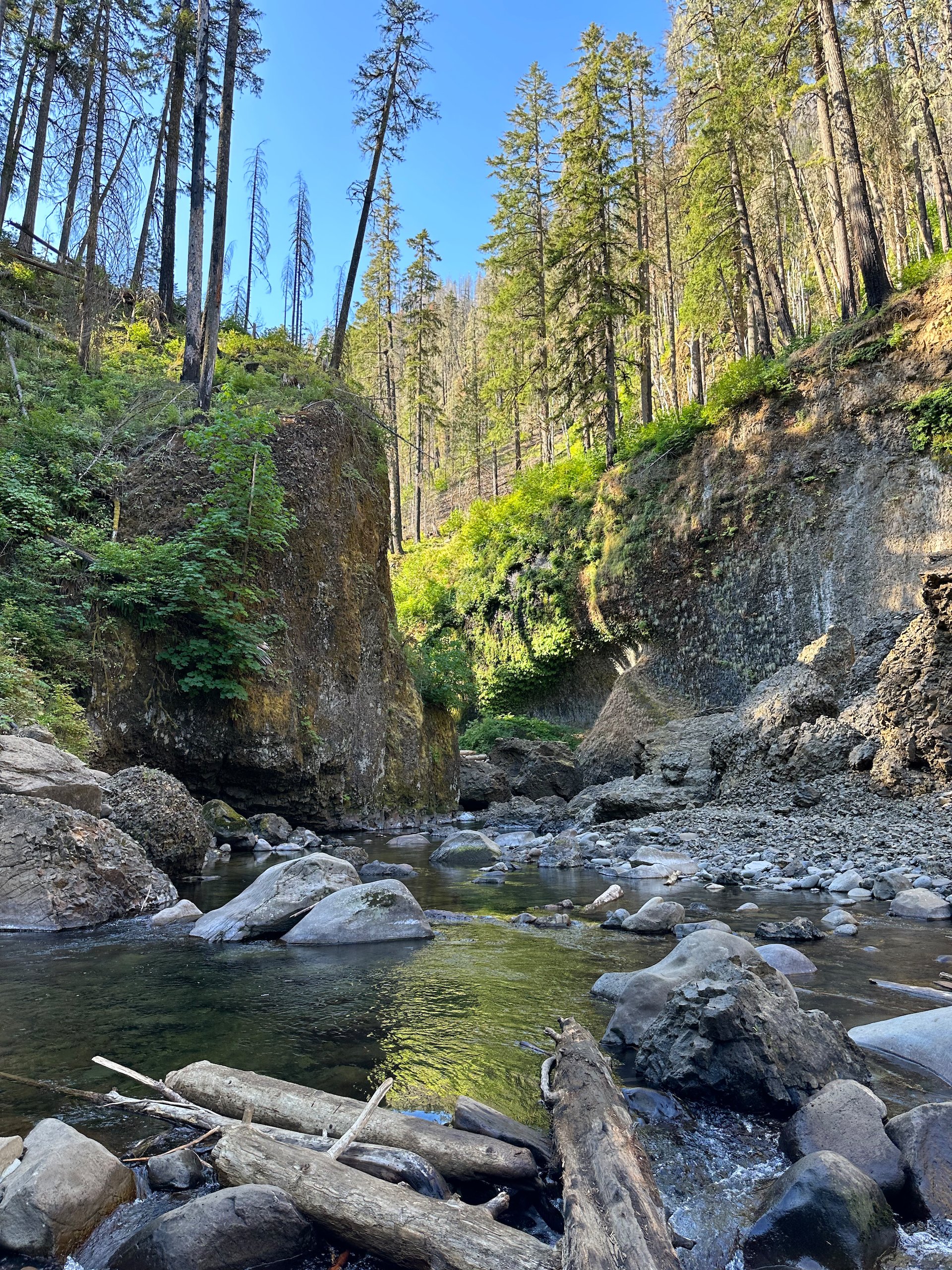
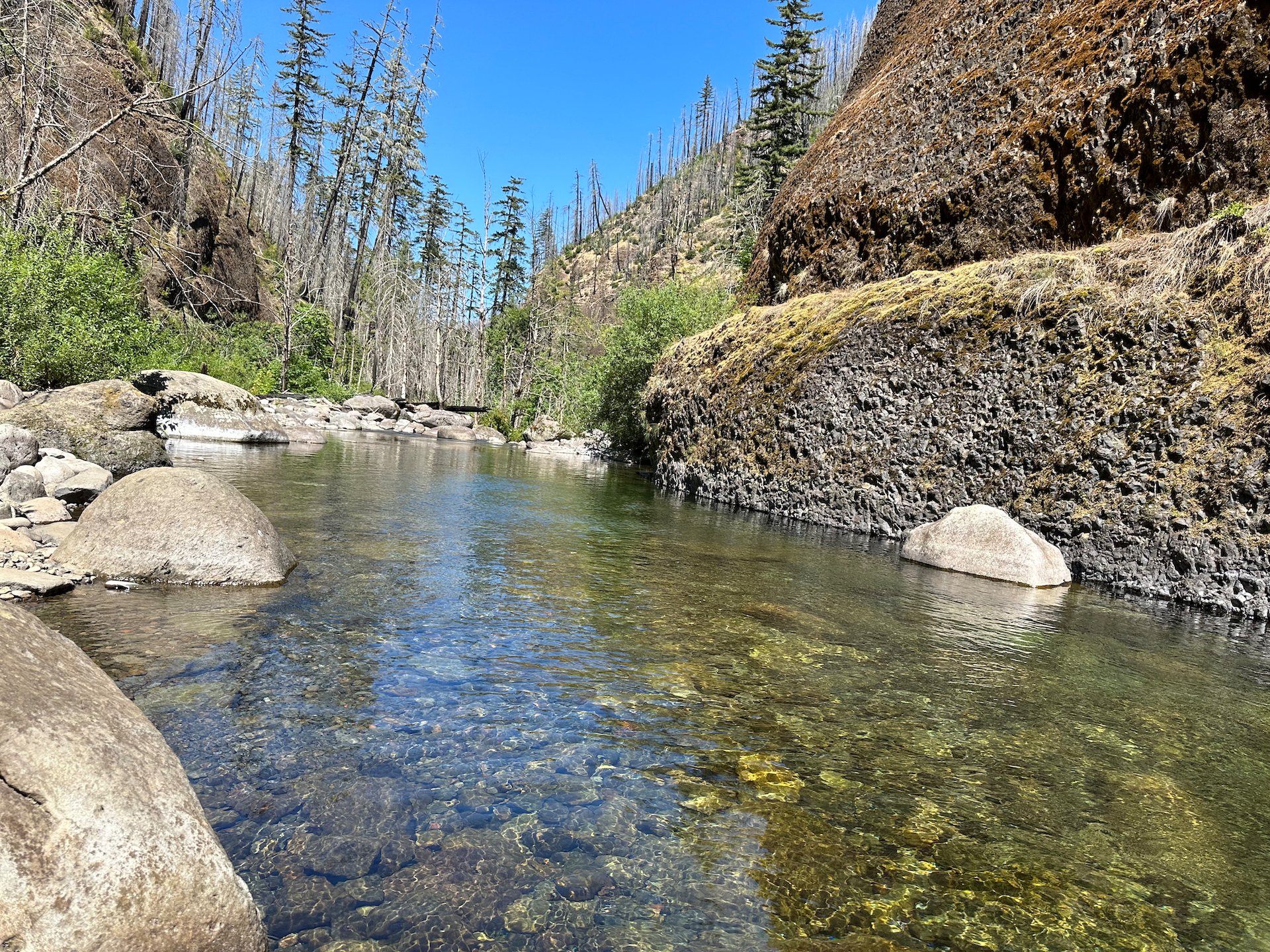
We continued on, dropping back down to the river at times, climbing again at others. About half way to Tunnel Falls, we crossed a big metal bridge over the river. You could get down to the water, so we decided to make that or lunch spot on the return journey. We had brought our water shoes with us, and expected by that point to love the idea of cooling our feet and legs in the river.
Under this bridge was to be our lunch stop on the way back down. But we needed to make it to Tunnel Falls first! Love the rock wall on the other side - so cool.

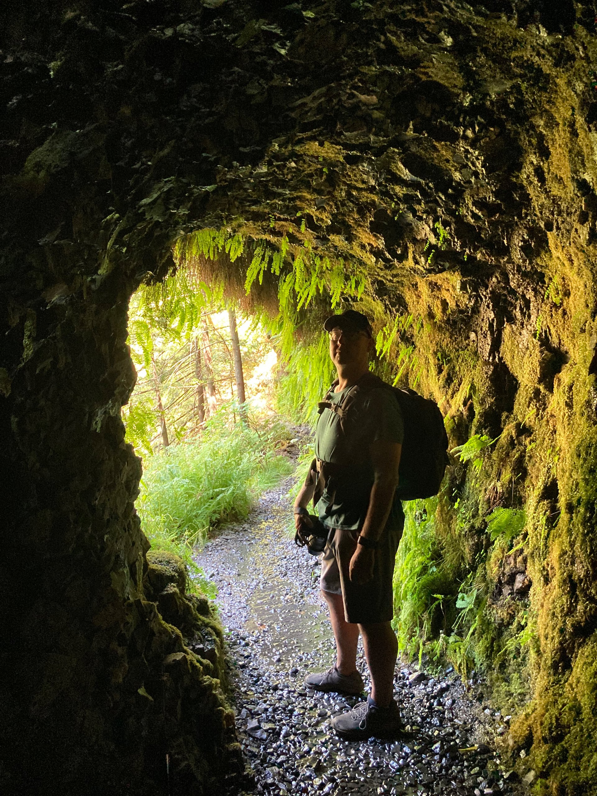
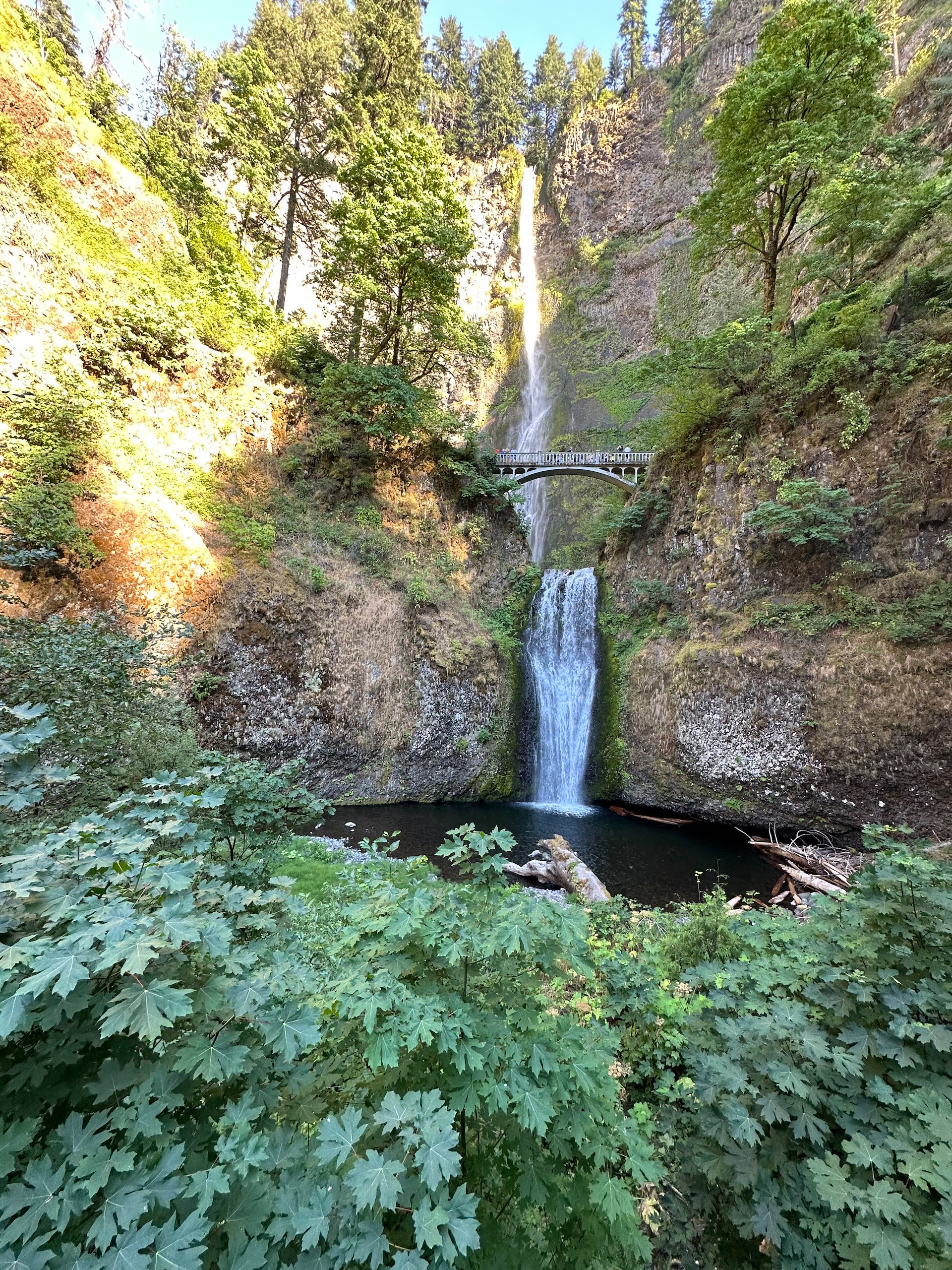
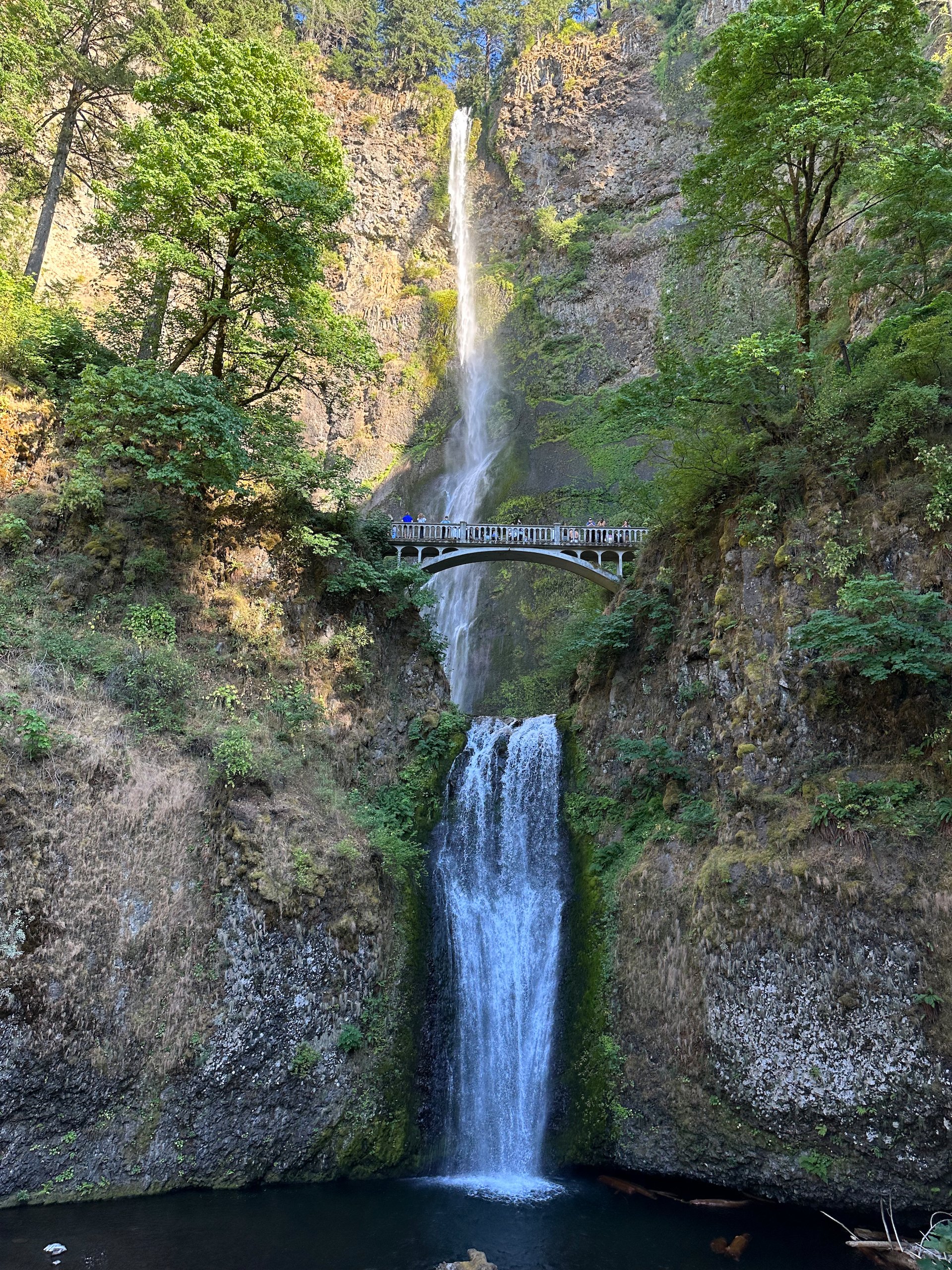
From there, it was the press on to climb up to Tunnel Falls. And boy, is it worth the extra effort. By the time you make it up there, you’re ready to turn back. But then yo round that last corner to this huge waterfalls pouring over the top of this huge cliff! It’s named Tunnel Falls as they literally blasted a tunnel behind the waterfall. Apparently, they blasted huge stretches of this trail to make it navigable. It is very much appreciated, as it is truly a spectacular trail.
We made it to Tunnel Falls!
The entrance to the tunnel behind the waterfall.
And the view back from the other side, after walking through the tunnel.
Looking through the tunnel.
We spent a bunch of time at the waterfall taking pictures and enjoying the cool spray. Eventually it was time to head back down the trail and head for home. My watch was showing 13.6 km at this stage, so we had a long hike back.
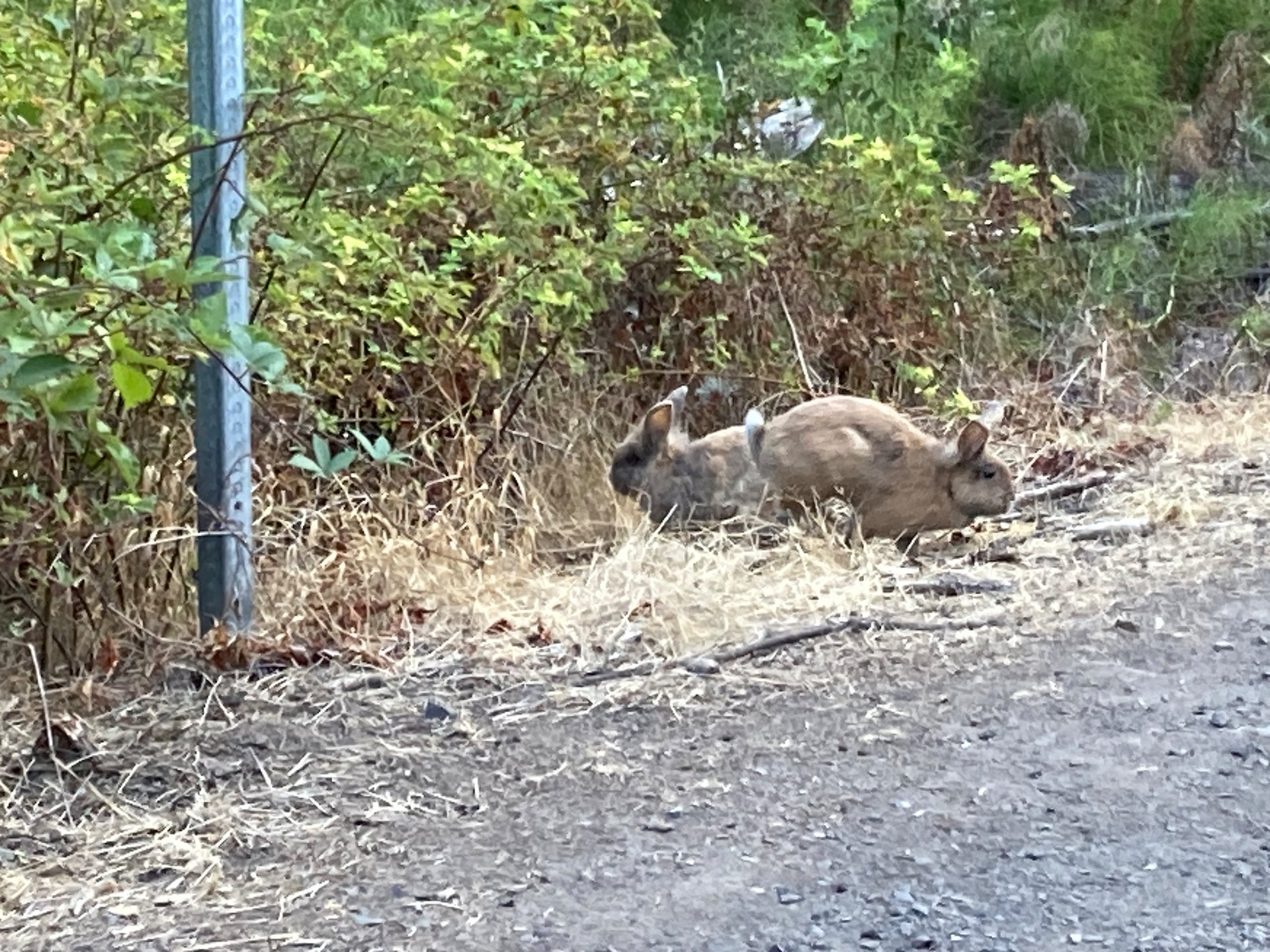
With the trees burned, the underbrush is really growing like crazy!
Garter snake!
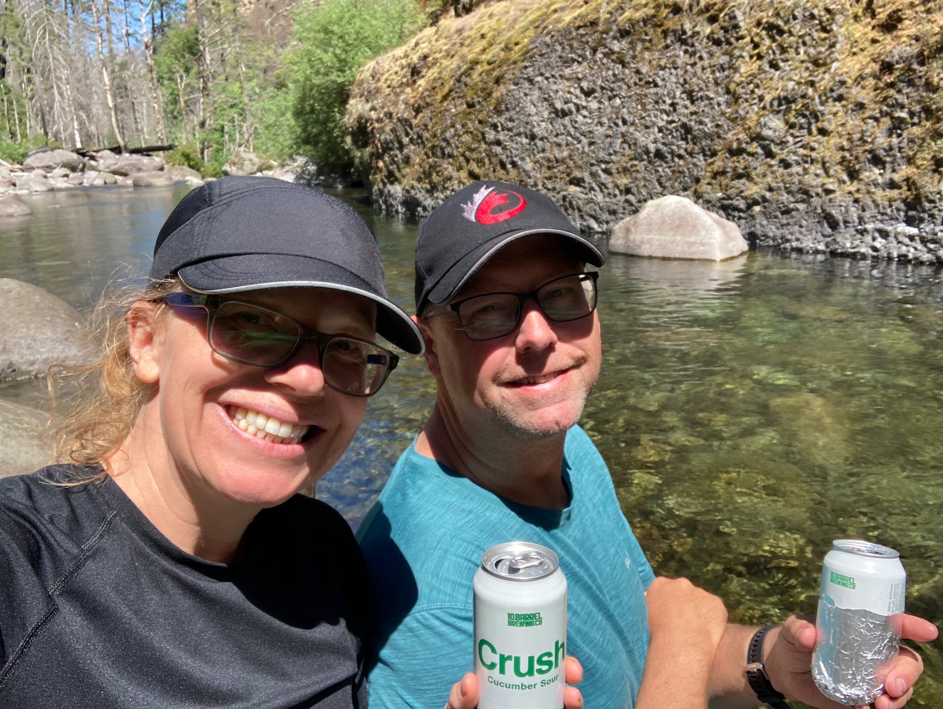
The sun was beating down on the trail for most of the way home. We stopped at the bridge and took off our shoes and stuck our feet in the water. It was heavenly. We had lugged a beer up to have with or lunch and it was mercifully, still cold! We had our lunch and rested a bit, before getting geared back up and continuing back down the trail. Fortunately, it was mostly downhill from High Bridge onward. We needed the help at that point.
As we got back towards Punchbowl, the crowds started to get a it much. There were a lot of people walking up, clearly just going to the river for a swim. Lots of people in bathing suits and sandals; I was almost dying in proper hiking shoes! As mentions\ed, looking down into the river at that point it was just jammed with people. We passed on joining the throng and made a push to end back to the trailhead.
In total we did 25.3 km over the course of 6 1/2 hours. I was a pretty epic day, and it was great to see the trail again after the fire. It certainly had changed - but it was as Daly devastated as we had feared. It’s a different trail for sure, but hard to say if it’s lesser.
The map of our hike up to Tunnel Falls
Cascade Locks
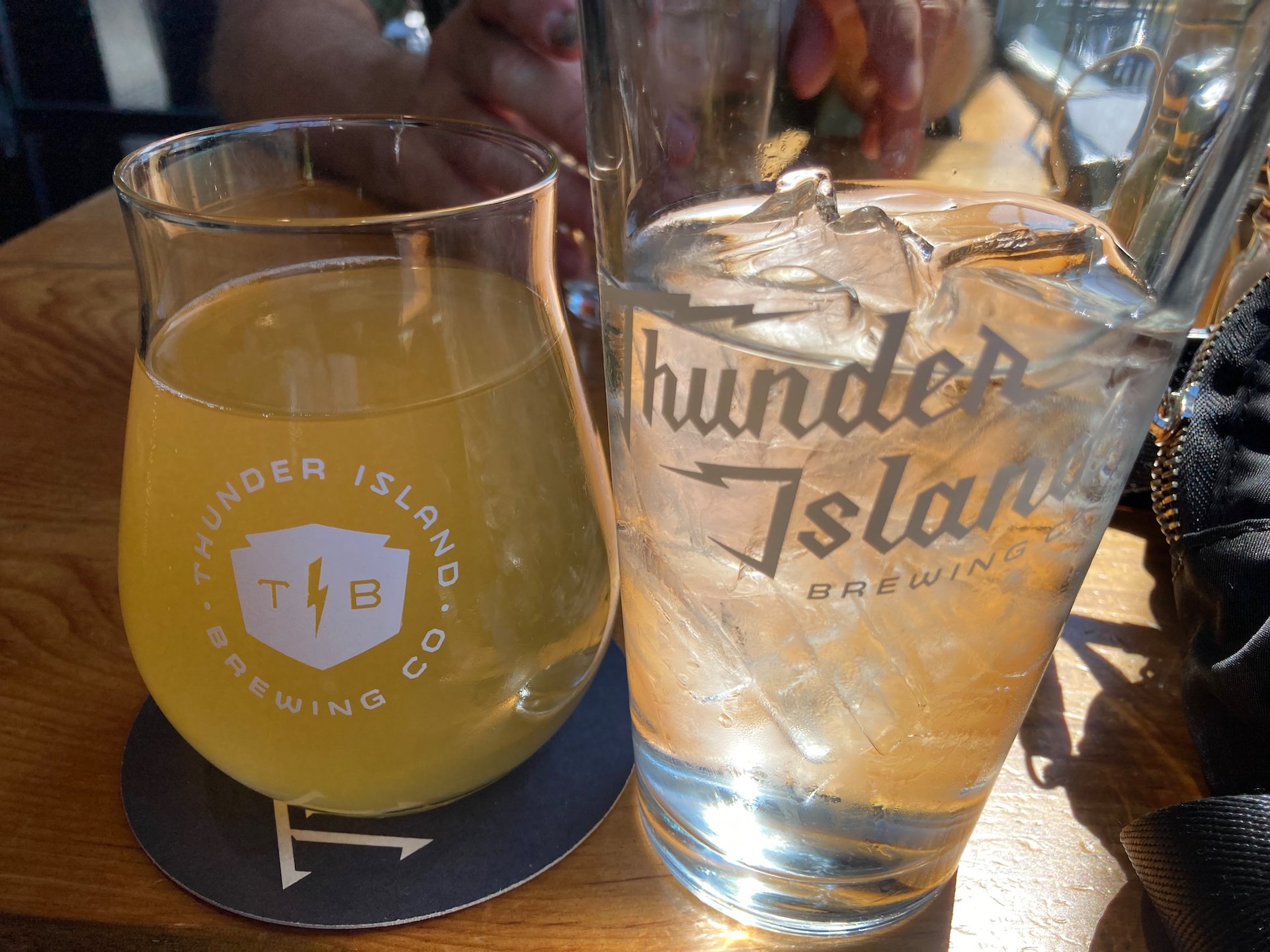
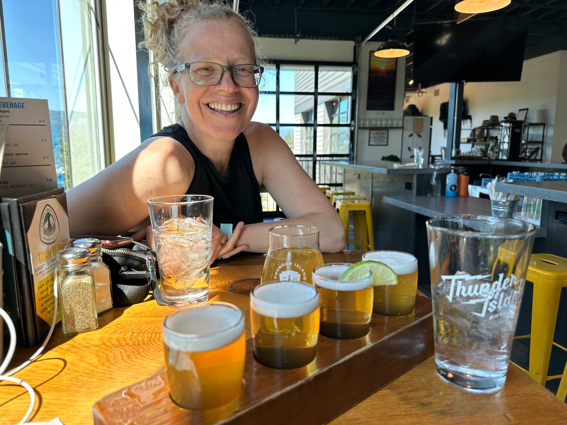
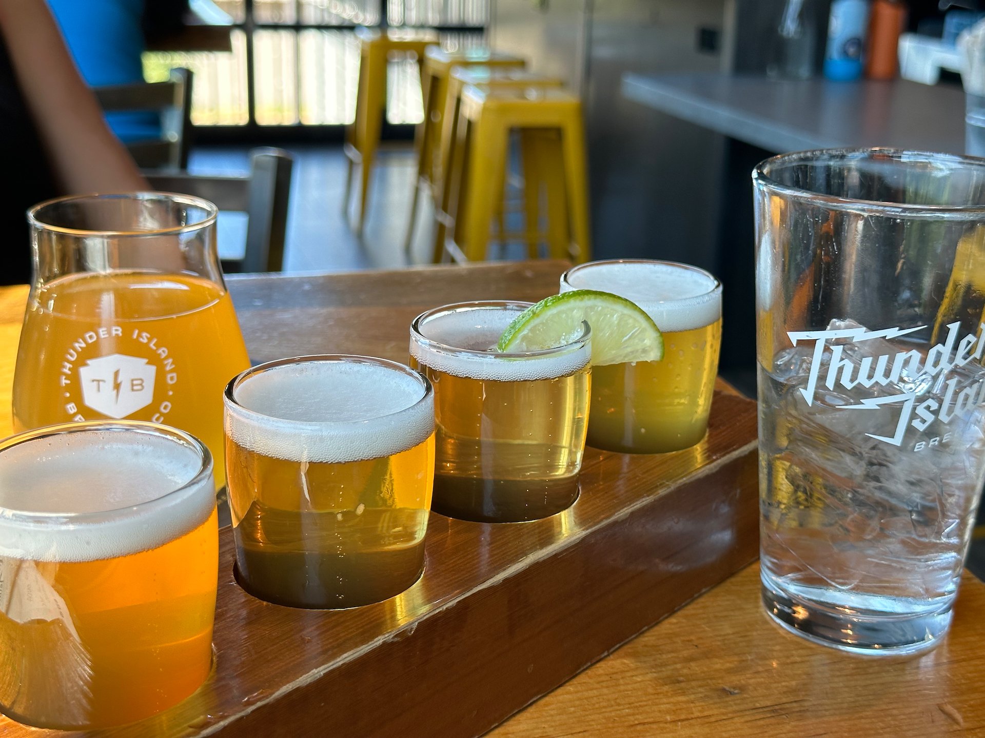
It was early afternoon so the next stop was back in Cascade Locks and Thunder Island Brewing. We discovered this place years ago, and the last time we were through, it was still at its original location on the river, tucked into an old industrial unit. But it had an amazing patio and a ton of charm.
We we surprised to find that they have obviously been successful, as there was a huge new brewery facility and restaurant right on the Main Street in Cascade Locks! Not at all what we expected. It seems that they opened the new facility just at the beginning of COVID, and have been thriving. Wile the new facility was nice, it had lost the charm of the original.
We had a beer and some snacks, then headed back out. It just wasn’t the same. Since we were halfway to Portland, we decided to head to Costco and do some shopping. We didn’t end up grabbing a lot, but there were a few interesting things that we did purchase. After that, it was the drive back to Hood River.
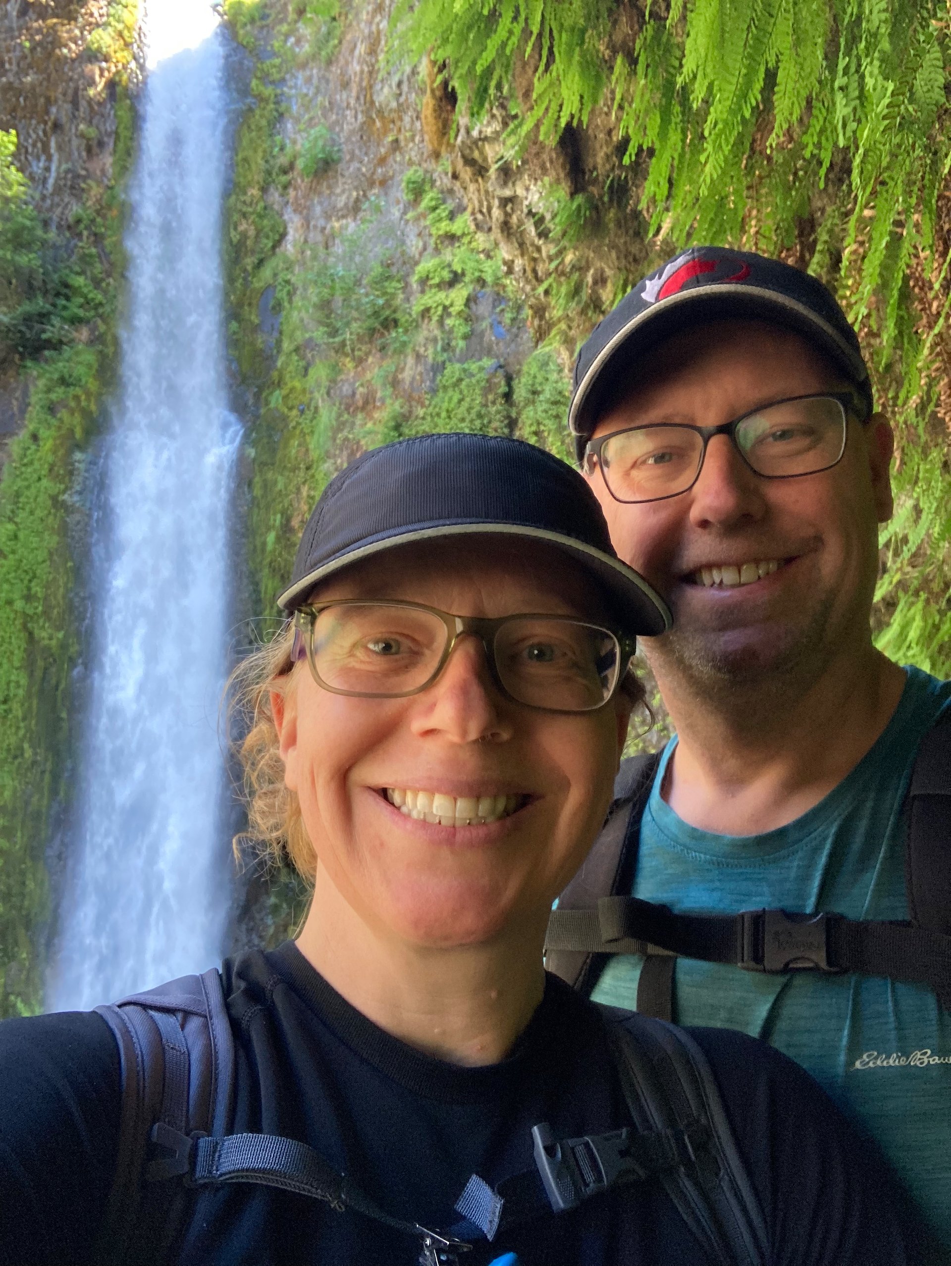
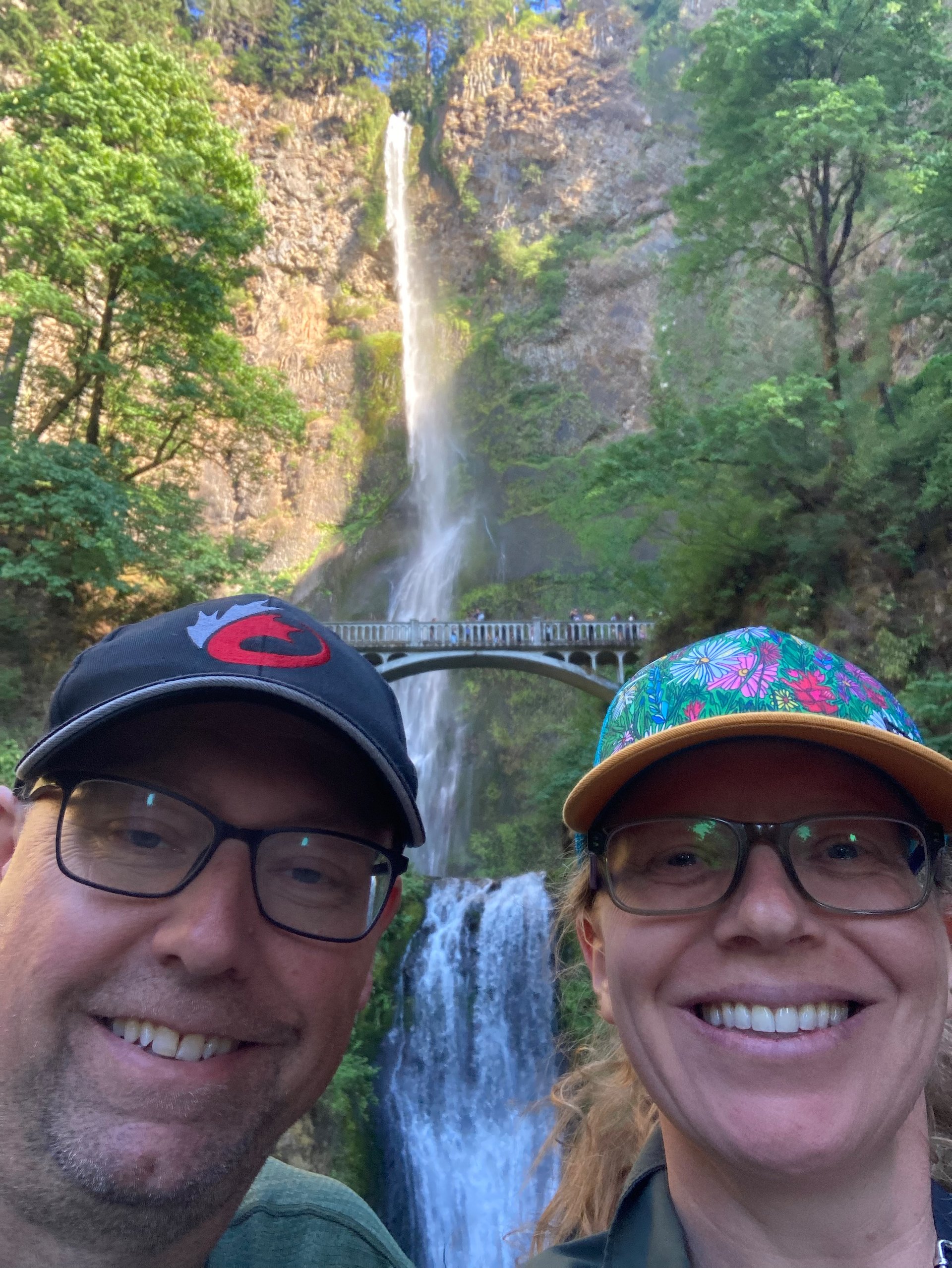
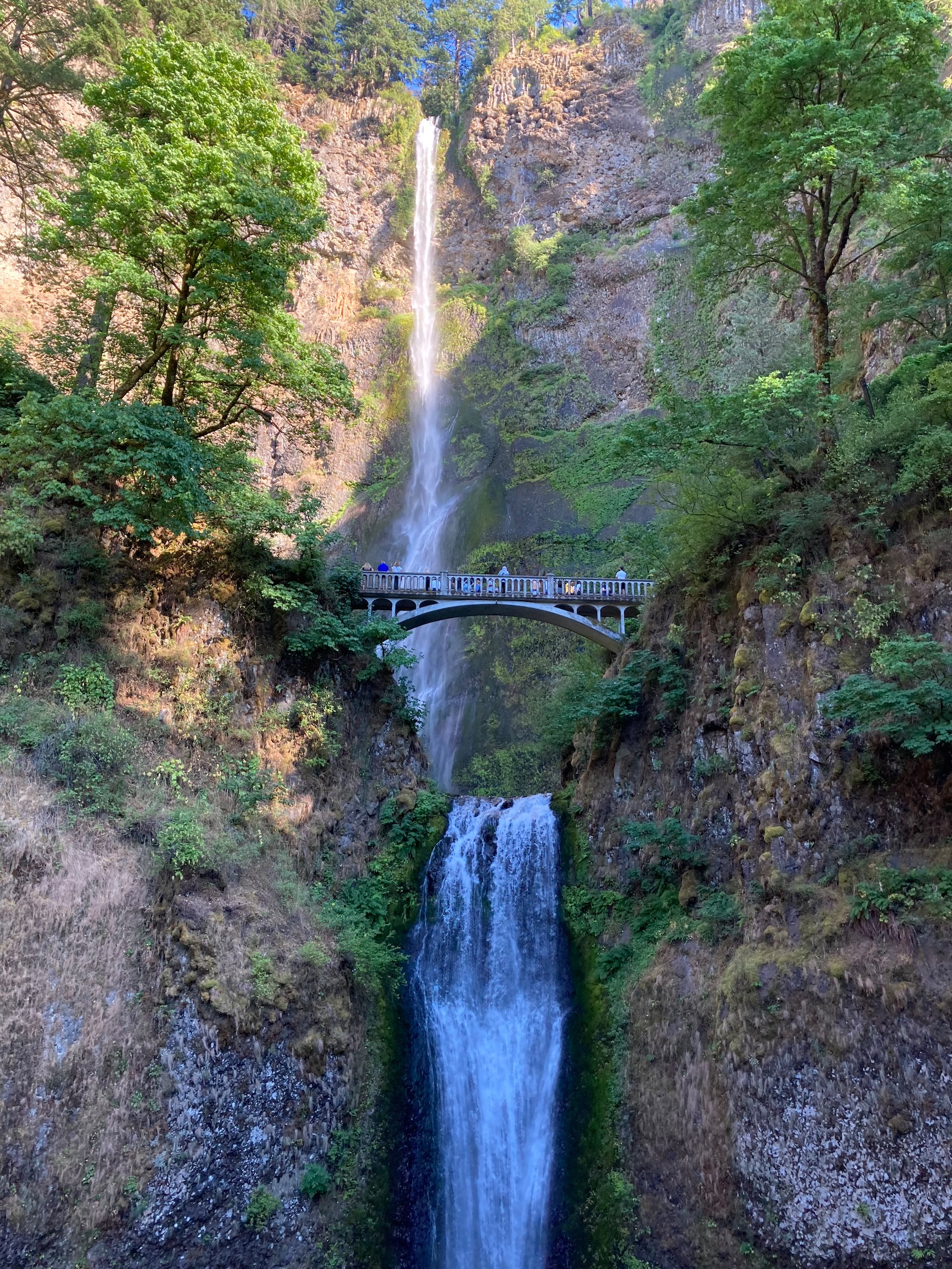
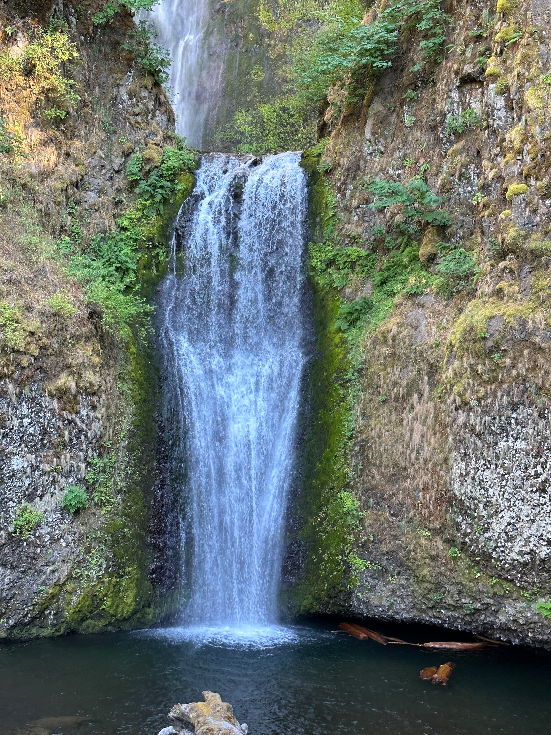
We made a quick stop at Multnomah Falls, the iconic waterfall along the Gorge. Our timing was good as before 6 pm you need to book a permit online! We didn’t have one, so we waited until after 6:00, then headed in. It was still busy, but we were able to get in and take a few pictures before heading out again.
We decide to have dinner in town rather than cooking at the campground. We stopped at Double Mountain Brewing as they make excellent pizza! We sat inside and had a great dinner and a beer, before driving back to the campground and relaxing until it was time to head to bed.